HSVweather
Member
Looks like it. Same setup that south Ga steals all the juice.is this more of a south central GA event?
I could see a larger enchanced and a small moderate issued, if details become more clear.Knowing how these events ramp up for central Georgia, we'll probably have a small hatched area within a larger enhanced region by the Day 1. After the outbreak we had in central and east GA/SC on April 5th, I think I've had my share of close tornado encounters for the season.


It’s worth noting however that the HRRR has a bad PBL mixing bias, it’s mixed out way to much on setups, definitely gonna be some mixing tomorrow but low 50s ? Pretty skepticalYeah I think tomorrow is going to be a pretty fun/interesting day for some places. If I were to guess, the SPC will paint a small, incisive ENH zone with 10% tor in a skinny corridor that starts around Durham and peters out around Newport News. This corridor represents the goldilocks zone where the warm front is veering the surface winds a touch more (more easterly component) and upping helicity a little bit without sacrificing too much CAPE.
One thing that I think limits the tor potential some is the orientation of the warm front- it's not at a favorable angle to storm motions. Storms will have a tight window to take advantage of the most supportive environment before they just lose all the surface CAPE and become elevated guff. All of those "ride the warm front" cells typically occur with a front orientation that's a little more parallel.
I also don't think this is going to be a very "widespread" event- a lot of CAMs show these rogue strips of very dry air mixing to the surface tomorrow. It looks like a lot of dry upper air got entrained when this trough got cut off in the west. See below in the sandhills.

And yeah with dews in the mid 50s you're going to stifle storm development. Think that the NC/VA border is the sport to track here.
One of the bigger enhanced regions I can remember! Interested to see the probabilities and discussionView attachment 118133
Sure looks that way right now. Storms popping down along the Gulf. That setup has kept North Georgia severe weather in check this year.Could that batch of storm steal the energy for the metro area?
Don't worry we are probably going to mix dews into the 50s and won't have much to worry about locallyI just don't buy it. An enhanced zone that big seems overdone and more of a CYA thing than an actual forecast.
Well, it's still overcast here. Maybe it will stay that way and we'll even get some rain ahead of time to limit the instability before the front comes through. It doesn't seem like it's supposed to do much here until around 8:00 tonight.Don't worry we are probably going to mix dews into the 50s and won't have much to worry about locally
Well, it's still overcast here. Maybe it will stay that way and we'll even get some rain ahead of time to limit the instability before the front comes through. It doesn't seem like it's supposed to do much here until around 8:00 tonight.

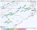
Was just about to post similar map, HRRR also has DPs in mid/upper 60s and that's like one UH track over Brick, my office and then my house lolThing is the longer we hold on to the stratus and cool the more likely we are to see the initial warm front storms initiate potentially farther SW new HRRR fires them along I40View attachment 118138
If i were looking for a tornado today I would head up your way, down just west of Charlotte or maybe to the NW of GSO. Those seem to be the areas of the state where the potential might be maximized for different reasonsWas just about to post similar map, HRRR also has DPs in mid/upper 60s and that's like one UH track over Brick, my office and then my house lol
edit: also always seems to be the case, clouds hold on longer, warm front delayed and best chance in situations like this a little more south. Could be part of the reason for the larger enhanced? May have to wait a few hours to get a feel for where best spot will be
Cool, I guess... yeah definitely keeping an eye on itIf i were looking for a tornado today I would head up your way, down just west of Charlotte or maybe to the NW of GSO. Those seem to be the areas of the state where the potential might be maximized for different reasons
Well I'm 3 for 3 in years for being in a tornado warning since I moved to Hillsborough. With one actually on the ground. Might as well. Make it 4 for 4.Haha what
View attachment 118147
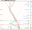
Depends on how much sunlight can get through. FFC sounding def had a pretty dry layer in the mid levels, it could definitely crimp convection depending on where it screws off toIt’s worth noting however that the HRRR has a bad PBL mixing bias, it’s mixed out way to much on setups, definitely gonna be some mixing tomorrow but low 50s ? Pretty skeptical

These storms are having a hard time firing up though. Also, I am seeing storms fire up along the coast too.Clearing moving into GA View attachment 118155
