Yeah, I think it all depends on who sees the sun. Guess that's why the SPCwent with the large level 3 area to cover their butts.
-
Hello, please take a minute to check out our awesome content, contributed by the wonderful members of our community. We hope you'll add your own thoughts and opinions by making a free account!
You are using an out of date browser. It may not display this or other websites correctly.
You should upgrade or use an alternative browser.
You should upgrade or use an alternative browser.
Severe Severe Thread May 4-6
- Thread starter Detective WX
- Start date
SnowwxAtl
Member
Tornado Warning southest of New Orleans.
Last edited:
Don’t think many see sun today but that doesn’t mean you won’t see severe weather, much more go into the atmosphere to get severe weather. If we had sun as well into the equation this would be a much more dangerous day for many more peopleYeah, I think it all depends on who sees the sun. Guess that's why the SPCwent with the large level 3 area to cover their butts.
SnowwxAtl
Member
The sun is out in ATL...not a good sign!
njbarrineau
Member
Greenwood County Schools in Upstate SC are dismissing early
Sent from my iPhone using Tapatalk
Sent from my iPhone using Tapatalk
packfan98
Moderator
I was curious if we’d see early dismissals. Seems like we saw this the last time we saw a large level three threat with similar timing.Greenwood County Schools in Upstate SC are dismissing early
Sent from my iPhone using Tapatalk
Durham County schools dismissing 2 hours early. I wish my office would close early.
HSVweather
Member

Went from flooding every week to can’t get a rain shower. Looks like the precip forecast is gonna bust bad across central AL.

Greg Fishel doesn't seemed too impressed with the severe chance.
VERY COMPLEX SITUATION-HAVE TO BE CAREFUL HOW I WORD THIS
The Storm Prediction Center, the incredible group of men and women who monitor the entire country looking for potential severe weather threats, has our area in what they call an "Enhanced" risk today. This equates to a Level 3 on a scale of 1 to 5. So what I am about to say is NOT intended to undermine their forecast. I'm just trying to point out that there are numerous competing factors that make this anything but a slam dunk severe weather outbreak.
First, the low level wind shear forecasts for early to mid afternoon are simply not impressive at all. That leads me to believe that the tornado threat this afternoon is not all that high. The only positive factor is a warm front that will be lifting northward across the region during the afternoon. There is always at least somewhat favorable low level wind shear along and just north of the warm front, so that is one thing to watch.
Then later this afternoon, drier air aloft begins to move in, and as the atmopshere becomes well mixed, that drier air will work its way down to the surface, thus lowering our dewpoints. That would imply a break in any thunderstorm activity until this evening, say around 8pm or so.
Between 8pm and 10pm, a cold front will traverse the area, and while the low level wind shear will be more favorable, the instability will have decreased. After 10pm, the threat of any severe weather will pretty much be gone.
And by the way, the transition to much cooler temperatures has been pushed back, so Saturday's temperatures will still reach the 70s, and the noticeable drop in temps won't occur until Saturday night.
Again, it is always better to be safe than sorry. If you prepare and nothing happens, don't be mad, be thankful!
Z
Zander98al
Guest
.gif")
Clouds are starting to thin out, though, in north Raleigh, and the sun is trying to poke through.
Fish just copying my post from last night hey bud how about get your own analysis.
Thinking i'm going to head out for South Hill around 3ish
Thinking i'm going to head out for South Hill around 3ish
Shaggy
Member

Cloud cover seems to be thinning?
And Wake County schools sent an email saying they will just hold the students in the schools if there are severe storms during dismissal instead of dismissing early. ?
Yeah, didn't want to see that.
Cloud cover seems to be thinning?
Drizzle Snizzle
Member
Has a tornado watch been issued for Georgia yet ?
Not yet but most likely will be issued soonHas a tornado watch been issued for Georgia yet ?
Why in the Lowcountry of SC their is a pocket of dry air?? Dew point dropped from 65 to 59 in last hr

iGRXY
Member
Winds have been quite stout so far today, but thick clouds have yet to break at all.
HSVweather
Member

Shaggy
Member
Temp has skyrocketed up to 86 with a DP of 70. Mostly sunny now tooWarm front through here with a solid temp and DP jump.
Area Forecast Discussion
National Weather Service Peachtree City GA
108 PM EDT Fri May 6 2022
...Tornado Watch in Effect for Central Georgia through 7PM...
.UPDATE...
SPC has coordinated a Tornado Watch for central Georgia through
7PM. While CAMs are still indicating the possibility of discrete
storm development over the state, the most favorable environment
for severe storm/tornado activity has shifted south over
middle/south Georgia. However, far north Georgia into Tennessee
also remains favorable for damaging winds and hail (with a non-
zero, though low, tornado threat), and continues to be monitored
for Severe Watch potential later today.
Tornado Warning
Tornado WarningNCC023-027-035-045-109-161-061745-
/O.NEW.KGSP.TO.W.0017.220506T1721Z-220506T1745Z/
BULLETIN - EAS ACTIVATION REQUESTED
Tornado Warning
National Weather Service Greenville-Spartanburg SC
121 PM EDT Fri May 6 2022
The National Weather Service in Greenville-Spartanburg has issued a
* Tornado Warning for...
Western Catawba County in the Piedmont of North Carolina...
East central Rutherford County in western North Carolina...
Western Lincoln County in the Piedmont of North Carolina...
Southeastern Caldwell County in western North Carolina...
Central Cleveland County in the Piedmont of North Carolina...
Southeastern Burke County in western North Carolina...
* Until 145 PM EDT.
* At 121 PM EDT, a severe thunderstorm capable of producing a tornado
was located 8 miles northwest of Shelby, or near Polkville, moving
northeast at 55 mph.
HAZARD...Tornado and quarter size hail.
SOURCE...Radar indicated rotation.
HSVweather
Member
FWIW

Tor watch issued

lol at that Metro Atlanta sucker hole (between Tornado Watches)..
NoSnowATL
Member
Atlanta suck zone engaged .

Loganville Winter
Member
Sun is out here on North side Warming up with some steady winds. Southside is forming clouds quickly.
GarnerNC
Member
Sun is out and wind has picked up pretty noticably as well.
Let’s get it going.
Shaggy
Member
Storms popping now
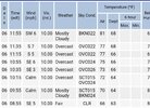
Beautiful day in West Central Alabama. Sunny, 76 F, Dew Point in 50's and dropping, Wind West @ 25mph.
83/73. Feels unstable.
Z
Zander98al
Guest
Extremely windy here in downtown Birmingham, feels good in this heat though.Beautiful day in West Central Alabama. Sunny, 76 F, Dew Point in 50's and dropping, Wind West @ 25mph.