Rosie
Member
Need a few warm days to test new ac")
It’s 67 degrees here at 2:43PM and our average high is 80. I get that people south of us are still hot but that fall front you asked for is here is it not? The extended looks like below avg highs for a bit also although our avg lows look to be above. I will admit our avg lows have basically been above normal since late May other then literally 4-5 nights.The good news is, this winter we're not going to have to worry about the warm nose or 33-34 and rain. It's going to be in the 80s all winter.
.gif")
.gif")


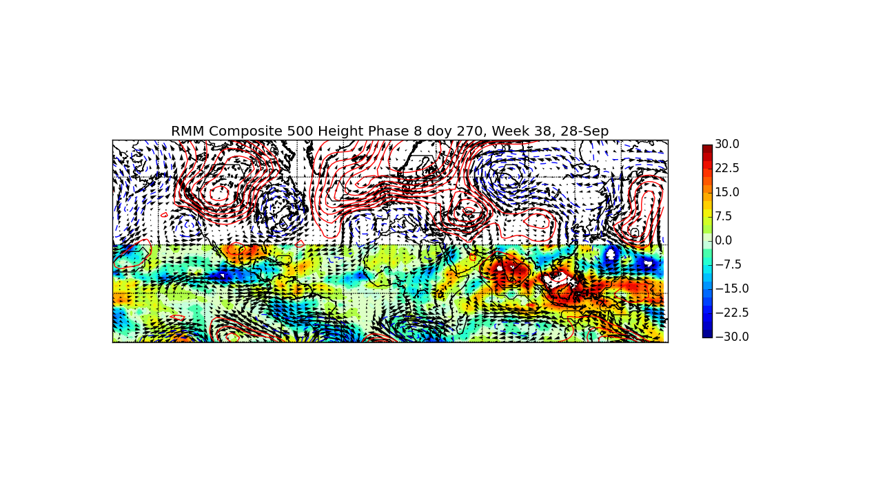
Watch how in winter, the MJO lives on the opposite side of the graph.Decide for yourself if you think the 500mb height anomalies on the GEFS for 12z September 28th fit the 500mb Phase 8 MJO analogs centered on that date.

(Zoomed in)
View attachment 6541
(Full size)
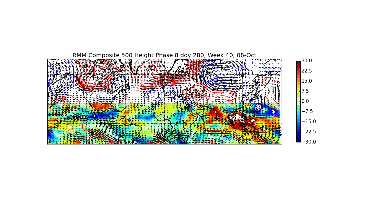
The following week, the signal very weakly suggests a 500mb SER.
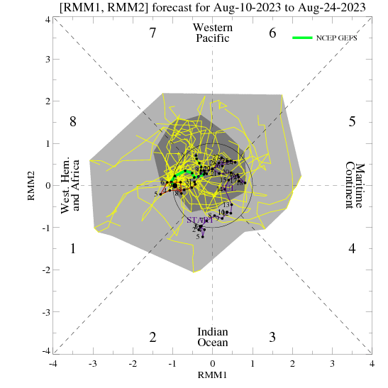
MJO is clearly forecast to be in phase 8 and have been there for quite some time.
El NINO is still forecast right? Are things on track so far as in modiki?Ehhh no. The jet extension in the NE Pacific from preceding TC activity in the Indian Ocean & WP leads to that pattern on day 6 of the GEFS, the signal from the MJO (which responds to the Central America monsoon) doesn't actually appear and is masked until later in the period. The extratropical response to diabatic heating in the tropics isn't instantaneous once the MJO emerges w/ >1 amplitude from the COD. The EOFs used to calculate the MJO are projecting onto a convectively coupled Kelvin Wave being slowed by a strengthening Central America monsoon & a base state that already favors strong EP convection.
El NINO is still forecast right? Are things on track so far as in modiki?
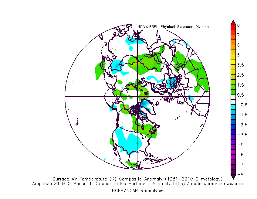
Phase 8-1 MJO (Eastern Pacific/W Hem) in late September & October actually strongly favors a SE US & the signal is robust beginning in late September, including the first half of the month dampens the signal.
Zoomed in version of the Phase 1 200 hpa height anomalies centered on October 8th via Paul Roundy I showed earlier.
http://www.atmos.albany.edu/facstaff/roundy/waves/rmmcyc/index200reg.html

El NINO is still forecast right? Are things on track so far as in modiki?
.gif")
.png")
Welcome to every winter storm ever talk! From mby!On the warm side of the wedge this morning. Full sun and warming quickly.
Sent from my SM-G955U using Tapatalk
Good grief. I'm learning all sorts of new words.September Somnolence... October Oscitance.
72 with full cloud cover. Ideal
Yep low to mid 90s looking more likely to start october.So maybe I was jumping the gun when I said no more 90’s. But at least we aren’t alone. 80’s in Boston in October. What a time to be alive.
Sent from my iPhone using Tapatalk

:weenie:72 with full cloud cover. Ideal

That's a good word for October and we're less than a week out so fire up the thread.September Somnolence... October Oscitance.

Sometimes that light at the end of the tunnel is a trainThere MAY be a light at the end of the tunnel, albeit dim, but the gfs says late next week cooler weather. I just hope it's not just another carrot on a stick.


Looks like an apps cutter pattern...yay... just in time for winter
Yeah, west of the Apps gets 2-4” of rain, we barely get an inch through Sunday! Stalled fronts rock, and it’s suppo to get to 91 tomorrow! We are winning so hard !Looks like an apps cutter pattern...yay... just in time for winter