• Hello, please take a minute to check out our awesome content, contributed by the wonderful members of our community. We hope you'll add your own thoughts and opinions by making a free account!

Pattern Scorchtember

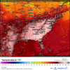
Per the 06z GFS, during the first week of October, places in the upper south and even mid Atlantic could shatter high temperature records by several degrees. Meanwhile Canada is cool but not cold. Man I’ll take anything...even some humid, wet gulf moisture.


Sent from my iPhone using Tapatalk
 
Feeling nice here in NW GA this morning. I wished it would stick around longer than a day or two!

Sent from my SM-N960U using Tapatalk
 
No 50's here in my part of the peach state. Had a low of 62° this morning. Still felt really nice though. Maybe it'll cool off like that again around December.

Sent from my SM-N960U using Tapatalk
 
That’s the warmest (temp departure) EPS run I have ever seen. And day 15 you would think is muted being an ensemble mean.

Good news is though, it can’t get worse as far as model runs go.

7426DA65-C667-4527-B0EF-7BB55732AE5F.png0150BCE9-B750-4F2A-A82A-12C4932F36FA.png
 
Depending on the orientation of the ridge, there could be some transient CAD throughout the period in parts of the region.

Yeah especially with that pattern where troughs sneak there way on the eastern side of the ridge and AK ridging almost “shedding” HPs to our north
 
GFS also showing similar, no cold shots in the south through 384 hrs, could this possibly be the warmest fall ever?

Euro has widespread 98-100 across much of the Eastern US next Saturday. That's 100 degrees on September 29th!! Would break records like crazy. Of course its way out in fantasy land. us_model-en-087-0_modez_2019092000_210_35_210.png

Looking forward into October and you don't see a lot of hope. The ENSO continues to be in a weird state but clearly la nina presence is influencing the weather pattern. Hot/dry Eastern US is staple la nina feel.

When the ENSO is in a neutral state it allows other indexes to flex their muscles.

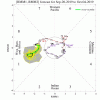
Heading into October the MJO is in a terrible position for our fall.ensplume_full.gif

Here are the temps based on MJO. You can see 8 and 1 are not nice to us in the Southeast.

I wouldn't be surprised to see this dry/hot pattern last into October. Especially without any outside forces. A lot of times we see a tropical system help break down this ridge. Without any influence there is nothing to knock it down.
Untitled 2.png
CPC also agrees with the continued warmth atleast until October.814temp.new.gif
 
It’ll be interesting to see how this ends. The two scenarios I’m thinking about are both bad. You finally get cold to build in Canada and it dives southeast into extreme heat and you have atmospheric napalm. Then other is a monster hurricane that obliterates the pattern. Both would unfortunately cause a lot of damage.


Sent from my iPhone using Tapatalk

Yeah, last year, Michael broke the pattern down, literally the next day it was beautiful.

This isn’t really an educated guess but I’d say that a big fall severe event will probably eventually break the pattern.
 
Euro has widespread 98-100 across much of the Eastern US next Saturday. That's 100 degrees on September 29th!! Would break records like crazy. Of course its way out in fantasy land. View attachment 23756

Looking forward into October and you don't see a lot of hope. The ENSO continues to be in a weird state but clearly la nina presence is influencing the weather pattern. Hot/dry Eastern US is staple la nina feel.

When the ENSO is in a neutral state it allows other indexes to flex their muscles.

Heading into October the MJO is in a terrible position for our fall.View attachment 23757

Here are the temps based on MJO. You can see 8 and 1 are not nice to us in the Southeast.

I wouldn't be surprised to see this dry/hot pattern last into October. Especially without any outside forces. A lot of times we see a tropical system help break down this ridge. Without any influence there is nothing to knock it down.
View attachment 23759
CPC also agrees with the continued warmth atleast until October.View attachment 23760

I think all of us are fully expecting warmth well into October. Frankly the models have largely held a steady hand with this. How it finally cracks will be interesting.


Sent from my iPhone using Tapatalk
 
Back
Top