Z
-
Hello, please take a minute to check out our awesome content, contributed by the wonderful members of our community. We hope you'll add your own thoughts and opinions by making a free account!
You are using an out of date browser. It may not display this or other websites correctly.
You should upgrade or use an alternative browser.
You should upgrade or use an alternative browser.
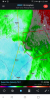
Severe Poss severe threat late this week
- Thread starter PEA_RIDGE
- Start date
I hope people in Reform, Alabama are taking shelter.
Looks like the rotation has weakened a bit.
bingcrosbyb
Member
New tornado warning Greene, Pickens, Tuscaloosa
Z
Zander98al
Guest
Injuries and damage reported through scanner from that tornado.
Z
Zander98al
Guest
Tornado warned storm moving to tuscaloosa is picking up steam
.jpg")
NoSnowJoe
Member
Link pleaseInjuries and damage reported through scanner from that tornado.
Here is where we put the 3km NAM against the WRF-ARW. Special 15z sounding from BMX showed decent cap along with trash LLLR and 3km CAPE. The question is does the QLCS outrun the meager instability it has at the moment. If it does, it may collapse like the 3km NAM showed. Interesting stuff.
bingcrosbyb
Member
Rotation tightening again about 15 miles east of Union heading into Tuscaloosa
GeorgiaGirl
Member
If that tornado holds up it might end up in Tuscaloosa, yikes.
Z
Zander98al
Guest
Link please
Tornado warning for Fayette county in Alabama.
Z
Zander98al
Guest

Mesoscale Discussion 0038
NWS Storm Prediction Center Norman OK
1150 AM CST Sat Jan 11 2020
Areas affected...Portions of AL
Concerning...Tornado Watch 12...13...
Valid 111750Z - 111915Z
The severe weather threat for Tornado Watch 12, 13 continues.
SUMMARY...Greatest potential for tornadoes and damaging
straight-line winds will shift from western into parts of northern
and central AL over the next couple of hours. Some of the tornadoes
could be strong.
DISCUSSION...A squall line has recently consolidated and
strengthened over western AL as large-scale ascent associated with a
northeastward-ejecting upper trough overspreads the central Gulf
Coast states. A couple of embedded low-level circulations have also
recently occurred within the line. One such rotational velocity
signature earlier produced a TDS over Pickens County AL. Very strong
low-level shear exists downstream of the convective line across
northern/central AL, with the VWP from KBMX showing southerly
low-level winds quickly strengthening to over 60 kt in the 0-1 km
layer. Some curvature of the low-level hodograph is supporting
effective SRH around 450-650+ m2/s2 given the northeastward motion
of individual elements embedded within the line. Coupled with a
gradually destabilizing airmass downstream into northern/central AL,
this very favorable kinematic environment will be conducive to
continued damaging straight-line winds and tornadic circulations
embedded within the line. Even with a mainly linear mode, there
remains some potential for a strong tornado or two in the short term
mainly across parts of west-central AL given the exceptionally
strong low-level shear.
..Gleason.. 01/11/2020
...Please see www.spc.noaa.gov for graphic product...
ATTN...WFO...BMX...HUN...MOB...
Z
Zander98al
Guest
Clearly see the supercell in this line 

Z
Zander98al
Guest
2 confirmed fatalities in pickens county per abc 3340
RollTide18
Member
Two fatalities in Carrollton.
bingcrosbyb
Member
Per NWS 2 fatalities with multiple injuries with carrolton tornado. Damn.
Z
Zander98al
Guest
Rotation? 

RollTide18
Member
Tornado warning in effect for central Tuscalossa county and southwestern Jefferson county.
Z
Zander98al
Guest
This spot here has been rotating and trying to tighten for a little while noe
Z
Zander98al
Guest
3 fatalities now confirmed by nws bham
Now it's 3 fatalities.Per NWS 2 fatalities with multiple injuries with carrolton tornado. Damn.
Storm5
Member

Sent from my iPhone using Tapatalk

Mesoscale Discussion 0039
NWS Storm Prediction Center Norman OK
1220 PM CST Sat Jan 11 2020
Areas affected...Northeast AL...Northwest GA...Southeast TN
Concerning...Severe potential...Watch likely
Valid 111820Z - 111945Z
Probability of Watch Issuance...95 percent
SUMMARY...Threat for damaging wind and a few tornadoes will increase
this afternoon. Watch issuance is likely by 19Z.
DISCUSSION...An extensive QLCS has recently intensified across
portions of western AL, with at least one confirmed tornado noted
earlier in Pickens County. Gradually increasing downstream
instability (noted in objective mesoanalysis and recent SWIRLL
soundings) will favor maintenance of this system as it moves into
northeast AL and adjacent portions of northwest GA and southern TN.
Very strong wind profiles will also spread eastward with time, with
1 km AGL flow of 60-70 kt and effective SRH expected to increase
into the 450-650 m2/s2 range. This powerful wind field will continue
to support the potential for relatively widespread damaging wind,
and also embedded circulations capable of producing at least brief
tornadoes. New watch issuance is expected by 19Z to cover these
threats from northeast AL into northwest GA and southern TN.
..Dean/Hart.. 01/11/2020
...Please see www.spc.noaa.gov for graphic product...
ATTN...WFO...MRX...FFC...OHX...BMX...HUN...
Power trying to go out here in Hartselle...
Z
Zander98al
Guest
The storm near jefferson county line is starting to bow out. Lets hope its not about to strengthen any 
.jpg")
Z
Zander98al
Guest
Downtown cullman in tornado warning.
Everytime I get the tv to load back up. The power blinks off for a few seconds and we start back over. Ohoy!!?
Z
Zander98al
Guest
New tornado warning in jefferson county!
Stay safe!Everytime I get the tv to load back up. The power blinks off for a few seconds and we start back over. Ohoy!!?
Storm5
Member
Close

Sent from my iPhone using Tapatalk

Sent from my iPhone using Tapatalk
Z
Zander98al
Guest
Tight rotation in north jefferson
bingcrosbyb
Member
I bet that northern Jefferson tornado is down.