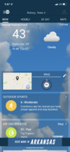
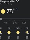
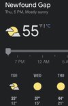
.07 so far but it is heading this way
-
Hello, please take a minute to check out our awesome content, contributed by the wonderful members of our community. We hope you'll add your own thoughts and opinions by making a free account!
You are using an out of date browser. It may not display this or other websites correctly.
You should upgrade or use an alternative browser.
You should upgrade or use an alternative browser.
Pattern October '22
- Thread starter ForsythSnow
- Start date
It was actually impressive woke me up.07 so far but it is heading this way
.89” for the event. This morning far exceeded my expectations.
The HRRR had the line drying up last night on the runs right before it approached, but it definitely exceeded expectations.
1.1" for me
Impossible. It wasn't supposed to rain a drop not a drop the whole month!
Much less impressive as it rolled through here, .27 so far today, now to wait and see if the afternoon/evening can produceIt was actually impressive woke me up
Wen ?sImpossible. It wasn't supposed to rain a drop not a drop the whole month!
I had .92 inches of needed rain in the gauge this morning and I am looking forward to the possibility of the first frost of the 2022-2023 winter next Tuesday or Wednesday night in my area. I don't think it will get cold enough for the first freeze next week which on average occurs around November 10th where I live.
I’m still waiting on my 104 degree October afternoonImpossible. It wasn't supposed to rain a drop not a drop the whole month!
whatalife
Moderator
smast16
Member
Received another 0.19" overnight for storm total of 0.40"Got a little of that sky juice myself. 0.21" sure isn't a bunch, but us beggars can't be too picky these days.
smast16
Member
Will be in Gatlinburg / Pigeon Forge starting Wednesday / Monday. Looks to be the bullseye of this incoming airmass.
Problems and snow ain’t one!
Currently 46 , cloudy, wind chill of 34, winds N 14, gusts to 32! ?
Change your name to NoRainATL.2. Brings my total for the last 30 days to .2.
I looked at that and some of the others and went to bed not expecting anything. I think it was around 3am when the rain woke me up. I was a bit shocked.The HRRR had the line drying up last night on the runs right before it approached, but it definitely exceeded expectations.
1.1" for me
Iceagewhereartthou
Member
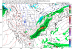
Well it's not too fall like at the moment and this weekend looks way too hot, but that front next week looks divine!Bonfire season ? ? View attachment 122997
JHS
Member
| U.S. Drought Monitor
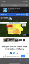
Getting worse fast and the next 2 weeks look dry. Parts of Al and GA will see improvement after yesterday's rain, but if the GFS is right the drought will start spreading fast again before too long.
Welcome to my nightmare! My whole state is Jonesville!?| U.S. Drought Monitor
droughtmonitor.unl.edu
Getting worse fast and the next 2 weeks look dry. Parts of Al and GA will see improvement after yesterday's rain, but if the GFS is right the drought will start spreading fast again before too long.
Only a blizzardcane will save me
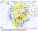
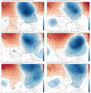
That is really a good looking pattern! If that holds into December and first week of January, like a typical La Nina, we are all gonna be loving life!Sheesh euro weeklies is quite the cold November .. View attachment 123003
JHS
Member
Hopefully this drought ends or at least improves before next summer. Iowa and all of the plains are very important for food production and major drought is the last thing the area needs.Welcome to my nightmare! My whole state is Jonesville!?
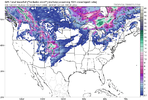
Only a blizzardcane will save meView attachment 123004
JHS
Member
You would love a repeat of the winter of 1998-99 I think. At least Dec into January. Much of the midwest had a major snowstorm in early Jan 1999. That same system gave the CAD area down here a major icestorm.That is really a good looking pattern! If that holds into December and first week of January, like a typical La Nina, we are all gonna be loving life!
How many drops did you get in the last 24 hours?| U.S. Drought Monitor
droughtmonitor.unl.edu
Getting worse fast and the next 2 weeks look dry. Parts of Al and GA will see improvement after yesterday's rain, but if the GFS is right the drought will start spreading fast again before too long.
Yep. Barges are already having a hard time getting up the river because water levels are so low! Sadly Sep and Oct, are some of iowas wettest monthsHopefully this drought ends or at least improves before next summer. Iowa and all of the plains are very important for food production and major drought is the last thing the area needs.
LovingGulfLows
Member
- Joined
- Jan 5, 2017
- Messages
- 1,499
- Reaction score
- 4,100
Weather.com really trying to get me sub-freezing Thursday morning next week ?. We'll see. Very impressive surface high that centers on the region so radiational cooling can definitely make it happen.
Rosie
Member
Mid 20’s here?Weather.com really trying to get me sub-freezing Thursday morning next week ?. We'll see. Very impressive surface high that centers on the region so radiational cooling can definitely make it happen.
Drizzle Snizzle
Member
First we have to deal with some major heat this weekend. Could be close to 90 in parts of the south.Weather.com really trying to get me sub-freezing Thursday morning next week ?. We'll see. Very impressive surface high that centers on the region so radiational cooling can definitely make it happen.
Troughing generally dominate in the east through the run. The weather in October, the winter will rem.... oh waitWinter preview. Happy Friday️ View attachment 123005
- Joined
- Jan 5, 2017
- Messages
- 3,775
- Reaction score
- 5,985
Maybe out in east TX or south Georgia and Florida. I see 80's in NC, SC, northern GA, AL, MS or TN, maybe.First we have to deal with some major heat this weekend. Could be close to 90 in parts of the south.
Drizzle Snizzle
Member
I could see Valdosta hitting 90 this weekend.Maybe out in east TX or south Georgia and Florida. I see 80's in NC, SC, northern GA, AL, MS or TN, maybe.
Maybe out in east TX or south Georgia and Florida. I see 80's in NC, SC, northern GA, AL, MS or TN, maybe.
I'm almost certain I will not hit 80F in my backyard.
Heard it was going to be 100 with no rain
For who?? I’ve just pulled up forecasts throughout the south and no where is forecasted to be higher than the mid 80s and that’s just one dayFirst we have to deal with some major heat this weekend. Could be close to 90 in parts of the south.
Edit: I see that east Texas might make a run at 90 on Sunday, but that is certainly nothing out of the ordinary there, especially ahead of a strong front
Last edited:
Drizzle Snizzle
Member
89 in Tallahassee on Sunday and 88 in Albany. I could definitely see a few locations in GA hitting 90 briefly.For who?? I’ve just pulled up forecasts throughout the south and no where is forecasted to be higher than the mid 80s and that’s just one day
Edit: I see that east Texas might make a run at 90 on Sunday, but that is certainly nothing out of the ordinary there, especially ahead of a strong front


