Avalanche
Member
We might flirt with it, but fall just shy.Heard it was going to be 100 with no rain
We might flirt with it, but fall just shy.Heard it was going to be 100 with no rain
We are done with 90's, also done with jetskiing, enjoying a cooler full at the beach, and swimming in the pool. Urgh.We have a better chance of seeing lows get into the 20s than highs near 90.
You’re talking about two cities that those highs are still within a few degrees of their averages this time of the year. There is absolutely nothing out of the ordinary with temperatures in the south this weekend89 in Tallahassee on Sunday and 88 in Albany. I could definitely see a few locations in GA hitting 90 briefly.
Honestly, you are falling into the snowlover87 aka dewpoint dan aka southeast ridge troll trap here, I'd ignore it and move on. He knows what he is doing lolYou’re talking about two cities that those highs are still within a few degrees of their averages this time of the year. There is absolutely nothing out of the ordinary with temperatures in the south this weekend
It's going to be in the low 80s this weekend very unusual and summer like have to go all the way back to almost the same dates last year to see 80s in mid October around hereHonestly, you are falling into the snowlover87 aka dewpoint dan aka southeast ridge troll trap here, I'd ignore it and move on. He knows what he is doing lol
Oh yeah I get that, definitely going to be warm but he said 90s and specifically mentioned....... anywayIt's going to be in the low 80s this weekend very unusual and summer like have to go all the way back to almost the same dates last year to see 80s in mid October around here
You fell for me doing it lolOh yeah I get that, definitely going to be warm but he said 90s and specifically mentioned....... anyway
He old, needs glasses.You fell for me doing it lol


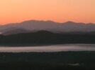
My dream inland property!!
Absolutely stunning. Where is this ?


Upper 80s tomorrow, 54 in Tulsa on Tuesday and near 80 again next weekend. Gotta love Oklahoma weather.Winter is comingView attachment 123014
West JeffersonAbsolutely stunning. Where is this ?
West Jefferson


GFS still not backing down! Close enough to smell theI need a sun angle update. Paging @southeasternridge
 ️
️ 


???GFS still not backing down! Close enough to smell the

The 6z GFS loses it for the most part.
Pieces are still there and its a little N of yesterday’s runs! But I didn’t have a fantasy snow show up on any model till about December last year, so it’s all good!The 6z GFS loses it for the most part.


Oh, you're talking about the nice Fall CAD setup.This a good look? View attachment 123046View attachment 123047


Y’all deserve it! The finest cold , cloudy , damp day in the 40s in the piedmont, is a great thing!Oh, you're talking about the nice Fall CAD setup.
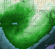
Temps at hour 288 (midday):
View attachment 123049
Yes it is. My favorite kind of days. Take them over sunny days anytime.Y’all deserve it! The finest cold , cloudy , damp day in the 40s in the piedmont, is a great thing!
Looks like your snow is back.Y’all deserve it! The finest cold , cloudy , damp day in the 40s in the piedmont, is a great thing!
Ended up with what will likely be the final day in the 90s for the year. By Monday night it’s forecast to be a few degrees above freezing. View attachment 123045
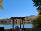
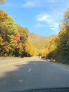
About time to book that cabin for a snow!We came to Asheville for my buddy’s birthday at Sierra Nevada Brewery today and the leaves are perfect here. Got to be peak season

About to get the best downpour of the last few months! Much needed rain!View attachment 123052