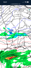
Until the Canadian is right, I have to dismiss these cold runs it’s spitting out in the 8-10 day range to be outliers. Remember, last week at this time it was saying a very cold Thanksgiving and then just the other day it was saying full on Arctic blast coming out of Thanksgiving weekend.Watch for a Rogue flake above 3000 ft tomorrow SW NC. Novelty as 540 cool pool washes out overhead passing by.
Then all eyes turn to next Tuesday through the end of the week. Find some SS energy and its not a stretch to score. All 3 Ops have cold air and the GFS has some energy cutting underneath us on Tues, while the Euro has it Thursday. Canadian is stupid cold late next week at least above our heads.

-
Hello, please take a minute to check out our awesome content, contributed by the wonderful members of our community. We hope you'll add your own thoughts and opinions by making a free account!
You are using an out of date browser. It may not display this or other websites correctly.
You should upgrade or use an alternative browser.
You should upgrade or use an alternative browser.
Pattern November 2023
- Thread starter packfan98
- Start date
The truth is these models really just suck. We don’t know what’s gonna happen till it’s here.Until the Canadian is right, I have to dismiss these cold runs it’s spitting out in the 8-10 day range to be outliers. Remember, last week at this time it was saying a very cold Thanksgiving and then just the other day it was saying full on Arctic blast coming out of Thanksgiving weekend.
JHS
Member
Unless something changes this system is not dropping 2+ amounts anywhere and many of us may get .50 or less. The GFS says this is it for the next 2 weeks as well. Hopefully we get a real pattern change soon.
No rain here yet either, I could see what was happening last night too. We aren’t getting any rain out of this thing. Maybe areas east will.
NBAcentel
Member
.7 so far and much more to come. Looks like 1.5 should be achieved
WXinCanton
Member
Dry slot city, roads were dry earlier lolNo rain here yet either, I could see what was happening last night too. We aren’t getting any rain out of this thing. Maybe areas east will.
Wedge has locked in here solid now. Will be stuck in mid 40s remainder of daylight part of the day guessing we get a windshift at the surface latter this evening, then back to NW wind sunrise early morning Wed
W
WSW
Guest
Some really nice rains on the radar in the Commonwealth. NWS says widespread 1.5 to 2.5 inches. Very much needed especially in the western half of the state.
Yeah, not really surprised when looking at the radar last night. The storms later this afternoon will probably form east of us as well. This was all a nice thought anyways.Dry slot city, roads were dry earlier lol
Yea I agree. But all 3 give a nice slap of canadian air in here middle next week. I just posted the most sexy looking one for reference. Nice blocking does the trick.Until the Canadian is right, I have to dismiss these cold runs it’s spitting out in the 8-10 day range to be outliers. Remember, last week at this time it was saying a very cold Thanksgiving and then just the other day it was saying full on Arctic blast coming out of Thanksgiving weekend.
Sounds like a strong el nino is underway, which is supposed to produce a blowtorch December and a very active STJ with lots of rain. ?Unless something changes this system is not dropping 2+ amounts anywhere and many of us may get .50 or less. The GFS says this is it for the next 2 weeks as well. Hopefully we get a real pattern change soon.
Ill take the over 1.0 here at our local. Nice soaker so far. Like yall, ground is hard as asphalt. So we need duration, not gully washer prefearably.Unless something changes this system is not dropping 2+ amounts anywhere and many of us may get .50 or less. The GFS says this is it for the next 2 weeks as well. Hopefully we get a real pattern change soon.
W
WSW
Guest
Lots of 33-35 degree temps on the northern Blue Ridge west of IAD with rain falling. Mostly between 1500 and 2400' asl out there. Those neighborhoods from Mount Weather/Bluemont to Blue Mountain to Linden.
We have a chance at some strong storms this afternoon:

sounding

sounding
W
WSW
Guest
North of you i think there will be 2+ totals in parts of NC/VA/WVUnless something changes this system is not dropping 2+ amounts anywhere and many of us may get .50 or less. The GFS says this is it for the next 2 weeks as well. Hopefully we get a real pattern change soon.
JHS
Member
You are in a nice spot for this. Central NC into VA should do well with this as the low cranks up later. Not so much for much of northern GA into upstate SC.Ill take the over 1.0 here at our local. Nice soaker so far. Like yall, ground is hard as asphalt. So we need duration, not gully washer prefearably.
D
Deleted member 609
Guest
The old bird man special

I was just looking at this. Honestly not far off here from something very interesting. The problem is I just don’t see anything to push cold enough air in.The old bird man special
View attachment 138086
HRRR is finally picking up on the fact that there won't be any organized line of storms until later in the day, way east. This was a non event for our area. Hopefully areas closer to Chattanooga were able to get some rain. I'm just so disgusted with our local mets and weather service. The audacity to forecast 1 to 2" of rain when not one single model was showing that. The RAP last night depicted what happened perfectly.

What RAP song were you listening to?HRRR is finally picking up on the fact that there won't be any organized line of storms until later in the day, way east. This was a non event for our area. Hopefully areas closer to Chattanooga were able to get some rain. I'm just so disgusted with our local mets and weather service. The audacity to forecast 1 to 2" of rain when not one single model was showing that. The RAP last night depicted what happened perfectly.
View attachment 138087
I’m up to .2” now so it is my best rain in a couple months.HRRR is finally picking up on the fact that there won't be any organized line of storms until later in the day, way east. This was a non event for our area. Hopefully areas closer to Chattanooga were able to get some rain. I'm just so disgusted with our local mets and weather service. The audacity to forecast 1 to 2" of rain when not one single model was showing that. The RAP last night depicted what happened perfectly.
View attachment 138087
CHA just passed 2" for the day, with most of that in the last 4 hours.
iGRXY
Member
Nothing like mid 40 wedges to get the season going
My physical gauge says .35", which is surprising to me as its all been light to moderate showers today. I've had .8" this month prior, and 1.8" last month, so areas north and west need it far more.I’m up to .2” now so it is my best rain in a couple months.
It’s been bone dry but it’s even worse to my NW so I’m glad to see Chattanooga and NE Bama getting hit. It does suck that my swamp is dry right when duck season opens.My physical gauge says .35", which is surprising to me as its all been light to moderate showers today. I've had .8" this month prior, and 1.8" last month, so areas north and west need it far more.
JHS
Member
.35 here with a little more coming over the next couple of hours. There are signs that a band of heavier rain forming in AL that might come up this way later. If this does not happen we will end this with under .50 with little to no rain for at least 10 days if not more.
Ron Burgundy
Member
Line is starting to build to our west. Hoping we can get a quick 0.25” if the intensity is there ?HRRR is finally picking up on the fact that there won't be any organized line of storms until later in the day, way east. This was a non event for our area. Hopefully areas closer to Chattanooga were able to get some rain. I'm just so disgusted with our local mets and weather service. The audacity to forecast 1 to 2" of rain when not one single model was showing that. The RAP last night depicted what happened perfectly.
View attachment 138087
We've had 0.37" of rain so far. Here comes a little more. I'm calling a total of around 1.25" and that's being generous.

HugeSnowStick
Member
The bottom just fell out in Midtown, blinding rain sheets.
Just got home for thanksgiving. 46F with 0.37” so far
Be interesting to see if any of the waves can over produce on the moisture side next week. Airmass is marginal at best but it's a good setup that can give a small area of winter weather if you time it right
Brent
Member
Well at least it feels like the holidays here ?
accu35
Member
Last night was and stormy night for me, it rain for several hours and on the way from work this morning I couldn’t see in front of me. The rain was so heavy and winds, definitely an overachiever for my area.
Big time overperformer here and put a nice dent in the drought. Chattanooga finished with 2.77", for wettest day since March 17th 2021.
At one point today, we had more rain in 30 minutes than in the previous 83 days combined!
At one point today, we had more rain in 30 minutes than in the previous 83 days combined!
- Joined
- Jan 5, 2017
- Messages
- 3,802
- Reaction score
- 6,051
Just under an inch here .99".
We were dry slotted. Ended up with only 0.76 in for the past 48 hrs.
ForsythSnow
Moderator
Ended at 1.65" for the event. It was much needed rain with how little we've had all month.
Had some heavy rain tonight. Hope the mountains were able to get enough to help put out the fires.
That's more than you had last month so it's a startWe were dry slotted. Ended up with only 0.76 in for the past 48 hrs.
JLL1973
Member