• Hello, please take a minute to check out our awesome content, contributed by the wonderful members of our community. We hope you'll add your own thoughts and opinions by making a free account!

Wintry More SE Snow ? (1/16-1/18)

Need better ukie maps

Sent from my SM-G955U using Tapatalk
Start calling you Captain (as in obvious lol)
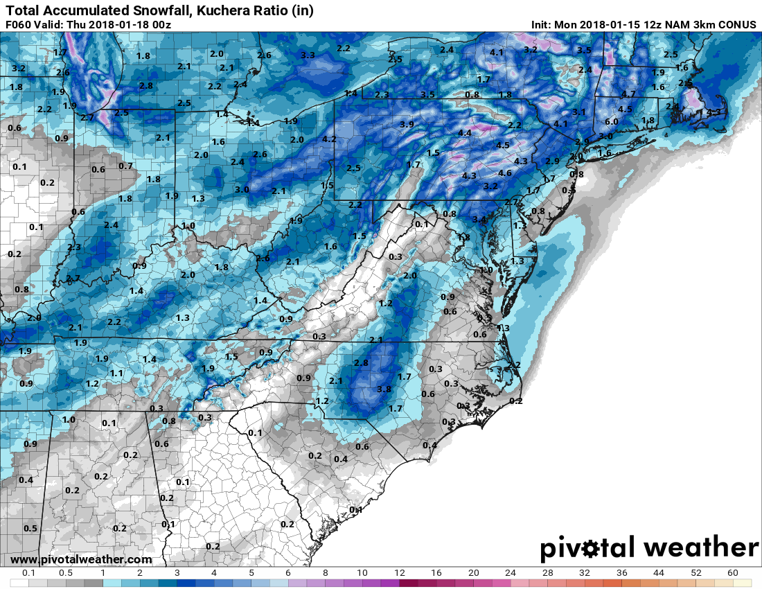
Anyway here are precip maps, looks anemic over our way....
P1_GZ_D5_PN_060_0000.gif
P1_GZ_D5_PN_072_0000.gif
 
Birmingham mean was .3 this morning with a max of 2 inches. I love watching those plumes. They were fantastic back in December.

I would watch the plumes for Montgomery. I still maintain that if this will become more than a flizzard south of TN, we need to get the overrunning setup going.
 
from bham nws this morning:
If there is enough lift remaining as this
moisture meets with the Arctic front, snow could become enhanced.
All of these factors are suggest that we are teetering on the edge
of potentially significant impacts, especially with temperatures
well below freezing. Model parameterization as it pertains to QPF
output may not be handling the situation very well. In fact, the
GFS shows fully saturated profiles in locations that receive no
QPF. My hunch is that QPF will trend upward as we approach the
event as models begin to resolve crucial features,
but this
requires the aforementioned trends to continue with future models
runs. For now we are showing snowfall amounts up to 1/2 inch
north and west of I-59, tapering to trace amounts farther south.
Temperatures in the 20s should yield snow ratios of 15:1, and a
slight increase in QPF could yield considerably more snowfall.
 
Last edited:
I think the GFS would be an outlier now. It is the only one not showing more precip.
 
All/most models are trending better except for the GFS
Thanks, I went back and looked, at other ones... should have done that before I made a idot comment. Lol and I forget what’s bad for Georgia doesn’t always mean bad for us or the other way around. I have to look where someone lives before I jump to conclusions. Lol
 
The DWD ICON is in fact the Euro in many regards. As I discussed a while back on this forum, the ICON's slow physics paramterizations were imported from the ECMWF. While the model is far from perfect it tends to be well NW of other more progressive guidance with east coast cyclones and overrunning events and was one of the few models that showed much of anything west of I95 in NC during the last event. It's generally as good or better than GFS or CMC. Also considering it looks like the Euro and NAM, and the GFS/CMC are trending towards this solution, the ICON is a legit NWP model.

The ICON was the first global medium
range model to have the surface low of the historic 1/3/2018 coastal winter storm move NNE from Grand Bahama Island rather than NE, which was what was needed to give the SE coast a very rare major winter storm, which turned out right. Moreover, it did this every run and obliterated the other globals, including the Euro. Major kudos for this.
 
All/most models are trending better except for the GFS
Yeah, I really don't get it... What is the GFS seeing that is preventing the precip? At first, I thought downsloping was the obvious choice. However, the winds are from the SW and we even have a slight gulf tap. Maybe it's the fact that the trough axis never goes negative. The model doesn't believe the moisture will advect up on the east side of the apps with that look. Maybe Delta, 1300, or Webb sees something I don't. What am I missing here?
 
Yeah, I really don't get it... What is the GFS seeing that is preventing the precip? At first, I thought downsloping was the obvious choice. However, the winds are from the SW and we even have a slight gulf tap. Maybe it's the fact that the trough axis never goes negative. The model doesn't believe the moisture will advect up on the east side of the apps with that look. Maybe Delta, 1300, or Webb sees something I don't. What am I missing here?

You just said it. Progressive, trough axis doesn’t dig and stays positive tilt.
 
Back
Top