Round Oak Weather
Member
Really formed back up as it came into middle GA
Really formed back up as it came into middle GA

looking like 3-6'ish AM? And I agree. Hard to get that cold air over those mountains. By no means am I optimistic about this. But that simulates radar looks beautifulTemps, temps, temps! If this comes in Tuesday evening or even midnight , I promise you upstate will be at 45+ degrees when rain starts

Wrong. Except me. #DryAirEveryone gets snow. Except Columbia.
Would love to be on the high end of that, but 2 inches would be great. RAH and the local TV mets are being conservative as always so they can increase totals as the storm unfolds.2-5" seems like the right call in the central-western piedmont of NC atm, barring a nice coastal forms to sling moisture back inland, someone along or east of US highway 1 is going to get appreciably less and/or screwed over.
How is this even possible. Looks like a few others and I are screwed if it verifies.

You've been screaming it for days. Mother natures payback is brutalWrong. Except me. #DryAir
I guess it's my turn...2-5" seems like the right call in the central-western piedmont of NC atm, barring a nice coastal forms to sling moisture back inland, someone along or east of US highway 1 is going to get appreciably less and/or screwed over.

Well the December event while different setup somewhat ended up verifying higher moisture when gulf was tapped won't be anything like that cause it was a much more moist system to begin with but one could hope that could end up on the .10 to .20 increase for some in East AL and West GA but won't know for sure until some of the shorter models start getting in rangeAnyone think snow totals across middle GA could be higher with the gulf tap?
Maybe it'll bust in our favor to the east this time.I guess it's my turn...


Or model output. Maybe the models will be nice to me today and give me MOISTURE. Hear these words models, MOISTURE! LOL. But if you read my post above, as I said, I feel the snow hole could be a lie.You've been screaming it for days. Mother natures payback is brutal
Sent from my SM-J320VPP using Tapatalk
And mine.... againI guess it's my turn...

I guess it's my turn...
Would love to be on the high end of that, but 2 inches would be great. RAH and the local TV mets are being conservative as always so they can increase totals as the storm unfolds.
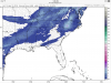
Apparently you have expanded the snow shield, in all seriousness if that band is that solid and pretty intense back to the Triad I think it holds up to your area still could easily fizzled by the time it reaches me but that's just a odd looking snow gap, to me anyway. I think you'll be fineAnd mine.... again
Sent from my SM-G955U using Tapatalk
Well, I am pretty much right on US1. Maybe it'll get lucky up this way.Yeah vorticity stretching in the wake of the Apps is going to give areas towards the Triad and/or just west of Raleigh/US-1 a major boost. If trends continue it's possible a few isolated areas west and/or NW of Raleigh close in on 6", while 1-3" might be the best play atm for Raleigh & Fayetteville barring that NWP continue to trend favorably (as they have been in general) at the large-scale. Like I said, I am worried that areas along/east of US-1 (including Raleigh) could get a lot less than this figure or possibly screwed over as the precipitation shield is liable to maintain or weaken as it comes east. We're almost to the point now where we should start giving more credence to high resolution guidance like the NAM/RGEM, esp for those west of the Carolinas.
I guess it's time for the climatological favored areas of NC to get theirs, if it can hold together long enough to give me a solid inch I'll be happy I did get 4 with the last system so I'm trying not to be greedy.Yeah vorticity stretching in the wake of the Apps is going to give areas towards the Triad and/or just west of Raleigh/US-1 a major boost. If trends continue it's possible a few isolated areas west and/or NW of Raleigh close in on 6", while 1-3" might be the best play atm for Raleigh & Fayetteville barring that NWP continue to trend favorably (as they have been in general) at the large-scale. Like I said, I am worried that areas along/east of US-1 (including Raleigh) could get a lot less than this figure or possibly screwed over as the precipitation shield is liable to maintain or weaken as it comes east. We're almost to the point now where we should start giving more credence to high resolution guidance like the NAM/RGEM, esp for those west of the Carolinas.
ill take that anydayMuch better
Sent from my SM-J320VPP using Tapatalk
Well, I am pretty much right on US1. Maybe it'll get lucky up this way.

Yeah vorticity stretching in the wake of the Apps is going to give areas towards the Triad and/or just west of Raleigh/US-1 a major boost. If trends continue it's possible a few isolated areas west and/or NW of Raleigh close in on 6", while 1-3" might be the best play atm for Raleigh & Fayetteville barring that NWP continue to trend favorably (as they have been in general) at the large-scale. Like I said, I am worried that areas along/east of US-1 (including Raleigh) could get a lot less than this figure or possibly screwed over as the precipitation shield is liable to maintain or weaken as it comes east. We're almost to the point now where we should start giving more credence to high resolution guidance like the NAM/RGEM, esp for those west of the Carolinas.
Lake Murray outside of Columbia, SC does the same thing to storms.I don't even think Delta, 1300, or Webber have an answer for why that could happen. It's just weird. I fear it to be true though.


Yeah, and the southern half of Central Georgia. It's looking like that I might even slightly miss a dusting that will occur just to my North.Everyone gets snow. Except Columbia.