Tarheelwx
Member
Maybe this is the year we get a heavy wet snow on a leafed out canopy.
TW
TW

I had that back in April 2019 and had 2 Bradford pears literally split down the middleMaybe this is the year we get a heavy wet snow on a leafed out canopy.
TW
No biggie, it's the GFS! It'll have a much different look probably at 00z or no later 06zGFS operational didn’t factor in that prediction at 18z. Cranks the ridge into mid March.
Sent from my iPhone using Tapatalk
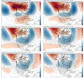
I’m not sold on a +PNA yet, but I’m definitely sold on a much weaker SER and mostly BN temps for the 2nd and 3rd weeks of March. The trend to stronger high latitude blocking has been fairly evident and consistent now.I have no doubt cold is coming. High amp phase 8 and blocking is a recipe for cold in the east. I have a feeling we will see weakening of heights out west by mid March and a pop of a +PNA by then as well.. View attachment 133673
Definitely seems very possible, too bad we’re out of prime climo by then so we really need a good setup to score. It definitely can happen, but it’s harder than in January-February, or even early March.I’m not sold on a +PNA yet, but I’m definitely sold on a much weaker SER and mostly BN temps for the 2nd and 3rd weeks of March. The trend to stronger high latitude blocking has been fairly evident and consistent now.
The seasons are all out of whack. It's never cold when it's supposed to be and then when it's supposed to warm up in the spring that's when the cold arrives.Deep down we all know the cold is coming. Whether in March or April...its coming. Geoengineering
Huh??? No please. Let’s hope that isn’t for real. So ready for warm temps!The seasons are all out of whack. It's never cold when it's supposed to be and then when it's supposed to warm up in the spring that's when the cold arrives.
Yeah negative pna doesn’t look likely …I’m not sold on a +PNA yet, but I’m definitely sold on a much weaker SER and mostly BN temps for the 2nd and 3rd weeks of March. The trend to stronger high latitude blocking has been fairly evident and consistent now.
That screams severe outbreak!


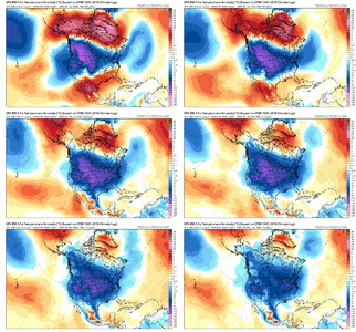
Wow 2-7degrees below avg. So low 60s down here and yall get mid to low 50s? Wen snowstorm?Welcome to high amp phase 8 MJO .. fasten your seatbelts we will be launching back into winter View attachment 133687
Welcome to high amp phase 8 MJO .. fasten your seatbelts we will be launching back into winter View attachment 133687
Yeah it's going to take a lot more than greens to get any winter weather. We'll have lows in the mid 30s and highs in the low to mid 50s probably. Maybe we get down to freezing for a night or two. YayWow 2-7degrees below avg. So low 60s down here and yall get mid to low 50s? Wen snowstorm?
Looks well below normal starting at 240hrs through the end of the run. Also 5h pattern looks very conducive for wintery threats. Always skeptical of anything here in mid March but the mountains should be excited.I guess no one has actually looked at the eps mean or the plumes. That ---- is cold
We have had nothing but warmth for a long time. Then we will have 5 months where it is too hot to do anything outside at all. Let's get all the cool we can for as long as we can.again..bring on warmth and dyness...over it
Yeah it's going to take a lot more than greens to get any winter weather. We'll have lows in the mid 30s and highs in the low to mid 50s probably. Maybe we get down to freezing for a night or two. Yay
Yup not to mention 850s will be cold .. if u get a storm to form in and around that type of air you’re going to find a way to get winter precip on the edge of this airmass .. ex. See euro ensemble noiseI guess no one has actually looked at the eps mean or the plumes. That ---- is cold
I want us to save the cooler than normal weather until June. I don't wanna waste it in March and April !We have had nothing but warmth for a long time. Then we will have 5 months where it is too hot to do anything outside at all. Let's get all the cool we can for as long as we can.
The problem is we're the southeast. I tell folks moving here that June, July, and August are hot/humid. We usually get very little to no cool breaks. The month of May is another story. It can be cool/beautiful or summer hot.I want us to save the cooler than normal weather until June. I don't wanna waste it in March and April !
In my experience, the 1st half of May is usually very pleasant but the 2nd half of May could be hot/humid.The problem is we're the southeast. I tell folks moving here that June, July, and August are hot/humid. We usually get very little to no cool breaks. The month of May is another story. It can be cool/beautiful or summer hot.
Been fooled too many times this year alreadyI guess no one has actually looked at the eps mean or the plumes. That ---- is cold
The summer of 2013 wasn’t terribly hot temp wise, but it was incredibly humid and wet that whole seasonI recall 2013 was a really mild summer. Very few days above 90 in ATL. July 4th was rainy and in the low 70’s.
Sent from my iPhone using Tapatalk
Guys, I will take that at this stage.I mean, this isn't too shabby...EPS means in NC look interesting.View attachment 133698
I mean, this isn't too shabby...EPS means in NC look interesting.View attachment 133698
What type of tree is that? I don’t have the first leaf on anything up here. Maples and tulip magnolia have bloomed but that’s it.I can't recall ever seeing trees leafed out like this in February...View attachment 133690
My forsythia is gorgeous this year!What type of tree is that? I don’t have the first leaf on anything up here. Maples and tulip magnolia have bloomed but that’s it.
