^^I have a lot of trees leafing out right now. I wouldn't mind some slightly below freezing temps just to ensure our last freeze of the season isn't in February; but (^^) low 20s would kill back everything. This might be the few times us cold weather lovers need to hope for slightly warmer temps.
-
Hello, please take a minute to check out our awesome content, contributed by the wonderful members of our community. We hope you'll add your own thoughts and opinions by making a free account!
You are using an out of date browser. It may not display this or other websites correctly.
You should upgrade or use an alternative browser.
You should upgrade or use an alternative browser.
Pattern Mega March 2023
- Thread starter SD
- Start date
There is a 200 year old oak tree leafing our in our neighborhood. An iconic, picturesque one. Until it got exploded by a lightning strike this morning at 4 am.^^I have a lot of trees leafing out right now. I wouldn't mind some slightly below freezing temps just to ensure our last freeze of the season isn't in February; but (^^) low 20s would kill back everything. This might be the few times us cold weather lovers need to hope for slightly warmer temps.
iGRXY
Member
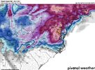
This is an average over 10 days. So it will be colder than the 50's.-10 below avg will put you in the low 50s. You need that purple punch to feel like winter.
ATLwxfan
Member
There is a 200 year old oak tree leafing our in our neighborhood. An iconic, picturesque one. Until it got exploded by a lightning strike this morning at 4 am.
That was jarring and sad.
Sent from my iPhone using Tapatalk
Nomanslandva
Member
Uggh, hopefully it will survive. I am a hobby woodworker and those old trees have a lot more character than most young stuff, but I still hate it when we lose them. Think about everything they have lived through.
Man that is horrible. Saw that with hurricane Fran. Everybody was crying about the damage to the houses, but it was the trees that upset me the most. As long as nobody gets hurt, a house can be rebuilt quickly. But a loss of an old tree is unreplaceable.
ATLwxfan
Member
Oh man! That’s awful. What a tree!
Sent from my iPhone using Tapatalk
ATLwxfan
Member
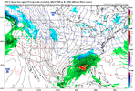
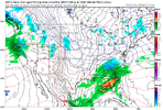
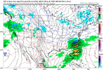
The GFS wants to do some really bad things. And by bad I mean good.
Sent from my iPhone using Tapatalk
Sent from my iPhone using Tapatalk
It looks good, but too far out in fantasy land. Might as well be the CFS at this range. At least the cold look continues.The GFS wants to do some really bad things. And by bad I mean good.
Sent from my iPhone using Tapatalk
But at this range, you could end up in the bullseye. I've relearned this year that anything past day 7 is garbage.that doesnt look winter for me unforch
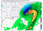
A shot or 2 is all you can ask for in March, especially this winter. The GFS Suite has definitely moved toward the CMC / Euro in the medium rangeOh and this is another system at just past day 11:
View attachment 133855
As we've discussed in the past, don't look at the fine details. Anything at this range will radically change form run to run. Just know that the pattern could produce something wintery by mid-month.
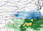
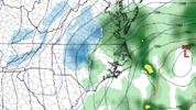
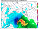
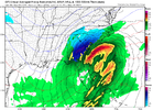
GFS snow depth....a lot falling a lot melting
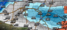
Wider loop view of Ptype, snow depth, 2m temps
View attachment 030223.mp4

Wider loop view of Ptype, snow depth, 2m temps
View attachment 030223.mp4
Oh...
SWVAwxfan
Member
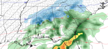
Seriously doubt we see a storm moving east-southeast in mid March.GFS snow depth....a lot falling a lot melting
View attachment 133859
Wider loop view of Ptype, snow depth, 2m temps
View attachment 133860
Drizzle Snizzle
Member
LukeBarrette
im north of 90% of people on here so yeah
Meteorology Student
Member
2024 Supporter
2017-2023 Supporter
Gfs is showing some possibilities as well, potential is there
LukeBarrette
im north of 90% of people on here so yeah
Meteorology Student
Member
2024 Supporter
2017-2023 Supporter
It’s ok, we are all weenies at heart
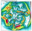
Obviously it’s fantasy but these types of patterns no matter what months have potential for winter storms. Westward retrograding -NAO .. ridging out west popping up.. upper lows/ energy spinning around like fidget spinners.. if something connects a boom scenario could happen. I haven’t seen much ensemble support yet for any type of storm signal but high amp phase 8 stuff is nothing to sneeze at and a threat could pop up outta the blue at any point imo.
This is true in spirit though some find pleasure in tormenting us with talk of never ending SE forest fire ridges and snow droughtsIt’s ok, we are all weenies at heart
severestorm
Member
LOL


? ? ?
This is why I try to be a bit relentless with the cold pattern coming up.. I mean hey we spent 2 months in a burning fire don’t we deserve a little fun for once ??This is true in spirit though some find pleasure in tormenting us with talk of never ending SE forest fire ridges and snow droughts
J1C1111
Member
Your exactly right. Well said. We do. We all know what's around the corner. We have had to deal with a heat lovers paradise this non winter all but a few days around Christmas. Just wait till next week at this time if the models hold serve the whining and crying index will be at a monumentental high. I can hear it all now. Better get the tissues ready. Like we didn't see this coming. Going to be like the 4th or 5th year in a row this pattern always wants to take shape in the spring and give us a late winter. Most said the last few months but not all said oh no it want happen again this spring because it's a third year Nina and the southeast ridge is to strong and will have a normal spring and go into a early summer. The southeast ridge did win out this non Winter but it looks like it gets ----- slapped back to reality this time. Well folks. Right on schedule. Look what's coming at the end of next week. Pretty much the norm for spring around these parts lately. But some folks just don't see the writing on the wall. When you torch almost all of winter. What do you expect. I can't wait. Let's get it.This is why I try to be a bit relentless with the cold pattern coming up.. I mean hey we spent 2 months in a burning fire don’t we deserve a little fun for once ??
Well these are definitely great weenie runs of the GFS overnight and this morning, but let’s remember this was a model that 2 days ago kept showing a strong SER despite high amp phase 8 MJO, -AO, -NAO combination.
rburrel2
Member
GEFS snowfall means have really bumped up overnight. This may have legs.
NBAcentel
Member
Euro being amped up is a big red flag imho. That has been the trend the last month

