Happy Sunday
Stuck in the clouds I guess. Tons of bust and close calls lately.Where is all this rain KATL keeps honking?????

")


And precip over the next few days give or take. With plenty to come after this as well. Nice


ATL is literally sucked in by a black hole,,,lol
UPDATE...
Just a quick update to tweak POPS across much of the area as
models are starting to show higher confidence in convection
impacting portions of northwest GA and central GA with lower
chances across the Atlanta metro and Athens areas. Also tweaked
cloud cover as I expect mostly clear skies will start to see some
cumulus build through the afternoon given the increased moisture
across the area. Updated forecasts will be issued shortly.

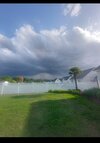
Much better coverage than pop up storms coming up. Looks solidly like 50-70% coverageRelative humidity levels are hovering around 40% across the area. Why they keep forecasting rain chances above 50-70% is kind of beyond my comprehension.
View attachment 118683

I’ve got legit 1” cracks all over my field now with crunchy grass. I’m at 65% humidity today though and have had some heavy sprinkles a couple times. We need about 3” this week to get back to normal.Relative humidity levels are hovering around 40% across the area. Why they keep forecasting rain chances above 50-70% is kind of beyond my comprehension.
View attachment 118683
I think this OFB will be only good for focusing storms for tomorrow and onwardOFBs on the way, let's see if it can fire some storms or kills off chances altogether
I just had a brief sprinkle, the humidity has only come up to 58% after 9PM. I wonder how much time we have before the Allatoona and Lanier really start to drop levels. The prior wet periods have the river flow probably fairly close to normal, at least for now. To go 40 to 50+ days without any significant rainfall into June could really start some serious evaporation out of both lakes.I’ve got legit 1” cracks all over my field now with crunchy grass. I’m at 65% humidity today though and have had some heavy sprinkles a couple times. We need about 3” this week to get back to normal.


How are things now? Looks like a deluge throughout all of Georgia right nowI just had a brief sprinkle, the humidity has only come up to 58% after 9PM. I wonder how much time we have before the Allatoona and Lanier really start to drop levels. The prior wet periods have the river flow probably fairly close to normal, at least for now. To go 40 to 50+ days without any significant rainfall into June could really start some serious evaporation out of both lakes.

Yeah less than ideal if you didn't protect them. Hopefully wind stayed up or too dry for frost, they may be okI hope my maters are ok????
Not a veggie growing expert, but this can’t be good View attachment 118692
It’s great, thankfully! I really thought we might miss the bulk to the west based on some short range guidance during the 00z runs, but the It’s been good. Most stations are reporting over an inch already.How are things now? Looks like a deluge throughout all of Georgia right now
Well as of now here in central Walton County 1.98 in gauge so farHow are things now? Looks like a deluge throughout all of Georgia right now
AI driven or not, i almost always take summer nado forecasts with a grain of salt. There's a paper i saw years ago (but still feels very true, it has completely stuck with me) that basically implied once you get into summer regimes you can basically throw STP and all of the model driven supercell/tornado parameters out (or at least respect them way less) as their accuracy of predicting outbreaks goes down a lot.View attachment 118693
Interesting

Not .50 here so far?Well as of now here in central Walton County 1.98 in gauge so far
I’m at .67” so far.Not .50 here so far?

You just got a new tempest didn't you? Its probably a little low, they are getting better, but are still generally short.I’m at .67” so far.
It took mine about 2-3 years to really dial in now it matches my old Davis or is within a few hundredths each event.You just got a new tempest didn't you? Its probably a little low, they are getting better, but are still generally short.