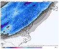
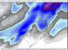
-
Hello, please take a minute to check out our awesome content, contributed by the wonderful members of our community. We hope you'll add your own thoughts and opinions by making a free account!
You are using an out of date browser. It may not display this or other websites correctly.
You should upgrade or use an alternative browser.
You should upgrade or use an alternative browser.
Pattern March Thread
- Thread starter SD
- Start date
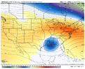
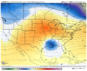
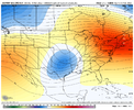
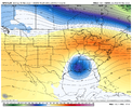
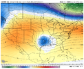
Might not look like much dampened out, but This pattern with a GOA/AK low favors energy handoffs from it —> cutoffs as the pacific energy moving east separates from the faster flow on top with ridging building over and then cutoff propagation east, and the GOAK low speeds up the flow favoring faster movement with these cutoffs. Volatile pattern for severe weather and cutoffs in general, mild pattern as well Gonna be lots of 70s probably 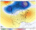

That absolutely was a typo my bad, should be "too cold".You said: “Models always seem to be too warm in windy, no radiation just *brutal cold* scenarios.”
1. Too warm or too cold in windy scenarios? Do you have a typo in what you said?
Last edited:
olhausen
Member
Very true, April 21st just last year.It is still early enough for the bulk of the SE and especially up your way and further north, to have a few more gorgeously dry, pleasant weekends even assuming a warm spring (not cold like this one but still pleasantly cool to mild with low RH). Typically there is at least one chilly period in April. I know that many Masters golf tourneys have very nice days and chilly nights. Canadian highs don't typically just go cold turkey on dropping well down into the US until at least well into spring.
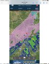
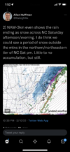
This will be a fun weather system to track.. very dynamic stuff.. severe threat sneaking up if we can get a solid southerly flow set up before the cold front kicks through this could be interesting. Quite the windy morning regardless .. and of course the NAM throwing some flake bones to us on the backside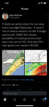


Delta Thunder
Member
I am certainly hoping this is the last trick freeze for USDA Zones 7 and Zones 8 for this year in the South. We have tons of stuff blooming - especially fruit trees. Looks absolutely devastating for areas all the way to the coast. What my Grandmother called a black frost.
MichaelJ
Member
I think the low nighttime temps will gradually rise as we get close to Sat
I think the low nighttime temps will gradually rise as we get close to Sat
Often I would agree with this due to the continued cold bias of model consensus. However, as you know, cold biased doesn’t mean too cold all of the time but rather too cold on average. I’ve been following the modeled 3/13 lows for quite a few days now and they really haven’t been warming and we’re getting close to the event. It has been more like one run warmer followed by the next run colder, etc. Back and forth. More typically, we would have seen some model warming by now. Also, this is a true Arctic airmass with very cold 850s for mid-March. So, I think the cold modeled lows will hold (no, not the CMC’s ridiculous cold lol). The GFS is my model of choice and it has been fairly consistent for days.
So, Im going with FFC’s low 20s at Atlanta and think even KATL will end up 23 or lower. Some ATL N burbs could see high teens. I like upper 20s down my way and 30 or lower for @pcbjr ‘s abode on the northside of Hogtown.
Last edited:
LickWx
Member
I bet you don’t drop below 30 . Atlanta won’t drop below 25. Same for RDU. That’s my wager !Often I would agree with this due to the continued cold bias of model consensus. However, as you know, cold biased doesn’t mean too cold all of the time but rather too cold on average. I’ve been following the modeled 3/13 lows for quite a few days now and they really haven’t been warming and we’re getting close to the event. It has been more like one run warmer followed by the next run colder, etc. Back and forth. More typically, we would have seen some model warming by now. Also, this is a true Arctic airmass with very cold 850s for mid-March. So, I think the cold modeled lows will hold (no, not the CMC’s ridiculous cold lol). The GFS is my model of choice and it has been fairly consistent for days.
So, Im going with FFC’s low 20s at Atlanta and think even KATL will end up 23 or lower. Done ATL N burbs could see high teens. I like upper 20s down my way and 30 or lower for @pcbjr ‘s abode on the northside of Hogtown.
Delta Thunder
Member
From an agricultural/horticultural standpoint, anything 28 and below for more than a few hours becomes quite damaging for things in bloom. In tight bud, they can take it down to the low to mid 20's for several hours. 28 degrees is a very crucial line. Most Spring freezes are between 28 and 32 degrees at this time of year and they usually only last for no more than 4 hours in the wee hours of the morning. Most temperate vegetation can handle that scenario. But low 20's for 8 hours blackens things and growth has to begin all over again from lateral buds. Much of the Deep South's mast crop may be destroyed over this weekend as the oaks are blooming in many places...especially along and south of the I-20 corridor all the way to within 10 miles of the beaches...If what the model consensus is showing is true.
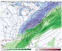
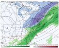
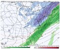
What is interesting is seeing the above freezing temps behind the precip areas on the maps from 6pm to 12am tomorrow night.
What is interesting is seeing the above freezing temps behind the precip areas on the maps from 6pm to 12am tomorrow night.
ATLwxfan
Member
For winter weather central Mississippi is much more exciting than ATL. Looking forward to the warmth ahead.
Sent from my iPhone using Tapatalk
Sent from my iPhone using Tapatalk
Iceagewhereartthou
Member
HurricaneSolomon
Member
- Joined
- Dec 6, 2021
- Messages
- 132
- Reaction score
- 237
GEFS cause why notView attachment 115316
I’ve wondered if we could see even a few flurries as this rain ends. There hasn’t been any mention of it as of yet but who knows.
Sent from my iPad using Tapatalk
Cad Wedge NC
Member
32 here this morning as well. Big frost.

