Chiliphil1
Member
Damn Macon is about to get nailed, prayers for Deltadog
Also for the people working at geico. I know they’re at work today and this is on the Southside where their offices are.
Damn Macon is about to get nailed, prayers for Deltadog
Ryan Cartee has a MASSIVE TORNDO on his stream
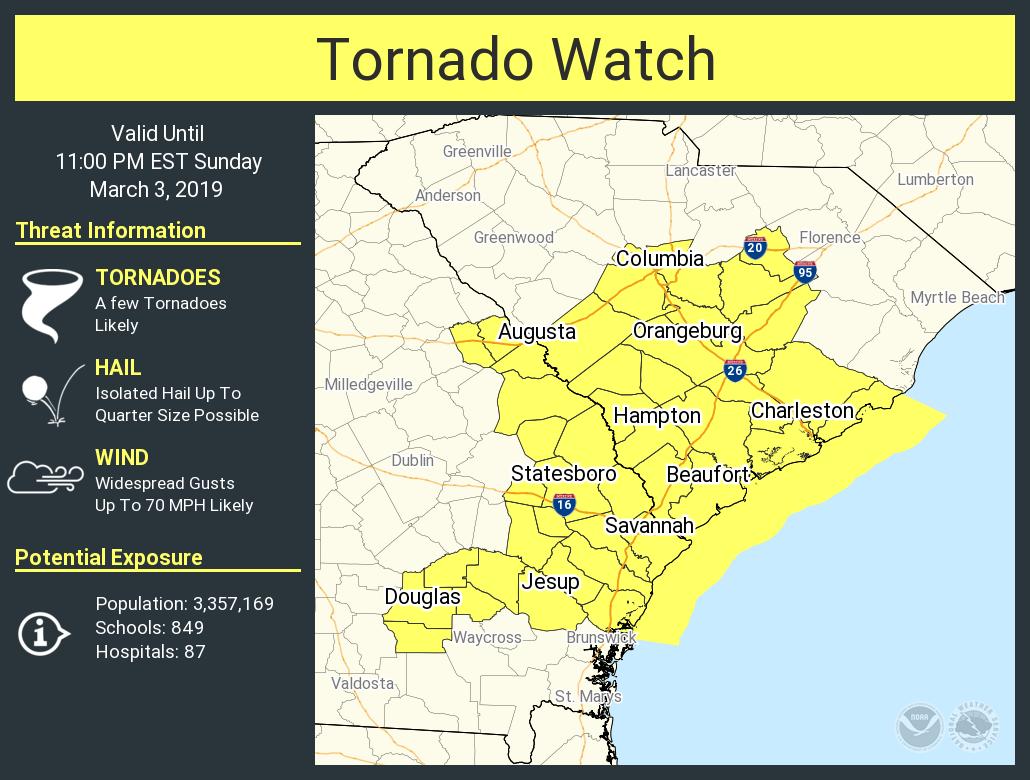
PDS tornado warning southwest of Macon
I hope Delta is okay.PDS tornado warning southwest of Macon
Yeah, I'm 20 min from therePossible TOR in Chatom AL!

Is that the one east of the city or is it a third?Another Tornado DOWN near Tuskeege!!!

Macon, GA... Is right turner.. Headed between Macon Airport and Warner Robins!!!WMAZ has live stream LARGE WALL CLOUD
I'm in a convoy heading to Robins AFB right now. Starting to get a little nervous about being on the road.
He text me hes fineI hope Delta is okay.
That's good to hear.He text me hes fine
Sent from my SM-G955U using Tapatalk
SD said he is fine.delta let us know you are ok!
just saw that! good!SD said he is fine.
I'm in a convoy heading to Robins AFB right now. Starting to get a little nervous about being on the road.

~1730. Just went through WrenWhat’s your eta? That area looks clear for the moment but there are more coming. Provided nothing else spins up.
~1730. Just went through Wren
