• Hello, please take a minute to check out our awesome content, contributed by the wonderful members of our community. We hope you'll add your own thoughts and opinions by making a free account!

Tropical Major Hurricane Milton

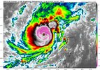
Gotta love pinhole eye hurricanes. When the eyewall falls apart, the result will be just as interesting.

Worst case will be a mega eye, shear and dry air resistance Cat 3.
The problem is that the storm will be in just as good of an environment once it begins to lift away from the Yucatan tomorrow another round of intensification is on the table. A more conventional 10-20 mile wide cat 5 eye probably.
 
664
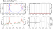
URNT15 KWBC 072344
NOAA2 1014A MILTON HDOB 22 20241007
233500 2149N 09029W 7513 01678 9065 +239 +208 296053 084 /// /// 03
233530 2151N 09029W 7506 01661 9035 +245 +209 002032 038 /// /// 03
233600 2152N 09029W 7541 01681 9111 +213 +215 064071 098 /// /// 05
233630 2154N 09029W 7526 01866 9286 +192 +213 069120 122 /// /// 05
233700 2155N 09029W 7518 02031 9460 +182 +202 070124 127 /// /// 05
233730 2157N 09029W 7545 02103 9579 +178 +187 075110 121 /// /// 05
233800 2159N 09030W 7521 02203 9659 +174 +182 076092 102 /// /// 05
233830 2201N 09030W 7512 02258 9716 +165 +181 075086 091 /// /// 05
233900 2202N 09031W 7512 02292 9765 +152 +175 073087 092 /// /// 05
233930 2204N 09031W 7513 02321 9807 +144 +170 074079 082 /// /// 05
234000 2206N 09032W 7508 02353 9821 +159 +163 076074 079 /// /// 05
234030 2208N 09032W 7512 02366 9847 +152 +174 074072 078 /// /// 05
234100 2210N 09033W 7527 02364 9869 +148 +168 070069 072 /// /// 05
234130 2212N 09033W 7511 02396 9885 +148 +160 072065 067 /// /// 05
234200 2214N 09034W 7519 02401 9900 +146 +163 068061 062 /// /// 05
234230 2216N 09034W 7512 02412 9909 +144 +162 075058 060 /// /// 05
234300 2217N 09035W 7512 02420 9916 +144 +167 069057 060 /// /// 05
234330 2219N 09035W 7513 02418 9924 +140 +163 066055 057 /// /// 05
234400 2221N 09036W 7512 02428 9933 +139 +165 062055 059 /// /// 05
234430 2223N 09036W 7513 02432 9933 +143 +161 059053 054 /// /// 05
899 mb but NOAA bias indicates 902 mb.
 
SUMMARY OF 700 PM CDT...0000 UTC...INFORMATION
----------------------------------------------
LOCATION...21.9N 90.4W
ABOUT 60 MI...100 KM NW OF PROGRESO MEXICO
ABOUT 650 MI...1045 KM SW OF TAMPA FLORIDA
MAXIMUM SUSTAINED WINDS...180 MPH...285 KM/H
PRESENT MOVEMENT...E OR 90 DEGREES AT 10 MPH...17 KM/H
MINIMUM CENTRAL PRESSURE...897 MB...26.49 INCHES
 
BULLETIN
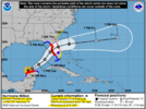
Hurricane Milton Intermediate Advisory Number 11A
NWS National Hurricane Center Miami FL AL142024
700 PM CDT Mon Oct 07 2024

...CENTRAL PRESSURE IN THE EYE OF MILTON HAS FALLEN TO A NEAR RECORD
LOW...
...MILTON POSES AN EXTREMELY SERIOUS THREAT TO FLORIDA AND
RESIDENTS ARE URGED TO FOLLOW THE ORDERS OF LOCAL OFFICIALS...


SUMMARY OF 700 PM CDT...0000 UTC...INFORMATION
----------------------------------------------
LOCATION...21.9N 90.4W
ABOUT 60 MI...100 KM NW OF PROGRESO MEXICO
ABOUT 650 MI...1045 KM SW OF TAMPA FLORIDA
MAXIMUM SUSTAINED WINDS...180 MPH...285 KM/H
PRESENT MOVEMENT...E OR 90 DEGREES AT 10 MPH...17 KM/H
MINIMUM CENTRAL PRESSURE...897 MB...26.49 INCHES
 
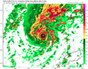
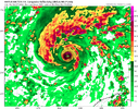
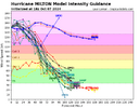
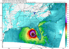
Okay it might have peaked before recon but some of the hurricane models still have another peak tomorrow

If it gets anywhere close, I will be very impressed and it will be in some very rare company.

Edit: Looks like Allen would be its competitor.
 
First time I've ever posted the Nam and thought "hey, maybe...."

View attachment 152847
Yeah, with this EWRC starting now, it will have some time to restrengthen. Also these smaller core storms will often start deepening faster after the new eyewall has taken over. I remember Andrew going through an EWRC between the Bahamas and Florida and it’s winds dropping back to 140mph, then on reanalysis a few years later the NHC found that it had gone up to cat 5 before landfall
 
Yeah, with this EWRC starting now, it will have some time to restrengthen. Also these smaller core storms will often start deepening faster after the new eyewall has taken over. I remember Andrew going through an EWRC between the Bahamas and Florida and it’s winds dropping back to 140mph, then on reanalysis a few years later the NHC found that it had gone up to cat 5 before landfall

I am honestly at a loss how long it is going/went. I saw what I thought were small signs of a possible slowdown/EWC around early afternoon. But nope.
Definitely rare territory when a hurricane drops past 900mb. Nothing really to slow it down. Really warm waters in gulf.
 
The eye is about to get a lot bigger... And probably makes another run at bombing out again more likely

Most of the hyped up weakening will occur on Wednesday btw in theory anyway
 
Directly into Tampa and at a horrible angle for the bay too. Disastrous situation going to unfold.
This exact catastrophic situation has been talked about for decades. I lived almost all of my life there in south Florida and it was the worst situation that could be imagined. I really hope it doesn't continue to materialize. But the models are converging on St. Pete and Tampa Bay and the clock is running out.

The early RI and ERC only increases the potential to expand the wind field and push a greater surge into the west coast. Not good at all.
 
Back
Top