Shaggy
Member
We will know once we start getting center fixes againSo is Milton moving E or NE? Some say it started the turn but NHC says east
We will know once we start getting center fixes againSo is Milton moving E or NE? Some say it started the turn but NHC says east

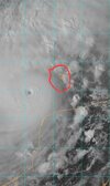
That's Scorpion Reef. It was originally plotted to go north of there before the southward component happened starting yesterday.Does look like northern component to movement but too early to tell. I'll be watching this little island, Isla Perez (I think). NHC has it going south of there, sat images can be deceiving but looks like headed straight for it, we will know soon enough. Either way not gonna get close enough to land mass to impede strength atm it seems
View attachment 152818
Just looking at that map and from what I can remember of Tampa, if the storm makes landfall just to the the north of the bay a 10-15’ storm surge would put most of downtown underwater.
Just looking at that map and from what I can remember of Tampa, if the storm makes landfall just to the the north of the bay a 10-15’ storm surge would put most of downtown underwater.
I’m also assuming a landfall close to high tide.
Man that eye must be about 3 miles wide now. it's shrinking fast. Gotta be sub 900mb by now.
Sent from my iPhone using Tapatalk
When the next plane?Man that eye must be about 3 miles wide now. it's shrinking fast. Gotta be sub 900mb by now.
Sent from my iPhone using Tapatalk
Were probably 10-15min from a center passWhen the next plane?
That’s what I remember reading about that storm. I wonder if the effects are magnified any from the effects of so much water being pushed into such a small area… relatively speaking1848 supposedly had 15 feet and nearly wiped out the whole city
Can't imagine the turbulence...
Yes the Pacific has lower records
For the Atlantic it's 190 mph and 882 mb
I didn't think he could push wilma and I still don't think he does but man he isn't far offYes the Pacific has lower records
For the Atlantic it's 190 mph and 882 mb
No it’s probably gotta little bit more strengthening. Cloud tops are still getting colder and several mets have posted that there’s not really any sign that a EWRC is startingI'm curious to see if the pressure is rising on the few next passes. I think it may have bottomed out a few hours ago, but could be wrong of course.
10 mb or about 250 feet up, which is not far has 215 mph winds. Absolutely nuts with the surface at 185.
View attachment 152826
We'll find out in a few minutes. It would be really annoying to have missed the minimum pressure reading because we had no planes flying in it all afternoon.No it’s probably gotta little bit more strengthening. Cloud tops are still getting colder and several mets have posted that there’s not really any sign that a EWRC is starting
It’s still easily strengthening right now. There’s nothing stopping it from strengthening furtherWe'll find out in a few minutes. It would be really annoying to have missed the minimum pressure reading because we had no planes flying in it all afternoon.
But yea, it still looks pretty perfect at the moment.
