-
Hello, please take a minute to check out our awesome content, contributed by the wonderful members of our community. We hope you'll add your own thoughts and opinions by making a free account!
You are using an out of date browser. It may not display this or other websites correctly.
You should upgrade or use an alternative browser.
You should upgrade or use an alternative browser.
Tropical Major Hurricane Milton
- Thread starter SD
- Start date
I’m expecting this to tug poleward. Massive storm. Best guess is we’ll be on the northern end of guidance
Brent
Member
I’m expecting this to tug poleward. Massive storm. Best guess is we’ll be on the northern end of guidance
Already looks like it's starting on satellite. This is the turn that may doom Tampa
that with the latest dropsonde it has taken a wobble to the NEAlready looks like it's starting on satellite. This is the turn that may doom Tampa
I noticed that. Makes a big difference especially for weather down my way. Def. further south vs the 12z RUN.0Z GFS is barely further S vs 18Z with it still near Tampa. Each run today has trended further S.
Took some erratic motion to get there. Started out further north then hooked hard east for a few frames before returning to NE motion. If that happens it’s going to be a nerve wracking few hours for Tampa0Z Euro: Tampa late Wed night
looks a little faster this run as well.
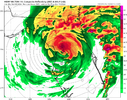
THE AMOUNT OF LIGHTING IN THE CENTER OF THIS THING IS ABSOLUTELY AMAZING.. AND SOME IN THE NE QUADRANT
Hurricane Milton Discussion Number 13
NWS National Hurricane Center Miami FL AL142024
400 AM CDT Tue Oct 08 2024
The structure of Milton has changed significantly overnight. The
pinhole eye seen yesterday has filled and earlier aircraft data
showed a double eyewall structure. More recent microwave images
show only one larger eyewall, and it is clear that Milton is
completing an eyewall replacement cycle. These eyewall replacement
cycles are common in strong hurricanes and often cause the peak
winds to fluctuate, while the wind field generally expands. Based
on the aircraft data from a few hours ago, the initial intensity is
set at 135 kt. Both the NOAA and Air Force Hurricane Hunters are
scheduled to investigate Milton again later this morning.
The major hurricane is beginning to gain latitude, and the latest
initial motion estimate is 075/10 kt. A turn to the northeast with
a slight increase in forward speed is expected later today and
Wednesday as the hurricane moves in the flow between a trough
digging into the Gulf of Mexico and a ridge near the Greater
Antilles. This motion should take the core of Milton to
west-central Florida Wednesday night. After the hurricane passes
Florida, a faster east-northeastward motion is expected within a
more zonal steering flow. Little change was made to the track
forecast through landfall, but this prediction is a little slower
while the system enters and moves over the Atlantic.
Fluctuations in strength due to continued structural changes are
likely during the next day or so while Milton moves across the
central and eastern Gulf of Mexico. An increase in vertical wind
shear will likely cause some weakening before the hurricane reaches
Florida, but there is high confidence that Milton will remain an
extremely dangerous hurricane when it reaches the state. After
landfall, more notable weakening is forecast and Milton is now
expected to become extratropical by day 3 when it is over the
Atlantic. The NHC intensity forecast lies at the high end of the
model guidance in best agreement with the hurricane regional models.
Milton is still a relatively compact hurricane, but the wind field
is expected to continue to grow in size as it approaches Florida.
In fact, the official forecast shows the hurricane and
tropical-storm-force winds roughly doubling in size by the time it
makes landfall. Therefore, damaging winds, life-threatening storm
surge, and heavy rainfall will extend well outside the forecast
cone. It is worth emphasizing that this is a very serious situation
and residents in Florida should closely follow orders from their
local emergency management officials. Milton has the potential to
be one of the most destructive hurricanes on record for west-central
Florida.
Belle Lechat
Member
- Joined
- Aug 29, 2021
- Messages
- 1,529
- Reaction score
- 1,215
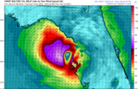
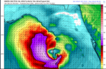
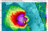
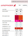
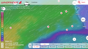
The website has weather stations, showing buoys off Florida, for example, but it may extrapolate wind data poorly, because I can't find hurricane force winds clicking on the map.


 www.windfinder.com
At 1am.


Windfinder - wind, wave & weather reports, forecasts & statistics worldwide
Wind and weather reports & forecasts for kitesurfers, windsurfers, surfers, sailors and paragliders for over 160,000 locations worldwide.
At 1am.

Last edited:
Belle Lechat
Member
- Joined
- Aug 29, 2021
- Messages
- 1,529
- Reaction score
- 1,215
Belle Lechat
Member
- Joined
- Aug 29, 2021
- Messages
- 1,529
- Reaction score
- 1,215
BHS1975
Member
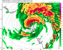
The HRRR has it pulling in a lot of dry air before landfall.
Sent from my iPhone using Tapatalk
Sent from my iPhone using Tapatalk
Henry2326
Member
Unfortunately, even if it does happen, may not be enough to reduce impacts.The HRRR has it pulling in a lot of dry air before landfall.
Sent from my iPhone using Tapatalk
NOPE. BY THAT TIME THE DAMAGE WILL BE ONGOINGUnfortunately, even if it does happen, may not be enough to reduce impacts.
Belle Lechat
Member
- Joined
- Aug 29, 2021
- Messages
- 1,529
- Reaction score
- 1,215
Henry2326
Member
NHC 4am
FORECAST POSITIONS AND MAX WINDS
INIT 08/0900Z 22.3N 88.9W 135 KT 155 MPH
12H 08/1800Z 22.9N 87.5W 140 KT 160 MPH
24H 09/0600Z 24.2N 85.8W 135 KT 155 MPH
36H 09/1800Z 26.0N 84.2W 125 KT 145 MPH
48H 10/0600Z 27.6N 82.6W 110 KT 125 MPH...NEAR THE COAST
60H 10/1800Z 28.8N 79.9W 70 KT 80 MPH...OVER WATER
72H 11/0600Z 29.7N 76.5W 60 KT 70 MPH...POST-TROP/EXTRATROP
96H 12/0600Z 30.4N 69.9W 45 KT 50 MPH...POST-TROP/EXTRATROP
120H 13/0600Z 31.5N 63.8W 35 KT 40 MPH...POST-TROP/EXTRATROP
AH HUR HNTR TEAL72 HEADED IN FROM Biloxi MS.. SHOULD ARRIVE IN A BIT.. THEY ARE JUST NOW JUST SOUTH OF LA
Henry2326
Member
Henry2326
Member
I won't be surprised.....the stronger storms tend to pull North and east. HWRF is on an island of itself at Crystal River for landfall, more north.UNLESS MY EYES ARE TIRED IT HAS TAKEN A BIG NORTH TUG
THE 4 AM UPDATE HAS IT SE OF THE ISLAND TO THE LEFT OF CENTER
View attachment 152885
Chattownsnow
Member
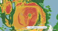
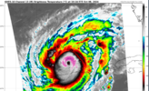
He appears to have shed the remaining part of the former eyewall and is ready to re-intensify based on IR imagery
MichaelJ
Member
Pretty sure this will come inland just north of Tampa as a Cat 4 with 140mph winds as dry air will take some of the top off, still going to be a strong storm and Tampa will be hit hard. Let's see if the NHC agrees
Belle Lechat
Member
- Joined
- Aug 29, 2021
- Messages
- 1,529
- Reaction score
- 1,215
UNLESS MY EYES ARE TIRED IT HAS TAKEN A BIG NORTH TUG
THE 4 AM UPDATE HAS IT SE OF THE ISLAND TO THE LEFT OF CENTER
View attachment 152885
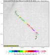
Yes, it now has a N component.

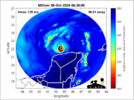
You can see Isla Perez of the Alacranes lightly to the left of the center in the Recon map. They were in a weaker part of the eyewall, winds decreasing to the north and south of them as it passed over. It appears they didn't even get hurricane force wind gusts, as I showed previously.

Scorpion Reef - Wikipedia
Last edited:
Brent
Member
More and more I'm feeling this like this is the feared Tampa storm sadly
We can only hope it weakens a lot but it may not matter
We can only hope it weakens a lot but it may not matter
Belle Lechat
Member
- Joined
- Aug 29, 2021
- Messages
- 1,529
- Reaction score
- 1,215
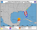
| HURRICANE AND STORM SURGE WARNINGS ISSUED FOR PORTIONS OF THE EAST COAST OF FLORIDA... ...RESIDENTS IN FLORIDA ARE URGED TO USE TODAY TO PREPARE FOR MILTON'S ARRIVAL AND EVACUATE IF TOLD TO DO SO BY LOCAL OFFICIALS... |
| 7:00 AM CDT Tue Oct 8 Location: 22.5°N 88.8°W Moving: ENE at 12 mph Min pressure: 929 mb Max sustained: 145 mph |
Belle Lechat
Member
- Joined
- Aug 29, 2021
- Messages
- 1,529
- Reaction score
- 1,215
Henry2326
Member
HWRF and I agree. I quit counting Hwrf runs with this solution.Pretty sure this will come inland just north of Tampa as a Cat 4 with 140mph winds as dry air will take some of the top off, still going to be a strong storm and Tampa will be hit hard. Let's see if the NHC agrees
Jax gets hit hard too.
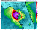
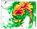
Matthew East on Facebook posted this.
8:30am Tuesday: Looking at #Milton this morning, I think it has a good chance to strengthen again today. It has completed an eyewall replacement cycle and conditions are favorable for the next 24 hours or so. Think it could achieve Cat 5 again before weakening on its approach to Florida.
8:30am Tuesday: Looking at #Milton this morning, I think it has a good chance to strengthen again today. It has completed an eyewall replacement cycle and conditions are favorable for the next 24 hours or so. Think it could achieve Cat 5 again before weakening on its approach to Florida.
Belle Lechat
Member
- Joined
- Aug 29, 2021
- Messages
- 1,529
- Reaction score
- 1,215
Belle Lechat
Member
- Joined
- Aug 29, 2021
- Messages
- 1,529
- Reaction score
- 1,215
Belle Lechat
Member
- Joined
- Aug 29, 2021
- Messages
- 1,529
- Reaction score
- 1,215

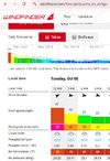
For the record, seeing this thing make a dip close to the Yucatan coast around midnight, I just now checked all the coastal weather stations as far inland as the Merida airport on Windfinder. While it's possible there were stronger winds before midnight, Windfinder reports data in 3 hour increments, and I could only see data for today the 8th, and the winds on the coast decreased after the 12am readings. The strongest gusts I saw was 72 mph.
Last edited:
Belle Lechat
Member
- Joined
- Aug 29, 2021
- Messages
- 1,529
- Reaction score
- 1,215
Satellite presentation doesn't give the impression that it's primed for takeoff just yet. But it may make another run at cat 5 status later this afternoon. Overall conditions seem pretty favorable for a while.
ForsythSnow
Moderator
I definitely wouldn't say it's strengthening, but I definitely wouldn't say it's weakening either. Eye is at 13 miles this morning but if it clears in the next few then the floor is back open unless another influence comes in. I'm curious why so many hurricane models bust it open before landfall too. Jet influence maybe? I feel like I saw this with Helene's modeling but the eye stayed intact for awhile versus modeled.Satellite presentation doesn't give the impression that it's primed for takeoff just yet. But it may make another run at cat 5 status later this afternoon. Overall conditions seem pretty favorable for a while.
Downeastnc
Member
I definitely wouldn't say it's strengthening, but I definitely wouldn't say it's weakening either. Eye is at 13 miles this morning but if it clears in the next few then the floor is back open unless another influence comes in. I'm curious why so many hurricane models bust it open before landfall too. Jet influence maybe? I feel like I saw this with Helene's modeling but the eye stayed intact for awhile versus modeled.
13 miles is pretty small still and with contraction would hopefully/probably lead to another ERC fairly quickly....best case is a ERC happening late tonight while also ingesting some dry air...
the usual suspects- dry air and shear. i still maintain that when this thing deteriorates it will deteriorate fastI definitely wouldn't say it's strengthening, but I definitely wouldn't say it's weakening either. Eye is at 13 miles this morning but if it clears in the next few then the floor is back open unless another influence comes in. I'm curious why so many hurricane models bust it open before landfall too. Jet influence maybe? I feel like I saw this with Helene's modeling but the eye stayed intact for awhile versus modeled.
you can feel it in the air this morning. woke up and the house was sitting at 65 (no heat on). i think it's inevitable dry air gets ingested tomorrow on the southeast side- all models show this- the question to me is how long it can maintain its structural integrity
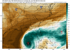
the impacts will be similar but i don't agree verbatim with the "the impacts will be the exact same" message- personally i think there's a big difference between a ragged but intact storm coming ashore vs. a half-icane that has been decaying for a little bit

