• Hello, please take a minute to check out our awesome content, contributed by the wonderful members of our community. We hope you'll add your own thoughts and opinions by making a free account!

Tropical Major Hurricane Laura

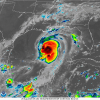
Alarming the eye is still open! If that closes it's gonna be even worse

URNT12 KNHC 260605
REPNT2

VORTEX DATA MESSAGE AL132020
A. 26/05:08:50Z
B. 25.38 DEG N 089.98 DEG W
C. 700 MB 2922 M
D. 979 MB
E. 120 DEG 4 KT
F. OPEN E
G. C20
H. 85 KT
I. 078 DEG 26 NM 05:01:00Z
J. 157 DEG 91 KT
K. 079 DEG 30 NM 05:00:00Z
L. 86 KT
M. 046 DEG 28 NM 05:20:00Z
N. 140 DEG 104 KT
O. 046 DEG 33 NM 05:21:30Z
P. 12 C / 3049 M
Q. 15 C / 3054 M
R. 10 C / NA
S. 1234 / 7
T. 0.02 / 1 NM
U. AF309
1913A LAURA OB 31
MAX FL WIND 104 KT 046 / 33 NM 05:21:30Z
MAX FL TEMP 15 C 047 / 7 NM FROM FL CNTR
 
That euro might verify at this rate. I could definitely see a Cat 4 tomorrow at some point

The NW quad still looks meh......though it does seem to be close to trying to close off a eye again...it still has some work to do to get to 935 MB.....need another plane in there ASAP....
 
The NW quad still looks meh......though it does seem to be close to trying to close off a eye again...it still has some work to do to get to 935 MB.....need another plane in there ASAP....

Oh I agree the satellite appearance is meh but apparently if you look at the VDM the eye is almost closed I'm a little surprised it's 105 already tbh
 
...LAURA EXPECTED TO RAPIDLY STRENGTHEN TO A CATEGORY 4 HURRICANE...
...FORECAST TO PRODUCE A LIFE-THREATENING STORM SURGE, EXTREME
WINDS, AND FLASH FLOODING OVER EASTERN TEXAS AND LOUISIANA LATER
TODAY...


SUMMARY OF 400 AM CDT...0900 UTC...INFORMATION
----------------------------------------------
LOCATION...26.1N 90.7W
ABOUT 315 MI...510 KM SSE OF LAKE CHARLES LOUISIANA
ABOUT 335 MI...540 KM SE OF GALVESTON TEXAS
MAXIMUM SUSTAINED WINDS...110 MPH...175 KM/H
PRESENT MOVEMENT...NW OR 310 DEGREES AT 15 MPH...24 KM/H
MINIMUM CENTRAL PRESSURE...973 MB...28.72 INCHES

031013_5day_cone_no_line_and_wind.png
 
Last edited:
Be interesting to see what the recon finds, still struggling a bit to consolidate a eye at least on IR, seems to keep opening up on the west side.... also some warming cloud tops as well though some new taller tops south of the center, still less pink now than a few hrs ago........she has really expanded the CDO though....still this should be a easy 110-115 mph when the recon gets there.....

Laura 1.jpg
 
Be interesting to see what the recon finds, still struggling a bit to consolidate a eye at least on IR, seems to keep opening up on the west side.... also some warming cloud tops as well though some new taller tops south of the center, still less pink now than a few hrs ago........she has really expanded the CDO though....still this should be a easy 110-115 mph when the recon gets there.....

Yep...

095230 2625N 09046W 6967 02928 9781 +132 +132 131073 094 091 025 00
095300 2624N 09048W 6965 02920 9770 +127 //// 124062 068 095 011 01
095330 2622N 09049W 6964 02917 9749 +120 +115 124051 056 095 009 00
 
Down to 969mb

095800 2610N 09100W 6969 02877 9695 +134 +100 125015 018 024 001 03
095830 2608N 09101W 6967 02878 9696 +131 +117 127008 014 022 002 00
095900 2607N 09103W 6967 02876 9686 +140 +119 135001 003 021 001 03
095930 2605N 09103W 6970 02874 9688 +140 +120 296006 008 022 001 00
100000 2603N 09103W 6971 02874 9691 +138 +119 307013 017 024 003 03
100030 2602N 09105W 6954 02901 9690 +143 +114 317027 032 035 003 00
100100 2601N 09106W 6973 02888 9708 +135 +120 319045 052 042 004 00
 
HWRF is picking up on what IR is showing. Pretty large eye which will be very stable and be harder to weaken by shear. Surge will be monumental.

6z HWRF looks like mid-930s and ~120Knts at landfall.
 
If you live in the Carolinas here is what you can do now. 1) fill up gas before the prices go up 2) clean storm drain debris 3) have batteries and flash lights ready to go in case weak tornadoes knock the power out 4) stock up on essentials/medications that do not need refrigeration
Stock up on birdseed!
 
Forecast to be a cat 4 at landfall now! Per TWC
 
I saw somebody giving a news conference last night, saying this was going to be worse than Rita!
 
Is the 953 reading legit? If so good god.

A bunch of those readings were flagged (for other reasons)... not sure I buy a ~15 mb drop in ~1 hour..

104200 2616N 09106W 6444 03540 9681 +128 //// 119018 020 022 006 05
104230 2618N 09106W 6443 03543 9679 +128 //// 122023 024 /// /// 05
104300 2620N 09105W 6443 03544 9670 +137 //// 121026 026 /// /// 05
104330 2619N 09103W 6443 03544 9671 +136 //// 121027 027 /// /// 05
104400 2618N 09101W 6446 03541 9678 +132 //// 123022 024 /// /// 05
104430 2616N 09102W 6440 03545 9681 +125 //// 121019 021 /// /// 05
104500 2615N 09105W 6442 03541 9681 +126 //// 114016 016 /// /// 05
104530 2616N 09107W 6443 03540 9684 +123 //// 116019 021 /// /// 05
104600 2619N 09107W 6445 03542 9680 +129 //// 122023 023 /// /// 05
104630 2620N 09106W 6440 03547 9668 +138 //// 117026 027 /// /// 05
104700 2620N 09104W 6444 03543 9672 +135 //// 119025 027 /// /// 05
104730 2619N 09102W 6445 03541 9672 +133 //// 121022 023 /// /// 05
104800 2617N 09103W 6440 03544 9686 +122 //// 121017 020 /// /// 05
104830 2616N 09105W 6443 03540 9685 +122 //// 112016 017 /// /// 05
104900 2617N 09108W 6448 03539 9671 +123 -278 114016 018 /// /// 03
104930 2619N 09108W 6442 03542 9654 +130 -212 116022 023 /// /// 03
105000 2621N 09107W 6440 03546 9630 +139 -024 110026 026 /// /// 03
105030 2621N 09105W 6444 03542 9591 +137 //// 117026 027 /// /// 05
105100 2619N 09104W 6441 03543 9560 +131 //// 129024 025 /// /// 05
105130 2617N 09104W 6450 03535 9544 +124 //// 138017 019 /// /// 05
105200 2616N 09106W 6442 03540 9528 +123 //// 130012 012 /// /// 05
105230 2617N 09108W 6440 03544 9633 +121 //// 116014 018 /// /// 05
105300 2619N 09109W 6449 03538 9651 +132 +084 114021 023 /// /// 03
105330 2621N 09108W 6442 03542 9641 +140 +060 109024 024 /// /// 03
105400 2621N 09106W 6444 03540 9645 +135 +079 115025 025 /// /// 03
105430 2620N 09105W 6446 03537 9655 +128 +079 124020 022 /// /// 03
105500 2618N 09105W 6440 03544 9655 +124 +092 127016 019 021 005 00

The other mission also got a dropsonde into the eye about an hour ago that measured 969 mb (rather than derived from FL readings).

1598440624142.png
 
961-963 mb readings from the other mission... Laura's definitely strengthening

110300 2612N 09115W 6971 02845 9635 +165 +095 204007 012 020 004 03
110330 2613N 09117W 6961 02862 9625 +175 +085 111005 007 014 003 03
110400 2613N 09119W 6978 02832 9613 +181 +100 026009 013 /// /// 03
 
Be interesting to see what the recon finds, still struggling a bit to consolidate a eye at least on IR, seems to keep opening up on the west side.... also some warming cloud tops as well though some new taller tops south of the center, still less pink now than a few hrs ago........she has really expanded the CDO though....still this should be a easy 110-115 mph when the recon gets there.....

View attachment 47333

Anyone else see the face?
 
What the heck?! 6z HMON shows Cat 5 status in a few hours although pressure is high for a Cat5 also shows Cat 5 landfall. Not buying but wow.

1598442518123.png
 
And to think we were wondering where the pressure would be this morning in comparison to the models ... she’s lower than most thought ...
 
BULLETIN
Hurricane Laura Intermediate Advisory Number 26A
NWS National Hurricane Center Miami FL AL132020
700 AM CDT Wed Aug 26 2020

...LAURA STRENGTHENS INTO A MAJOR HURRICANE...
...POTENTIALLY CATASTROPHIC STORM SURGE, EXTREME WINDS, AND FLASH
FLOODING EXPECTED ALONG THE NORTHWEST GULF COAST TONIGHT...
...STEPS TO PROTECT LIFE AND PROPERTY SHOULD BE RUSHED TO
COMPLETION IN THE NEXT FEW HOURS...


SUMMARY OF 700 AM CDT...1200 UTC...INFORMATION
----------------------------------------------
LOCATION...26.4N 91.4W
ABOUT 280 MI...450 KM SSE OF LAKE CHARLES LOUISIANA
ABOUT 290 MI...465 KM SE OF GALVESTON TEXAS
MAXIMUM SUSTAINED WINDS...115 MPH...185 KM/H
PRESENT MOVEMENT...NW OR 310 DEGREES AT 15 MPH...24 KM/H
MINIMUM CENTRAL PRESSURE...963 MB...28.44 INCHES
 
00Z Euro has it at 945 around noon....not sure it pulls that off given the current structure in the time it has left...
Maybe not, but if it can get that eyewall fully closed off, its been dropping 3ish mb/hr if I'm not mistaken. Would not at all be surprised to see it get 13-15mb by the 1o'clock hour
 
Back
Top