B
Brick Tamland
Guest
GFS has it making landfall as a 959 mb hurricane in TX.
That would be a category 3.
GFS has it making landfall as a 959 mb hurricane in TX.
That would be a category 3.

.png")


.png")
.png")
Which one is coming in first, I can never remember... Laura or Marco?
MarcoWhich one is coming in first, I can never remember... Laura or Marco?
Euro right to Texas lol!! You can keep ItMarco on Monday then Laura Wednesday or Wednesday Night depending on how far west it goes
Euro right to Texas lol!! You can keep It

Thanks, Brent. So, 2004 had 2 direct TS+ hits only one day apart for the same state. That would beat 2020's projected 2 days apart. However, the two storms in 2004 didn't affect the same areas and, as you said, Bonnie was weak. So, if the NHC tracks verify, 2020 would beat 2004 for the same area being affected and potentially with the weaker of the two being stronger in 2020.


@Brent Curiosity got hold of me and I had some time. So, I looked even further back to add to what Brent was able to find about 2004 and found two other years that are worth a mention:
1. 1923
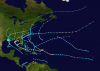
View attachment 47016
In mid October just 43 hours apart apart, there was a cat 1 H (80 mph) landfall from storm #6 ( a storm that formed in the E Pacific, a rarity in itself) in C LA followed by a TS landfall from storm #8 in MS only ~120 miles east. E LA was significantly affected by both.
On the map below, you can see the first storm hitting LA while the 2nd storm was forming over the Bay of Campeche:
View attachment 47015
I found this map here: https://en.wikipedia.org/wiki/1923_Atlantic_hurricane_season
2. 1985
View attachment 47018
In late September just under 3 days apart, there was a 40 mph TS, Henri, that crossed far E Long Island, NY, followed by cat 1 H (85 mph) Gloria over E L.. ~75 miles to Henri's west. Far E L.I. and into E New England had effects from both.


Yeah... that sounds like something that would happen in 2020...The 0Z EPS shifts with the operational and wallops TX and W LA followed by many of them then looping around through or near TN and coming back offshore from NC or nearby. One of these members coming SE off NC then loops back around again and comes back onshore near Jacksonville, FL, as a H followed by a move into the Gulf a 2nd time followed by a 3rd US landfall as a H into Pensacola on Sept. 5th! After this, it goes NW to Memphis late on Sep 6th as still a formidable storm 14 days from today! And that would be a 2nd hit on Memphis from this member!
I think you missed Irma on your map. It definitely came past your block line.The latest 00z Euro would be a proper solution based on the past 15 years of the mysterious and tenacious block Phenomenon of hurricanes and tropical storms lol:
View attachment 47020
View attachment 47019
I need to see this member that hits Memphis twice. LolThe 0Z EPS shifts with the operational and wallops TX and W LA followed by many of them then looping around through or near TN and coming back offshore from NC or nearby. One of these members coming SE off NC then loops back around again and comes back onshore near Jacksonville, FL, as a H followed by a move into the Gulf a 2nd time followed by a 3rd US landfall as a H into Pensacola on Sept. 5th! After this, it goes NW to Memphis late on Sep 6th as still a formidable storm 14 days from today! And that would be a 2nd hit on Memphis from this member!
I don’t know if you’ll be able to see it but it’s the one curving back towards Florida.I need to see this member that hits Memphis twice. Lol

I see it! Thanks!I don’t know if you’ll be able to see it but it’s the one curving back towards Florida.
View attachment 47023


The way the models are wanting to hook this back to the East so quickly, it makes you wonder if that track could set up severe weather as it moves East across Tennessee and into the Carolinas and Virginia.
Look like quite a bit of the EPS members and a few GEFS members take it right through Tennessee and into the Carolinas.The way the models are wanting to hook this back to the East so quickly, it makes you wonder if that track could set up severe weather as it moves East across Tennessee and into the Carolinas and Virginia.


Florida 2004 Bonnie and Charley a day apart Bonnie was very weak though
That was the same year Florida had 4 hurricanes in 6 weeks Charley Frances Ivan Jeanne Frances and Jeanne hit the same spot 3 weeks apart
View attachment 47004
View attachment 47003

Did it say again that it was a conservative estimate or did they drop that language?Didn’t see it mentioned earlier, but the 5AM NHC intensity forecast had Laura reaching 100mph before landfall
Here is what they said about intensityDid it say again that it was a conservative estimate or did they drop that language?
advisory.
Little if any significant change in strength is expected due to
Laura moving pretty much down the spine of Hispaniola and Cuba
during the the next 36 hours, with the strongest wind likely
remaining over water in the northeast quadrant where the pressure
gradient will be the tightest between the cyclone and the Bermuda
High. By 48 hours and continuing until landfall, Laura is forecast
to remain in a low shear and very favorable upper-level outflow
environment while passing of extremely warm SSTs near 31C. This
should allow for significant strengthening to occur once the cyclone
regains a decent inner core after exiting Cuba. The new NHC
intensity forecast is a blend of the intensity forecasts by the GFS
and ECMWF global models and the corrected consensus models HCCA and
FSSE.
Thanks.....the GFS and Euro end up in the 950s, so the other 2 must be conservative.....I bet they raise it going throughout the day.Here is what they said about intensity