-
Hello, please take a minute to check out our awesome content, contributed by the wonderful members of our community. We hope you'll add your own thoughts and opinions by making a free account!
You are using an out of date browser. It may not display this or other websites correctly.
You should upgrade or use an alternative browser.
You should upgrade or use an alternative browser.
Tropical Major Hurricane Irma (Part 1)
- Thread starter Snowfan
- Start date
- Status
- Not open for further replies.

About to get into the Atlantic again.
Nope stays just onshore.
Xtreme Weather
Member
Well will say shift W continues and with the HP getting stronger and the trough farther N trend W is limitless till we see it settle in on a solution. Just a hunch...
....carry on
....carry on
Storm5
Member
Unrealistic thank God
Sent from my SM-J320VPP using Tapatalk
ForsythSnow
Moderator
Abominably huge.

And we thought Harvey was bad about sticking around.
People on another weather forum saying this run makes no sense and is a clown run. Toss it.
accu35
Member
Chances of a gulf storm is increasing as of now


ForsythSnow
Moderator
Oh man, up the border of SC and Ga now. It's visiting the whole SE.
Brent
Member
UKMET also goes to Cuba...
Haha then it becomes the ULL Hybrid of doom.
Cary_Snow95
Member

RollTide18
Member
Chances of a gulf storm is increasing as of now
10% looking like 40% right now
Storm5
Member
Rain for all lol

Sent from my SM-J320VPP using Tapatalk

Sent from my SM-J320VPP using Tapatalk
Deeeeeee Teeeeeee?People on another weather forum saying this run makes no sense and is a clown run. Toss it.
ForsythSnow
Moderator
Tornadoes and powerless for many too.Rain for all lol
Sent from my SM-J320VPP using Tapatalk
I thought the west side was the dry side of a tropical system ? Yet its showing a lot of rain in AL ?
Jesse
Member
Non-meteorologist question: What makes it so consistent that there's ever a North/northeast-ish turn at all? Still seems western Gulf highly unlikely because that north/northeast turn is coming (the only consistent thing I've seen every run of almost everything). Why is that inevitable?
You can't make this up. HAHA

Storm5
Member
CMC running the spine of Florida
Sent from my SM-J320VPP using Tapatalk
Sent from my SM-J320VPP using Tapatalk
Brent
Member
UKMET Is so far south it scrapes Haiti and goes into Eastern Cuba
whatalife
Moderator
Rain for all lol
Sent from my SM-J320VPP using Tapatalk

Sent from my iPhone using Tapatalk
Stormlover
Member
Goes to Knoxville next
Heading toward Chicago. Great run.
Xtreme Weather
Member
CMC even farther W LoL


whatalife
Moderator
The GEFS should be another nice shift.
Sent from my iPhone using Tapatalk
Sent from my iPhone using Tapatalk
That can't happen, it just can't...
WeatherWatch
Member
After all, my first prediction map I drew up 2-3 days ago may be right after all.
P.S. I'm not bragging, I'm happy that my prediction map may come true)

Sent from my SM-J700T1 using Tapatalk
P.S. I'm not bragging, I'm happy that my prediction map may come true)

Sent from my SM-J700T1 using Tapatalk
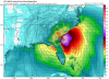
So its showing it 973 mb in extreme North GA. Has a tropical system ever stayed over land for 800 miles and still have a pressure that low ?
GeorgiaGirl
Member
0z GFS and 0z CMC
Great runs. Would watch again. Just insane.
Great runs. Would watch again. Just insane.
Storm5
Member
The inland path to the NW matches the track of many GEFS and EPS members
Sent from my SM-J320VPP using Tapatalk
Sent from my SM-J320VPP using Tapatalk
I think it's overdoing the intensity especially with the interaction of higher terrain in Cuba.
The inland path to the NW matches the track of many GEFS and EPS members
Sent from my SM-J320VPP using Tapatalk
Yep, the run was crazy, but it has some support from all sides.
Storm5
Member
Yep and SW shift on the OPs mean wild ensemble runsThe GEFS should be another nice shift.
Sent from my iPhone using Tapatalk
Sent from my SM-J320VPP using Tapatalk
GeorgiaGirl
Member
The pressure probably is overdone a bit but it doesn't mean this won't still be an intense storm...
Stormlover
Member
Ryan Maue(sp?) says the new GFS shows about 40 mb lower on those than it should, but even at that it would be a cat 5I think it's overdoing the intensity especially with the interaction of higher terrain in Cuba.
Stormlover
Member
It stalls around Kentucky and would cause a lot of flooding into several states,
- Status
- Not open for further replies.