Larry, you are probably going to get some pretty scary weather down your way, whatever run you choose today!12Z EPS hour 120: near ATL vs 0Z EPS hour 132 near Augusta consistent with westward shift Storm5 just mentioned.
-
Hello, please take a minute to check out our awesome content, contributed by the wonderful members of our community. We hope you'll add your own thoughts and opinions by making a free account!
You are using an out of date browser. It may not display this or other websites correctly.
You should upgrade or use an alternative browser.
You should upgrade or use an alternative browser.
Tropical Major Hurricane Irma (Part 1)
- Thread starter Snowfan
- Start date
- Status
- Not open for further replies.
B
Brick Tamland
Guest
If the Euro is right the whole state of Florida might have to evacuate.
stboo6
Member
Hmmm guess bama could see some action if this were to verify.
WATCHING thanks for all the great info!
WATCHING thanks for all the great info!
Storm5
Member
As Larry mentioned with his super fast eps lol

Sent from my SM-J320VPP using Tapatalk

Sent from my SM-J320VPP using Tapatalk
South AL Wx
Member
It's hard not to root for that one OTS member!As Larry mentioned with his super fast eps lol
Sent from my SM-J320VPP using Tapatalk
UKMET + EURO + EPS. VS GFS. This is looking a lot better for the GA/SC coasts. Finally feeling slightly better about this for mby.
skywatcher
Member
Outlier ftw!It's hard not to root for that one OTS member!
")
RollTide18
Member
It's gonna be pretty windy next week
Larry, you are probably going to get some pretty scary weather down your way, whatever run you choose today!
Yes, but will it be the absolute devastation like some models have suggested at times or will it just be "pretty scary"/bad.
Storm5
Member
Maybe for the coast but inland areas of those states would still have big issuesUKMET + EURO + EPS. VS GFS. This is looking a lot better for the GA/SC coasts. Finally feeling slightly better about this for mby.
Sent from my SM-J320VPP using Tapatalk
Did these people not just see the Euro? If you are on the coast and that verifies you are more safe staying put.
"GA, mandatory evac. all counties East of I-95, SC evac. is voluntary now, likely mandatory 10AM Saturday for coastal counties. Colleges on the coast closing now, asking students to go home."
"GA, mandatory evac. all counties East of I-95, SC evac. is voluntary now, likely mandatory 10AM Saturday for coastal counties. Colleges on the coast closing now, asking students to go home."
BHS1975
Member
Wonder if the NHC is going to shift there track since they're so in love with the euro.
Sent from my iPhone using Tapatalk
Sent from my iPhone using Tapatalk
Bama Ravens
Member
Problem with that is that that was one Euro run, and it's hard to say "no need to evacuate" based on a single run of a single model. They go based on what the National Hurricane Center/National Weather Service tells them, and at this point, NHC has not changed the track.Did these people not just see the Euro? If you are on the coast and that verifies you are more safe staying put.
"GA, mandatory evac. all counties East of I-95, SC evac. is voluntary now, likely mandatory 10AM Saturday for coastal counties. Colleges on the coast closing now, asking students to go home."
Well shouldn't they tell people to give it another day to see if the models stick to this western track?Problem with that is that that was one Euro run, and it's hard to say "no need to evacuate" based on a single run of a single model. They go based on what the National Hurricane Center/National Weather Service tells them, and at this point, NHC has not changed the track.
Looks like gfs and especially euro moving quicker with that trof in NE. Building heights east of Irma.I just have a hard time buying into the fact that it would not feel the weakness sooner and turn North . Someone help me out. That's a massive weakness and a powerful storm . 1+2 = poleward
Sent from my SM-J320VPP using Tapatalk
Storm5
Member
They might a little bit but nothing drastic. Like you won't see it over Atlanta . Still plenty of time to slowly shift the track west or east . Let's remember , just cause there was a west trend in the 12z runs does not mean it can't trend back east . Still lots of shifts expected over the coming 24-36 hoursWonder if the NHC is going to shift there track since they're so in love with the euro.
Sent from my iPhone using Tapatalk
Sent from my SM-J320VPP using Tapatalk
ForsythSnow
Moderator
This too. Someone tell me this will be weaker please.This would be horrible
Sent from my SM-J320VPP using Tapatalk

- Joined
- Sep 4, 2017
- Messages
- 216
- Reaction score
- 260
Here they come, walkin down the street... hey, hey their the SW's....
Tilt your head to the right and tell me that doesn't look like a gremlin over the N central plains getting ready to throw a wrench into all of this
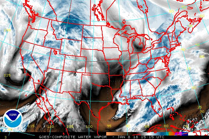
Tilt your head to the right and tell me that doesn't look like a gremlin over the N central plains getting ready to throw a wrench into all of this
Well shouldn't they tell people to give it another day to see if the models stick to this western track?
You can't. Not enough time to do orderly evacuation.
Aren't the winds kind of high for the pressure ? 922 mb is the same pressure Andrew was I believe. I don't think winds were 175 mph with Andrew were they ?
pcbjr
Member
Hey man!Here they come, walkin down the street... hey, hey their the SW's....
Tilt your head to the right and tell me that doesn't look like a gremlin over the N central plains getting ready to throw a wrench into all of this
See that but what way does the wrench turn?
WXinCanton
Member
To answer this, this is right nowWell shouldn't they tell people to give it another day to see if the models stick to this western track?

WXinCanton
Member
And it's only going to be worse tomorrow
- Joined
- Sep 4, 2017
- Messages
- 216
- Reaction score
- 260
Million dollar question. That's why they call them GremlinsHey man!
See that but what way does the wrench turn?
It really is pretty much a race now. Every big storm I've ever seen get into this general area it always comes down to this. Ridge building to its NE, weakening trof, shortwaves racing down it. Those are all of the big players. the little guys that models dont resolve well can have a bigger influence than normal. That small ridge building over Katia? That could easily force the SW's shallower and a little more east if it overperforms as the entire weakness gets pinched from both sides. We're getting real close to the devils in the details time, not just overall patterns.
Edited for crappy keyboard
JHS
Member
That map is horrendously wrong over GA, NC and SC. If the 12z GFS verified, I can see 60-70%, maybe more, over upstate SC into the mountains of NC.Based on Matthew, outages could easily be far higher than the 20-40% predicted for the GA coast. I'd think 90%+, unfortunately.
Rosie
Member
My nephew in Palm Beach County said roads are horrible, staying put.You can't. Not enough time to do orderly evacuation.
atlantasweetie
Member
I remember Hurricane Opal! I was a senior in high school and the wind was crazy in Atlanta! I think she was barely a hurricane still or a very strong tropical storm. All I know is that the winds were scary. I didn't sleep for fear of my neighbors' trees falling on our house, especially my room. Oh, and we lost power too, can't remember for how long.
Sent from my ONEPLUS A3000 using Tapatalk
Sent from my ONEPLUS A3000 using Tapatalk
Brent
Member
Yall should see Eric Blake's twitter an nhc forecaster he knows his stuff and hes got chills with the forecast of a worst case scenario track of a cat 4+

Hmm, Brad Nitz was just talking about the NHC track of Hurricane Irma and it updated to the 5pm track live on air. It's a shift to the west. It showed Irma still a Cat 1 over NE GA.
ForsythSnow
Moderator
Cat 1 you say? Can we get the giant fans out soon? This keeps sounding worse and worse. I'm hoping for the best that it weakens, but it is sounding worse each hour it gets closer.Hmm, Brad Nitz was just talking about the NHC track of Hurricane Irma and it updated to the 5pm track live on air. It's a shift to the west. It showed Irma still a Cat 1 over NE GA.
bud006
Member
Hmm, Brad Nitz was just talking about the NHC track of Hurricane Irma and it updated to the 5pm track live on air. It's a shift to the west. It showed Irma still a Cat 1 over NE GA.
I saw that, too. Cat 1 over Clayton, Ga.
Just one run, but still just crazy.
--30--
Storm5
Member
If you live in Alabama fear not Spann says no rain .
Yet the other met that posted just before him said rain and 50 mph wind gusts of Euro is right.
Lol abc3340 never on the same page
Sent from my SM-J320VPP using Tapatalk
Yet the other met that posted just before him said rain and 50 mph wind gusts of Euro is right.
Lol abc3340 never on the same page
Sent from my SM-J320VPP using Tapatalk
ForsythSnow
Moderator
Forecast advisory has Irma inland south Georgia an 80 knot hurricane, then 40 knot TS in Knoxville. Given that, I expect Irma to pass Athens as a 75 mph to 70 mph storm.
Storm5
Member
The west shift continuesForecast advisory has Irma inland south Georgia an 80 knot hurricane, then 40 knot TS in Knoxville. Given that, I expect Irma to pass Athens as a 75 mph to 70 mph storm.
Sent from my SM-J320VPP using Tapatalk
All of this new balloon data being sent 6 hourly is going to be a God send for the models and forecast! Excited to see the 18z GFS.
W
WeatherLC
Guest
How are you guys seeing the 5PM advisory before its released?
ForsythSnow
Moderator
And here comes the panic I'm sure. I expected the wobble of the models with this morning going east, then it going west again. Watch them wobble a bit more, but I'm sure this is going to end horribly for all of the Floridian peninsula. It's not looking good for all of GA and parts of SC.The west shift continues
Sent from my SM-J320VPP using Tapatalk
The TWC has the 5 PM advisory.
Brent
Member
The marine came out early which gives you the technical forecast
- Status
- Not open for further replies.