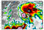
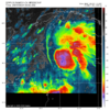
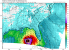
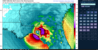
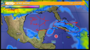
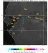
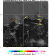
Makes you wonder if they plan to go ahead and give it a name by morning. We are in an odd situation with formation to landfall.. not very long between the two. Easier to have media attention with a name.RECON HAS 2 PLANES HEADED INTO THE PTC NOW!!
-
Hello, please take a minute to check out our awesome content, contributed by the wonderful members of our community. We hope you'll add your own thoughts and opinions by making a free account!
You are using an out of date browser. It may not display this or other websites correctly.
You should upgrade or use an alternative browser.
You should upgrade or use an alternative browser.
Tropical Major Hurricane Helene
- Thread starter SD
- Start date
- Status
- Not open for further replies.
Local news here has been hyping it. Wife and I were refilling our cars and gas cans at Kroger today with our .40cents off per gallon and we weren't the only ones.Makes you wonder if they plan to go ahead and give it a name by morning. We are in an odd situation with formation to landfall.. not very long between the two. Easier to have media attention with a name.
severestorm
Member
Brent
Member
Blowup very near the NHC position. Those guys are good
Hurricane Ian in 2022 was probably the last "big" miss for NHC, the image below was on Sept. 25th and 3 days later it made landfall around Fort Myers (just north of FM but in southern part of state). Although to be fair, it was right on the eastern edge of the cone and due to angle of the coast that couple hundred mile miss to the east was costly along the coastline of Fl
***NOT CURRENT***
View attachment 151563
The UKMET model was an outlier that was far to the SE of the Euro and especially the GFS/CMC. It ended up very close days in advance. UK isn’t always the best and can be lousy just like any model is at times. But it was amazing for Ian. The Icon was second best.
Lets be honest here. The GFS model's bad skill forced the hand of the NHC with Ian.
View attachment 151564
GFS and CMC were both terrible for Ian. Euro was far better but even so was not that good as it was too far N, also, but not nearly as much as those other two. UKMET was stellar and Icon 2nd.
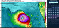
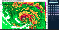
00z HAFS a and b stronger, b around 923mb and further east. Interesting.
Hwrf stonger at around 925 and East
Hwrf stonger at around 925 and East
Belle Lechat
Member
- Joined
- Aug 29, 2021
- Messages
- 1,529
- Reaction score
- 1,215
Hurricane John in EPAC is feeding tons of moisture into PTC9 (Helene). Several models under 930mb in there 00z runs. Don't look at the NAM 3K. Cause I'll post it here for you.
View attachment 151574
To save the curious time looking it up,
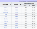
Rita reached a peak intensity of category 5 with sustained winds of 180 mph and a minimum pressure of 895 millibars, making it the strongest hurricane ever recorded in the Gulf of Mexico.
0Z UKMET: Apalachicola late Thu night then to Atlanta area in only ~12 hours due to moving on average ~25 mph!
TROPICAL DEPRESSION 09L ANALYSED POSITION : 18.1N 81.8W
ATCF IDENTIFIER : AL092024
LEAD CENTRAL MAXIMUM WIND
VERIFYING TIME TIME POSITION PRESSURE (MB) SPEED (KNOTS)
-------------- ---- -------- ------------- -------------
0000UTC 24.09.2024 0 18.1N 81.8W 1003 32
1200UTC 24.09.2024 12 19.7N 83.9W 1003 36
0000UTC 25.09.2024 24 19.8N 85.6W 999 36
1200UTC 25.09.2024 36 21.3N 86.4W 995 41
0000UTC 26.09.2024 48 22.9N 86.5W 992 39
1200UTC 26.09.2024 60 24.8N 86.1W 991 43
0000UTC 27.09.2024 72 28.1N 85.5W 988 52
1200UTC 27.09.2024 84 31.9N 84.8W 989 37
0000UTC 28.09.2024 96 37.0N 85.8W 994 24
1200UTC 28.09.2024 108 40.2N 90.4W 1000 25
0000UTC 29.09.2024 120 CEASED TRACKING
Belle Lechat
Member
- Joined
- Aug 29, 2021
- Messages
- 1,529
- Reaction score
- 1,215
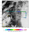
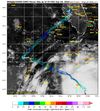
AF305 HURRICANE HUNTER IS IN THE STORM NOW..
NOAA9 IS HEADED IN FOR AN UPPER-LEVEL RECON
NOAA9 IS HEADED IN FOR AN UPPER-LEVEL RECON
Belle Lechat
Member
- Joined
- Aug 29, 2021
- Messages
- 1,529
- Reaction score
- 1,215
Belle Lechat
Member
- Joined
- Aug 29, 2021
- Messages
- 1,529
- Reaction score
- 1,215
Belle Lechat
Member
- Joined
- Aug 29, 2021
- Messages
- 1,529
- Reaction score
- 1,215
Belle Lechat
Member
- Joined
- Aug 29, 2021
- Messages
- 1,529
- Reaction score
- 1,215
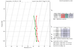
080900 1830N 08339W 6700 03466 0000 +100 +049 127010 010 014 001 00
1000 mb
1000 mb
Belle Lechat
Member
- Joined
- Aug 29, 2021
- Messages
- 1,529
- Reaction score
- 1,215
Belle Lechat
Member
- Joined
- Aug 29, 2021
- Messages
- 1,529
- Reaction score
- 1,215
NCHighCountryWX
Member
- Joined
- Dec 28, 2016
- Messages
- 699
- Reaction score
- 1,918
Highlights at the start of the work day this morning: from the 230am GSP AFD: 1. GSP says a possible storm precursor rain event across Western NC Wednesday depending on how the flow ahead of the storm sets up. 2. Starting Thursday afternoon and overnight 4 to 7 inches of rain is likely across the area with a possible foot of rain in the mountains . Thursday night wind: 30 - 50 mph gusts possible particularly just east of the cyclone center
HugeSnowStick
Member
SnowwxAtl
Member
It moved east again. I wouldn't be shocked at another 50 to 75 miles shift east again as the final track of the storm.
HugeSnowStick
Member
No, no it hasn't, and why do you think this?It moved east again. I wouldn't be shocked at another 50 to 75 miles shift east again as the final track of the storm.
SnowwxAtl
Member
Just what I remember last night and what I am seeing this morning. It is slightly east of the city popular. Kinda in line with 0z suite outside of UKMet.No, no it hasn't, and why do you think this?
They had the cone centered coming up the Alabama/Georgia State line yesterday at 5pm, hooking a hard turn NW. So yes they have shifted the inland cone east a good bit. He is correctNo, no it hasn't, and why do you think this?
I SEE WHAT YOU ARE REFERING TO...It moved east again. I wouldn't be shocked at another 50 to 75 miles shift east again as the final track of the storm.
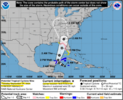
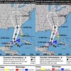
HERE IS THE 11PM ADVISORY AND IT HAS THE LINE RIGHT IN THE "BIG BEND"
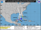
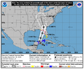
5 AM IS SLIGTLY AND I MEAN SLIGHTLY TO THE EAST BUT AT THIS POINT NOT ENOUGH TO REALLY MATTER...
Blue_Ridge_Escarpment
Member
That and the center line through GA moved quite a bit east as well.I SEE WHAT YOU ARE REFERING TO...
HERE IS THE 11PM ADVISORY AND IT HAS THE LINE RIGHT IN THE "BIG BEND"
View attachment 151589
5 AM IS SLIGTLY AND I MEAN SLIGHTLY TO THE EAST BUT AT THIS POINT NOT ENOUGH TO REALLY MATTER...
SnowwxAtl
Member
I don't understand the arguing. Sometimes just a little more context in a post would clear things up. For instance, when you say the track has shifted one way or the other, reference your location and whether your talking LF or inland or as it relates to your backyard. A few more words could go a long way and if you want to argue take it to banter.
Blue_Ridge_Escarpment
Member
Agreed. The post above is very helpful showing the two images side by side for reference. In this case, LF and Inland shifted east.I don't understand the arguing. Sometimes just a little more context in a post would clear things up. For instance, when you say the track has shifted one way or the other, reference your location and whether your talking LF or inland or as it relates to your backyard. A few more words could go a long way and if you want to argue take it to banter.
Downeastnc
Member
I suspect we see more east adjustments as well given all the major models now take the center over or east of Atlanta....especially with the track after landfall.
SnowwxAtl
Member
Gotcha- but I don't think no one was arguing. Just a slight disagreement or confusion. That's all. But I see your point and apply it to my next post. Let's get our mind ready for this storm.I don't understand the arguing. Sometimes just a little more context in a post would clear things up. For instance, when you say the track has shifted one way or the other, reference your location and whether your talking LF or inland or as it relates to your backyard. A few more words could go a long way and if you want to argue take it to banter.
I see we are arguing about cones this morning...
iGRXY
Member
GSP calling for widespread 4-8”, sustained winds around 20-30mph with guts over 50mph even back my way. Getting worried about power loss over this way
I see what you’re saying about the inland track and you’re correct. The landfall location though has been pretty much the same location all 4 advisories so farView attachment 151592
Slight east trajectory on the 5a advisory than the 11p. I wouldn't be shocked another shift to the east on the next or 5p advisory today.
Also one other thing about this, you can always go to the NHC graphic archives and see for yourself how the cone has or has not shifted over the life of the system.I don't understand the arguing. Sometimes just a little more context in a post would clear things up. For instance, when you say the track has shifted one way or the other, reference your location and whether your talking LF or inland or as it relates to your backyard. A few more words could go a long way and if you want to argue take it to banter.
- Status
- Not open for further replies.

