lexxnchloe
Member
Actually the hurricane models arent showing rapid deepening at anytime. Some slow steady pressure falls
I suspect they are picking up on the increased shear from the east pac caneIn the gate-
Hwrf now 984....was 970
Hmon now 974.....was 966
Hafs-a now 989.....was 945
Hafs-b now 988.....was 951
But don't get to happy. Hmon at 930 on approach. Similar to 12z Hwrf.
View attachment 151554
No. In the Yucatan channel it should be getting going. Anything before that is bad news.Wasn't it supposed to be developed by now?
Cat 4
I think honestly just a bit slower more than anythingSo far all the Hurricane models are west vrs last run
Yeah and westI think honestly just a bit slower more than anything
Track only changes every 6 hours
If there was a major change they would have updated.Track only changes every 6 hours
Agreed! NHC the past few (maybe 10 or so) years has been very conservative and won’t make changes to the location or intensity forecast unless they have to. They obviously know a lot more and have access to more than we do and don’t shift run to run unless warranted!If there was a major change they would have updated.
Agreed! NHC the past few (maybe 10 or so) years has been very conservative and won’t make changes to the location or intensity forecast unless they have to. They obviously know a lot more and have access to more than we do and don’t shift run to run unless warranted!
Incorrect, 5 and 11 o’clock hoursIf there was a major change they would have updated.
Incorrect, 5 and 11 o’clock hours
He said Major change, I’ll disagree respectfully and say they will make adjustments outside 5 and 11 if warranted.Incorrect, 5 and 11 o’clock hours
Sure, in special circumstances, like we saw today with John. But not at a 8PM advisory update when there is no immediate impact to land.He said Major change, I’ll disagree respectfully and say they will make adjustments outside 5 and 11 if warranted.
That MLC is looking stout and if the LLC is being pulled underneath or reforming there, yes sir watch out. In fact, if this gets stacked tonight in the area of that MLC that's east of most model initialization. Although I doubt that changes the track that much but certainly could be a RI issueEastern Pacific John to make landfall within the next 12 to 18 hours I believe. Embedded within the monsoon trough.
Honestly believe this could be foreshadowing of what PTC 9 MIGHT be capable up once it's consolidated, and it sure looks like the MLC is tightening up. Actually may be dragging the LLC closer or a reformation may be underway.
Looking at the forecast cone it shows that it will be a tropical storm in about 5 hours. Does that seem a bit early ?
By the look of it, the lower end models will end up verifying, but who knows. it's encountering some shear.
View attachment 151560
The last major change within 3 days I remember is with Katrina. On that Friday morning it was forecast to hit Florida a 2nd time. At 5pm that day they changed the forecast to Louisiana. It came ashore the next Monday morning south of New Orleans.Honestly at this point the NHC is usually never that far off inside 3-4 days where we are now. Probably at most 50-100 miles. So if you're expecting some massive track change yeah it's probably not happening until it gets well inland at least. You can probably bank on landfall between Panama City and Tampa at this point
Go back and look at past storms on the NHC website they have all the graphics there ... They nailed Debby and Francine at this range just this year
I believe that sheer is supposed to back out Westward as we head through the night into tomorrow.
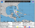
Hurricane Ian in 2022 was probably the last "big" miss for NHC, the image below was on Sept. 25th and 3 days later it made landfall around Fort Myers (just north of FM but in southern part of state). Although to be fair, it was right on the eastern edge of the cone and due to angle of the coast that couple hundred mile miss to the east was costly along the coastline of FlHonestly at this point the NHC is usually never that far off inside 3-4 days where we are now. Probably at most 50-100 miles. So if you're expecting some massive track change yeah it's probably not happening until it gets well inland at least. You can probably bank on landfall between Panama City and Tampa at this point
Go back and look at past storms on the NHC website they have all the graphics there ... They nailed Debby and Francine at this range just this year

