Anybody got storm total rainfall so far. Notice in wilmington,onslow bay region it's still hammering heavy rain
-
Hello, please take a minute to check out our awesome content, contributed by the wonderful members of our community. We hope you'll add your own thoughts and opinions by making a free account!
You are using an out of date browser. It may not display this or other websites correctly.
You should upgrade or use an alternative browser.
You should upgrade or use an alternative browser.
Tropical Major Hurricane Florence
- Thread starter ForsythSnow
- Start date
B
Brick Tamland
Guest
Death toll up to 8.
Some sporadic tropical downpours here today and looks like the mega band is settling in between Lumberton and Fayetteville
W
WeatherLC
Guest
Any chance it keeps going west?
0.0001 here so far!Anybody got storm total rainfall so far. Notice in wilmington,onslow bay region it's still hammering heavy rain
Still amazingly organized ...
https://earth.nullschool.net/#current/wind/surface/level/orthographic=-81.86,35.81,1918
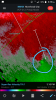
View attachment 6428
Dare I say that's awful close to the euro locations form couple days ago
Dare I say that's awful close to the euro locations form couple days ago
Those Euros as well as many EPS members had her stay offshore and then come ashore CHS/Beaufort (and in one case SAV). That hasn't happened at all.
12z euro with 10 more inches here through Monday. 27 more just west of Fayetteville

Sent from my SM-G955U using Tapatalk

Sent from my SM-G955U using Tapatalk
B
Brick Tamland
Guest
Maybe you should head to the coast of NC and help with the people that had their homes and businesses destroyed by flooding instead of complaining about not getting rain. It is becoming really annoying and absurd.0.0001 here so far!
ForsythSnow
Moderator
Clouds building and a light breeze here. Some rain is building to the NE so it could make its way down here.
I'm not sure what the expectation was either on the west side of a decaying tropical system. Just looked back at some old model runs and nothing had rain into the upstate until overnight.Maybe you should head to the coast of NC and help with the people that had their homes and businesses destroyed by flooding instead of complaining about not getting rain. It is becoming really annoying and absurd.
Sent from my SM-G955U using Tapatalk
jwb_84
Member
Haven't lost power out this way yet. Heard about plenty of others and wind damage though.
Again, I am very happy we have the FV3 we can take quite seriously now along with the Euro! They've obviously done a great job on this future upgrade, in regards to fixing some tropical issues especially.
Again, I am very happy we have the FV3 we can take quite seriously now along with the Euro! They've obviously done a great job on this future upgrade, in regards to fixing some tropical issues especially.
Webberweather53
Meteorologist
The Fv3 is a legitimate upgrade on the current operational GFS especially w/ more modern microphysics schemes, hopefully we can expect at least one or two similarly good performances w/ a winter storm this upcoming winter.
That’s crazy.12z euro with 10 more inches here through Monday. 27 more just west of Fayetteville
Sent from my SM-G955U using Tapatalk
Looks like the band upstream is bulging slightly north again. After this lull, looks like it might start raining again here. The latest HRRRr shows most of the county picking up between 1.5 and 2.5 over the next 18 hours or so. If the Euro is going to be right, we need to get under that feeder band.
pcbjr
Member
Present company most assuredly and gratefully included ...It's always helpful to hear that those who weren't expected to get anything, in fact, are not.

Deep brick. Really deepHere comes the rain again
Falling on my head like a memory
Falling on my head like a new emotion
Its a hell of a gradient on the HRRR even just between our locations with more 6-8 type stuff here and 3-4 type stuff there. The Euro brings most of our precip during the late overnight through the day tomorrow as Florence gets more to our west and our flow flips to southerly.That’s crazy.
Looks like the band upstream is bulging slightly north again. After this lull, looks like it might start raining again here. The latest HRRRr shows most of the county picking up between 1.5 and 2.5 over the next 18 hours or so. If the Euro is going to be right, we need to get under that feeder band.
B
Brick Tamland
Guest
Haven't lost power out this way yet. Heard about plenty of others and wind damage though.
Again, I am very happy we have the FV3 we can take quite seriously now along with the Euro! They've obviously done a great job on this future upgrade, in regards to fixing some tropical issues especially.
I'm going to want to see additional samples, but given the complexity of this setup - color me impressed!
The Fv3 is a legitimate upgrade on the current operational GFS especially w/ more modern microphysics schemes, hopefully we can expect at least one or two similarly good performances w/ a winter storm this upcoming winter.
Yes, I am glad we have GFS 2: Electric Boogaloo now and look forward to seeing how it does this winter.
Meanwhile, can Flo leave already?
Just looking at TWC and their futurecast model, whatever that is, shoes exactly what you said. Meanwhile, that band has gotten more robust and is about to bring it again. Going out for a quick rain run.Its a hell of a gradient on the HRRR even just between our locations with more 6-8 type stuff here and 3-4 type stuff there. The Euro brings most of our precip during the late overnight through the day tomorrow as Florence gets more to our west and our flow flips to southerly.
Congrats for y’all,really ecstatic!! Guess I’ll take my synoptic 1/2 inch and love it! What was I thinkingJust looking at TWC and their futurecast model, whatever that is, shoes exactly what you said. Meanwhile, that band has gotten more robust and is about to bring it again. Going out for a quick rain run.
Actually the 18z nams are way sw of 12z and get 1 inch totals all the way to the sc/ga borderCongrats for y’all,really ecstatic!! Guess I’ll take my synoptic 1/2 inch and love it! What was I thinking
Sent from my SM-G955U using Tapatalk
Blue_Ridge_Escarpment
Member
NAM finally getting a clue this low is not going to run the state line.Actually the 18z nams are way sw of 12z and get 1 inch totals all the way to the sc/ga border
Sent from my SM-G955U using Tapatalk
JHS
Member
We are doing nicely with rain so far where I am but it is having trouble getting to Greenville for sure. The radar seems to suggest we keep getting light to moderate rain for at least a few more hours. The heavier stuff probably comes in after midnight. Winds have not been bad here so far.Actually the 18z nams are way sw of 12z and get 1 inch totals all the way to the sc/ga border
Sent from my SM-G955U using Tapatalk
GeorgiaGirl
Member
I think it's rained off and on for a couple hours. Lightly though. Not really hearing it at all since it's windy.
Road out front is wet.
Edit: Well it's actually raining pretty good now. Just not hearing it because of the wind.
Road out front is wet.
Edit: Well it's actually raining pretty good now. Just not hearing it because of the wind.
You live too close to Shetley. But now, he’s getting rain. That’s got to sting, man.Congrats for y’all,really ecstatic!! Guess I’ll take my synoptic 1/2 inch and love it! What was I thinking
The 12k Nam is so stupid. It shows dry here on several frames where it has been raining.
Gives me confidence in SD’s statement above!The 12k Nam is so stupid. It shows dry here on several frames where it has been raining.
You guys are getting washed out and I just got done playing 18 holes of golf under a dry band all day. The wind was ripping. Hard to keep
It in bounds
It in bounds
Yep just looking at the NAM versus current radar.... it's way off. In fact looks like the rain shield sliding back north, you should stay in the rain for some time now not sure you get in the mega band but Shane certainly could.The 12k Nam is so stupid. It shows dry here on several frames where it has been raining.
Yeah, I don’t think I’ll get the super heavy stuff. That’s fine. 6”ish is plenty. Shane can have the rest. Maybe he can send some Mack’s Way.Yep just looking at the NAM versus current radar.... it's way off. In fact looks like the rain shield sliding back north, you should stay in the rain for some time now not sure you get in the mega band but Shane certainly could.
GeorgiaGirl
Member
Hmm, it actually started raining pretty good again without me noticing since I was watching football. Not sure how much more we'll get until tomorrow though, as there isn't that much behind this band.
Snownut
Member
Still a W movement at 2mph! If this thing decides not to turn, the western Carolinas are gonna be in trouble.
Sent from my SM-G955U using Tapatalk
Sent from my SM-G955U using Tapatalk
Does anyone have any accurate information on the actual scale of the flooding in NC, or SC for that matter? I'm finding reports of this town or that with flooding issues, some severe. But is every town seeing catastrophic flooding? Links or info appreciated. Thanks. This forum has been awesome through Florence.
Claycochaser
Member
About to get a tropical shower and breeze from the westernmost band...in ALABAMA.
There’s two death bands of rain that have been over SE NC for about 36 hours or so and are not moving by much. From coverage and radar obs, I know between Wilmington and Lumberton, have real bad flooding ongoing! NC has already beat the all time record for rainfall totals, and it’s still pouring! Some places have seen 24”+ by now, in localized spotsDoes anyone have any accurate information on the actual scale of the flooding in NC, or SC for that matter? I'm finding reports of this town or that with flooding issues, some severe. But is every town seeing catastrophic flooding? Links or info appreciated. Thanks. This forum has been awesome through Florence.
To early to even try and summarize things right now. Storm is about to cross halfway point. Can tell you as of 5 am this morning Swannsboro had had over 30 inches of rain and its rained there all day ,heavy at times. Interstate 40 from south of Raleigh to Wilmington is closed. Interstate 95 is closed. Govenor has asked no one from out of state to travel through NC , go around. The river flooding that we are fixing to endure, espeacilly along the Cape fear,lumber, neuse rivers is gonna be something to behold.
11 deaths so far
11 deaths so far
Kylo
Member
Euro shows a spawn of Florence that starts to develop off the SE coast. A piece breaks off day 5 tries to develop. She just won't go away.
 d
d
dpcbjr
Member
Winding down, but still there ...

I think florence might actually be moving fast enough its noticeable now
Sent from my SM-G955U using Tapatalk
Sent from my SM-G955U using Tapatalk