• Hello, please take a minute to check out our awesome content, contributed by the wonderful members of our community. We hope you'll add your own thoughts and opinions by making a free account!

Pattern July

100.9 F on my therm. at 2:30 PM. UN-BE-LIEVABLE! No seabreeze and just a few cumulus clouds.

Edit: make that 102.2 at 2:40 PM!! Hotter than anything I saw in May. Crazy!

Heat indices at 2 PM: 110 at Augusta and 108 at KSAV!

Irrigation resumes tonight.
Like for the reporting, not to be confused with the report itself ... ;)
 
@GaWx Larry, Here ya go ... :(

View attachment 20736View attachment 20737


98.7º on my shaded north facing front porch at 2:51 PM ...

Stay hydrated! As Phil's informative maps show, CHS, which is only 75 miles away as a crow flies, is only 87 and suburbs are down to as low as 77 due to an isolated popup due to the seabreeze!

My temp rose to an unreal 102.9 at 2:50 PM!! It will be interesting to see how hot the two official SAV area stations got at 3 PM.
 
Last edited:
Stay hydrated! As Phil's informative maps show, CHS, which is only 75 miles away as a crow flies, is only 87 and suburbs are down to as low as 77 due to an isolated popup due to the seabreeze!

My temp rose to an unreal 102.9 at 2:50 PM!! It will be interesting to see how hot the two official SAV area stations got at 3 PM.

Yikes, Larry ...

Regrettably south of you looks to share in all the glory ...

URGENT - WEATHER MESSAGE
National Weather Service Jacksonville FL
316 PM EDT Tue Jul 2 2019


FLZ020-021-023>025-030>033-035-037-038-122-124-125-133-136-138-
140-222-236-240-340-GAZ149-151>154-162-163-165-166-250-264-350-
364-030900-
/O.NEW.KJAX.HT.Y.0001.190703T1500Z-190703T2200Z/
Hamilton-Suwannee-Baker-Inland Nassau-Inland Duval-Union-Bradford-
Clay-Inland St. Johns-Gilchrist-Putnam-Inland Flagler-
Northern Columbia-Coastal Nassau-Coastal Duval-Coastal St. Johns-
Eastern Alachua-Coastal Flagler-Eastern Marion-Southern Columbia-
Western Alachua-Central Marion-Western Marion-Atkinson-Pierce-
Brantley-Inland Glynn-Coastal Glynn-Echols-Clinch-Inland Camden-
Coastal Camden-Northern Ware-Northeastern Charlton-Southern Ware-
Western Charlton-
Including the cities of Jasper, Jennings, West Lake, Belmont,
White Springs, Houston, Live Oak, McAlpin, Newburn,
Suwannee Springs, Macclenny, Olustee, Ratliff, Hilliard,
Kings Ferry, Bryceville, Normandy, Ortega, Riverside, San Marco,
Lake Butler, Starke, New River, Doctors Inlet, Lakeside, Bellair,
Middleburg, Orange Park, Fruit Cove, Switzerland, Bakersville,
Picolata, Trenton, Bostwick, Carraway, Palatka, Bunnell,
Espanola, Andalusia, Winfield, Suwannee Valley, Amelia City,
Fernandina Beach, Yulee, Arlington, Jacksonville, Oceanway,
Tallyrand, Ponte Vedra Beach, Durbin, Palm Valley, Anastasia,
Saint Augustine, Gainesville, Gainesville Airport, Newnans Lake,
Palm Coast, Lynne, Moss Bluff, Columbia, Lake City,
Oleno State Park, Lulu, Watertown, High Springs, Newberry,
Archer, Anthony, Burbank, Ocala, Weirsdale, Ocala Airport, Axson,
Pearson, Willacoochee, Blackshear, Atkinson, Hickox, Hortense,
Nahunta, Raybon, Waynesville, Hoboken, Thalmann, Jekyll Island,
Glynn Haven, Sea Island, St. Simons, Country Club Estate,
Dock Junction, Needmore, Statenville, Homerville, Colesburg,
Tarboro, Waverly, Woodbine, Dover Bluff, Kingsland, Dungeness,
Needham, Waycross, Winokur, Folkston, St. George, Homeland,
Race Pond, and Stephen Foster State Park
316 PM EDT Tue Jul 2 2019

...HEAT ADVISORY IN EFFECT FROM 11 AM TO 6 PM EDT WEDNESDAY...

The National Weather Service in Jacksonville has issued a Heat
Advisory, which is in effect from 11 AM to 6 PM EDT Wednesday.

* HEAT INDEX VALUES...Up to 109 due to temperatures around 100,
and dewpoints in the lower 70s.

* TIMING...Late morning through late afternoon hours on Wednesday.

* IMPACTS...The heat and humidity may cause heat stress during
outdoor exertion or extended exposure.

image16.pngimage1.png
 
Stay hydrated! As Phil's informative maps show, CHS, which is only 75 miles away as a crow flies, is only 87 and suburbs are down to as low as 77 due to an isolated popup due to the seabreeze!

My temp rose to an unreal 102.9 at 2:50 PM!! It will be interesting to see how hot the two official SAV area stations got at 3 PM.

Folks, all it takes is a seabreeze getting well enough inland and a quick cooldown can occur. That's precisely what happened over the last hour with it cooling from the hottest I've seen this year of 102.9 at 2:50 PM to "only" 96.4 F at 3:55 PM. It's all about the windflow. Our highs for the day are in!
 
Folks, all it takes is a seabreeze getting well enough inland and a quick cooldown can occur. That's precisely what happened over the last hour with it cooling from the hottest I've seen this year of 102.9 at 2:50 PM to "only" 96.4 F at 3:55 PM. It's all about the windflow. Our highs for the day are in!
So, time to go take a long liesury stroll down an asphalt street or concrtete sidewalk, now that ii's cooled down ... (JK) ...
 
Boom goes the dynamite on the 3k
c33de676a34f2e237f02c0d69a503aa1.gif


Sent from my SM-G975U using Tapatalk
 
You haven't had your morning coffee yet
Yeah I might have been a little over zealous I was thinking a little more activity along the sea breeze and with the Piedmont trough. Maybe things will get going later in the evening

Sent from my SM-G975U using Tapatalk
 
Really nice climatology map came across my twitter feed earlier on the number of 100F days during July over the US. The proverbial hell that we've all unfortunately come to know & love at this time of the year, i.e. the Augusta-Columbia-Fayetteville corridor, shows up nicely on this map.
Average Number of July 100F days US.jpg
 
CLIMATE REPORT
NATIONAL WEATHER SERVICE CHARLESTON SC
509 PM EDT TUE JUL 2 2019

..THE SAVANNAH GA CLIMATE SUMMARY FOR JULY 2 2019


VALID TODAY AS OF 0500 PM LOCAL TIME.


CLIMATE NORMAL PERIOD 1981 TO 2010
CLIMATE RECORD PERIOD 1871 TO 2019

WEATHER ITEM OBSERVED TIME RECORD YEAR NORMAL DEPARTURE LAST
VALUE (LST) VALUE VALUE FROM YEAR
NORMAL
..............................................................


TEMPERATURE (F)
TODAY
MAXIMUM 100 249 PM 101 1931 92 8 92
1897
MINIMUM 77 549 AM 63 1975 72 5 75
AVERAGE 89 82 7 84
-----------------------------------------------------------

Edit: Nearby Hunter also had a high of 100 meaning my 102.9 was an outlier of sorts. In the May heatwave, I was usually the coolest.
 
Last edited:
CLIMATE REPORT
NATIONAL WEATHER SERVICE CHARLESTON SC
509 PM EDT TUE JUL 2 2019

..THE SAVANNAH GA CLIMATE SUMMARY FOR JULY 2 2019


VALID TODAY AS OF 0500 PM LOCAL TIME.


CLIMATE NORMAL PERIOD 1981 TO 2010
CLIMATE RECORD PERIOD 1871 TO 2019

WEATHER ITEM OBSERVED TIME RECORD YEAR NORMAL DEPARTURE LAST
VALUE (LST) VALUE VALUE FROM YEAR
NORMAL
..............................................................


TEMPERATURE (F)
TODAY
MAXIMUM 100 249 PM 101 1931 92 8 92
1897
MINIMUM 77 549 AM 63 1975 72 5 75
AVERAGE 89 82 7 84
Larry,
Heart is out for y'all ...

Lost my boots in transit, baby they're a pile of smokin' leather
Nailed a retread to my feet and prayed for better weather
 
Tell me how this is anywhere remotely possible again? 5000 on the CAPE and a DP of 76? The NAM being itself of course.
Ooohhh NO... You're getting storms on the 4th. If we're going to have to deal with storms in Middle TN over the July 4th weekend, you should have to as well. Lightning will be part of the package too. :p
 
Here’s a great chart showing it. You know come winter it’ll reverse and be solidly positive.

View attachment 20732

The GEFS suggests the -NAO will go at least through 7/16, which would make it a whopping 81 days straight with no end yet in sight! As a result, we're on track for one of the most, if not THE most, -NAO since 1950 for May-July averaged out. These years since 1950 also had a strong -NAO for May-July averaged out: 1958, 1993, 1998, 2008, 2012, and 2016.

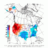
How did May-Jul temperatures average for these 6 winters, combined? Warm in the SE. A -NAO then correlates to a warm SE.

MayThruJulyTempsWith-NAO.png

How were the subsequent winter temperatures in the SE?

1958: normal
1993: cold
1998: warm
2008: normal
2012: warm
2016: warm

So, fwiw, these 6 winters favor warmth over cold. This is encouraging for my forecast for still another mild SER dominated winter coming up.
How did DJF temperatures average for these 6 winters, combined? Warm in the SE


WinterTempAfter-NAOMayThruJuly.png

Conclusion: having this current very long-lived -NAO doesn't at all favor a cold winter upcoming and to the contrary favors warmth. So, don't be fooled. The SER is liable to stick around for another winter. But I'm hopeful for a change for 2020-21.
 
Last edited:
Back
Top