-
Hello, please take a minute to check out our awesome content, contributed by the wonderful members of our community. We hope you'll add your own thoughts and opinions by making a free account!
You are using an out of date browser. It may not display this or other websites correctly.
You should upgrade or use an alternative browser.
You should upgrade or use an alternative browser.
Pattern July '22
- Thread starter Detective WX
- Start date
BHS1975
Member
Got notta here.
The high today at DFW was 100°F.
StormDrain
Member
I'm more offended by heat fizzers (i.e. that fail to come into fruition), but I fuсking hate all forecast downgrades with a passion, be they be cold, heat, or precip. Where models fool you into thinking there'll be an interesting weather event but fail to materialize. Wazzup fizzer derping fizzler wazzup fizzer derping wazzzzuuuuuuup?
11.52" of precip at my PWS thus far here. Looking slightly above average and largely dry the next few days here—maybe a few isolated T-storms initiated by sea breeze fronts...gotta enjoy summer while it lasts:

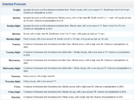
11.52" of precip at my PWS thus far here. Looking slightly above average and largely dry the next few days here—maybe a few isolated T-storms initiated by sea breeze fronts...gotta enjoy summer while it lasts:


SWVAwxfan
Member
Getting absolutely hammered by storms in the NRV. Temps dropped from the mid 80s to the mid 60s.
Brent
Member
Up to 3.5 this month. Too bad that's still BN lolz
Brent
Member
Brent
Member
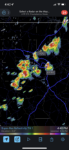
Yeah we do that. In all seriousness the short range guidance has absolutly sucked recently and just can’t see the CAP breaking these past few days with and explosion of outflows that collide .. would expect more of the same over the next couple days. NAM 18z finally sees todays stuff (better late than never I guess) and is also more active tomorrow and very active on Tuesday .. fun .. we’re at over an inch now here in the rain capital of apex 

JHS
Member
Got 1.09 here in the last 45 minutes from a very isolated storm.
Wonder why they form and move over the exact same places every day?Yeah we do that. In all seriousness the short range guidance has absolutly sucked recently and just can’t see the CAP breaking these past few days with and explosion of outflows that collide .. would expect more of the same over the next couple days. NAM 18z finally sees todays stuff (better late than never I guess) and is also more active tomorrow and very active on Tuesday .. fun .. we’re at over an inch now here in the rain capital of apexView attachment 120125
LickWx
Member
Wonder why nasty cities that don’t need rain always get rain? It’s detrimental to the literal entire planet for a city to get rain. I can almost guarantee if you had a way to measure it , there would be a direct correlation to rain totals over city areas and cancer cases in that cities watershed . Nasty cancerous runoffs.Wonder why they form and move over the exact same places every day?
Wrong thread?There yall go. Finally some.proof of voter fraud

Colorado Man Pleads Guilty To Casting Missing Wife's Ballot For Trump
"I figured all these other guys are cheating,” Barry Morphew said of his decision to cast the ballot after his wife's disappearance, according to an arrest warrant.www.yahoo.com
LickWx
Member
Are very isolated storms similar to your very isolated mega heatwave droughts that seemed to occur in your region most years?Got 1.09 here in the last 45 minutes from a very isolated storm.
LickWx
Member
I take it you arent getting any storms?There yall go. Finally some.proof of voter fraud

Colorado Man Pleads Guilty To Casting Missing Wife's Ballot For Trump
"I figured all these other guys are cheating,” Barry Morphew said of his decision to cast the ballot after his wife's disappearance, according to an arrest warrant.www.yahoo.com
Shaggy
Member
Wrong threadWrong thread?
Today's high at DFW was 102*F.
GarnerNC
Member
So over this summer and watching solid storms evaporate or suddenly shift south right before me. Bring on the endless non chances of snow.
aldamon
Member
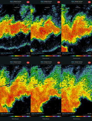
Really cool features on the radar from storms popping up in NC. Check out the rings:


Brent
Member
104 today. We've had enough triple digits for a couple years here
Had a nice storm earlier (.55"). The temp dropped into the upper 60s for a bit. That's probably the coldest temps I'll see for a while.
Brent
Member
We are only 11 days away from the most 100s in a season and have 3 more at least this week and still August to go...
Last edited:
If I'm not mistaken, 2022 has featured the warmest May-June-July (to date) on record for Dallas, only tied with 1998. The average temp is 85.2°F.
While the Summers of 1980 and 2011 are frequently compared to this season (in which May was normal to below normal), it really has rhymed more so with 1998 and 2018, which both featured torchy months of May.
While the Summers of 1980 and 2011 are frequently compared to this season (in which May was normal to below normal), it really has rhymed more so with 1998 and 2018, which both featured torchy months of May.
HugeSnowStick
Member
GA is an island of coolness in that hell.
58 this AM!  ️
️
LickWx
Member
That’s going to be your high all winter just you wait ! Everyone gets what they deserve and that’s what you deserve !58 this AM!️
smast16
Member
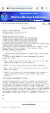
Snippet for the long term from RAH Disco.
Like music to my ears. Here's to hoping the front doesn't pass!
it may look a little 'off' because of a bit of a rainshadow going on over the apps. usually our wet patterns in the summer are because of moisture streaming in from the atlantic/gulf with storm motions moving due north or nnw. our soupy air here is coming from new madrid.Funky precip distribution the next 7 days...all or nothing depending on proximity to the front.
smast16
Member
Rah Disco talks about that.Funky precip distribution the next 7 days...all or nothing depending on proximity to the front.
View attachment 120144
An elongated area of high pressure aloft will extend across the
Southern US on Wednesday and Thursday. Meanwhile, a closed mid/upper
low will be slowly moving east over southern Ontario. Central NC
will be located in between these two features, opening the door for
disturbances aloft to move across our region. At the surface, a
trough will remain anchored over the Piedmont, with a Bermuda High
well offshore.
You can see it here on the MSLP anomaly maps as well.
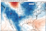
I'll be honest my concern is we are too far south versus a front passing through at least this work week. We are really depending on old ofbs and any subtle forcing embedded in the w to wnw flow aloft. After today this turns into a great pattern for local areas to get a big rain day but it's hard to find a catalyst for huge areas to get big totals through at least Thursday. Things may try to get a little more interesting Friday night into the weekend and the first half of next week as the heat ridge tries to bulge out west again helping to beat back the subtropical ridge over the SE allowing the next front to get much closerSnippet for the long term from RAH Disco.
Like music to my ears. Here's to hoping the front doesn't pass!
Last edited:
If you want to be ultra optimistic about the pattern any of these convective clusters that are likely to slide by to the north could leave an old ofb and differential heating boundary in its wake which would likely be situated west to east across nc any day this week leading to far better coverage that modeled. On the pessimistic side we could easily get trapped in debris clouds/subsidence any day this week and see nearly 0 coverage with better storms to our north closer to better forcing and to our south where better instability would reside. Again I wouldn't pin my hopes on high rain chances other than today and late week, the middle is a mess
smast16
Member
smast16
Member
Round 2 dropped another .2"
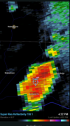
Had a lightning bolt fire off really close. As soon as i was able to register what was happening, it was thundering. Ear splitting thunder, and i could feel it. Like the bolt had 3 pulses, and i felt the 3 pulses, also heard the street light clicking 3 times with the pulses.

