-
Hello, please take a minute to check out our awesome content, contributed by the wonderful members of our community. We hope you'll add your own thoughts and opinions by making a free account!
You are using an out of date browser. It may not display this or other websites correctly.
You should upgrade or use an alternative browser.
You should upgrade or use an alternative browser.
Pattern July '22
- Thread starter Detective WX
- Start date
smast16
Member
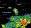
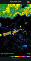
Time to upgrade your radar source, Mack.....Bottom of the line shrinking and pulling north just as the line gets to my location. Going to follow the exact same path of the last 4 storms to the mile. Meanwhile, new activity developing just to the South and East.
View attachment 120172
Why so I can pay to see storms miss me? No thanks!Time to upgrade your radar source, Mack.....
There is always tomorrow ?Why so I can pay to see storms miss me? No thanks!
Going to be really sucky when the line in the mountains hits wake again around dark
GoDuke
Member
Once again. Every cell today has missed in every fcking direction today, now everything is dying out. I think It’s only rained here like 5 times since MayHappens every ----ing day for me.
Copy n paste!
Caught the split again for the 2cnd day in a row. Thankfull for my water hose.
Caught the split again for the 2cnd day in a row. Thankfull for my water hose.
JHS
Member
Got another .28 of rain here today.
JHS
Member
Certainly not this month. This month has been very wet here and am closing in on 10 inches of rain so far. It'll be back soon enough though, LOL.It has to be cause it sure ain't over his house anymore.
I'm just over 1" for the month.Certainly not this month. This month has been very wet here and am closing in on 10 inches of rain so far. It'll be back soon enough though, LOL.
Today's high at DFW was 103*F.
D
Deleted member 609
Guest
You get screwed in winter and summerI'm just over 1" for the month.
Avalanche
Member
Bring it east. Maybe it will make it hot enough to spark a thunderstorm here. Summer drought continues...Today's high at DFW was 103*F.
Brent
Member
Dude, that app! Come on bro!Bottom of the line shrinking and pulling north just as the line gets to my location. Going to follow the exact same path of the last 4 storms to the mile. Meanwhile, new activity developing just to the South and East.
View attachment 120172
smast16
Member
I had four storms pass over my house yesterday. I have had more storms this summer than I have had in a long time. Looks like there might be a break from them today.
I sure hope those of you that haven't had the good rainfall totals get them soon, obviously because you need it but also so I won't feel guilty when I pray for a cold front to come through and take this jungle airmass with it.
I got lucky with a couple of storms this past week, but even those I got the fringe of bigger storms to my SE. Yesterday I got a few rain drops while areas again to my south and east got dumped on. It seems the golden zone in Wake County is from the Airport NE to Wake Forest. I need that to shift 10 miles northward. But if we could get a cool airmass I'll take getting no rain for a while. This hot/humid crap is getting old; and we still have August (...and September, and October, ...).I sure hope those of you that haven't had the good rainfall totals get them soon, obviously because you need it but also so I won't feel guilty when I pray for a cold front to come through and take this jungle airmass with it.
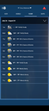
Hopefully we can get 100 tomorrow and Friday
smast16
Member
Inches of Rain?Hopefully we can get 100 tomorrow and Friday
Lick hacked your comp tooHopefully we can get 100 tomorrow and Friday
Lol rainInches of Rain?
Nah I'm on the extreme heat train I want it to suck for everyone like it has here for the most partLick hacked your comp too
LickWx
Member
Was 91/79 at RDU a bit ago. Epic dews! I love it personally. Wish we had something to ignite storms in this kind of atmosphere for todayNah I'm on the extreme heat train I want it to suck for everyone like it has here for the most part
Storms firing in the same places they have since Saturday. IncredibleWas 91/79 at RDU a bit ago. Epic dews! I love it personally. Wish we had something to ignite storms in this kind of atmosphere for today
Cad Wedge NC
Member
I don't want to hear anyone complaining about the cold this winter.... or wishing for heat. You should have gotten your fill already. I am sick of this heat... Bring on Fall.
StormDrain
Member
No, heat, when acclimatized to it is infinitely better than freezing your @ss off lmaoI don't want to hear anyone complaining about the cold this winter.... or wishing for heat. You should have gotten your fill already. I am sick of this heat... Bring on Fall.
Loving these mid-90s today through Friday
I don't want to hear anyone complaining about the cold this winter.... or wishing for heat. You should have gotten your fill already. I am sick of this heat... Bring on Fall.
We are probably going to get hotter around 8/5 before tempering back again afterward
StormDrain
Member
Allan gets you....Storms firing in the same places they have since Saturday. Incredible
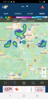
@Rain Cold  ? ? outflow collision headed your way
Oh I think we know how this ends lol@Rain Cold? ? outflow collision headed your way
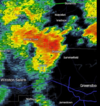
Will be fun to see how these stay 3 miles to my north.
Last edited:
Well this weekend isn't starting to look like something we might not even be able to screw upOh I think we know how this ends lol
And five miles to my south.. Again the golden zone through north-central Wake.Oh I think we know how this ends lol
Will be fun to see how these stay 3 miles to my north.
View attachment 120199


