-
Hello, please take a minute to check out our awesome content, contributed by the wonderful members of our community. We hope you'll add your own thoughts and opinions by making a free account!
You are using an out of date browser. It may not display this or other websites correctly.
You should upgrade or use an alternative browser.
You should upgrade or use an alternative browser.
Pattern Januworry
- Thread starter SD
- Start date
Hey GaWx love your insight. Wasn't January 21, 1985,, a day I will never forget in Atlanta, a La Nina year? Temps dropped from 56 to 14 in about 4 hours then down to -8 at KATL, I had -11..
I was there! It was a very similarly strengthed 2nd year La Nina as a matter of fact that was preceded by a similarly very warm Dec. that also had a near record -PNA, was in the warm MJO phases, and was warmer than November of 1984. January came along with the left side MJO and a transition to very strong +PNA along with very strong -NAO/-AO and then came history with cold throughout the month highlighted by the monster cold front 1/21. What's different about Jan 2022 is that the forecast for the first half of January is neutral AO and slightly +NAO.
bigstick10
Member
Thank you, you are quite an asset to this board.I was there! It was a very similarly strengthed 2nd year La Nina as a matter of fact that was preceded by a similarly very warm Dec. that also had a near record -PNA, was in the warm MJO phases, and was warmer than November of 1984. January came along with the left side MJO and a transition to very strong +PNA along with very strong -NAO/-AO and then came history with cold throughout the month highlighted by the monster cold front 1/21. What's different about Jan 2022 is that the forecast for the first half of January is neutral AO and slightly +NAO.
Coincidentally, the record high that CLT set today of 78 broke the previous record of 74 on 1/1/1985I was there! It was a very similarly strengthed 2nd year La Nina as a matter of fact that was preceded by a similarly very warm Dec. that also had a near record -PNA, was in the warm MJO phases, and was warmer than November of 1984. January came along with the left side MJO and a transition to very strong +PNA along with very strong -NAO/-AO and then came history with cold throughout the month highlighted by the monster cold front 1/21. What's different about Jan 2022 is that the forecast for the first half of January is neutral AO and slightly +NAO.
Coincidentally, the record high that CLT set today of 78 broke the previous record of 74 on 1/1/1985
Yeah, I see that the first two days of January 1985 were mild though I didn't realize that was the old record high at Charlotte. Then the bottom fell out with January 4th-February 16th dominated by intense cold due to a bunch of Arctic highs. Only 9 of those 43 days didn't have a freeze and only 3 warmer than 35 at KATL! So, there was a lot more to the cold than just the historic 1/21 cold front though naturally that's what those of us around then remember the most by far about that winter. If only we could get the -AO/-NAO back later this month!
Last edited:
I was only 8 that winter, but I do have some memory of that cold front on 1/21. It was a Sunday and the front actually came through while we were in church that morning. It was in the 30s when we went into church, and we came out it was snowing lightly with a coating on the ground and the temperature had dropped to 11… it was in the single digits most of the afternoonYeah, I see that the first two days of January 1985 were mild though I didn't realize that was the old record high at Charlotte. Then the bottom fell out with January 4th-February 16th dominated by intense cold due to a bunch of Arctic highs. Only 9 of those 43 days didn't have a freeze and only 3 warmer than 35 at KATL! So, there was a lot more to the cold than just the historic 1/21 cold front though naturally that's what those of us around then remember the most by far about that winter. If only we had the -AO/-NAO back!
Cary_Snow95
Member
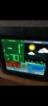
Got my new tempest set up just in time for the big front tomorrow. Oddly enough I’ve warmed from 65 to 68 in the last hour. Classic New Year’s Day temps ?
Think our high temps for 1/2 will be at midnight.
Got my new tempest set up just in time for the big front tomorrow. Oddly enough I’ve warmed from 65 to 68 in the last hour. Classic New Year’s Day temps ?
I’m ready, too. Check out my 1968 Tempest!

It was a record high of 82 today here and Fayetteville, NC, tied its alltime January record high of 81!
NBAcentel
Member
NBAcentel
Member
Can we say round 2???
NBAcentel
Member
NBAcentel
Member
NBAcentel
Member
Mby would be ok with thatThe lack of tall ridging out west from this really hurts us in this case so it’s hard to dig View attachment 100991
Would be a quick hitter but maybe a better chance at small accumulation than this upcoming eventThe lack of tall ridging out west from this really hurts us in this case so it’s hard to dig View attachment 100991
CAD incoming
Iceagewhereartthou
Member
Hmmm, now that looks more like an overrunning set up there, that's what I'm talkin bout! Need that high to slide along with the low, or better yet a blocking high. Change that L above NE to an H, or would that count as a 50/50 low...I will leave this here. Mid range. View attachment 100990
Glad it long range
Great trends with the +PNA amazing stuffGlad it long range
Webberweather53
Meteorologist
Great look for your amigo in New Mexico!
I see the Euro and GFS backed off on the artic intrusions beyond in the mid-range over the 00z and 6z runs respectively. Less +PNA
EDIT. The EPS still looks solid.
EDIT. The EPS still looks solid.
Last edited:
The cold front has begun to arrive. Current temp is now 68 from a highof 73 at midnight. Its all downhill from here today! ?
Ok, better I guess?Was supposed to be -8 this AM! Bust :View attachment 101029
Another GFS and CMC run that have backed way off on the PNA ridging in the day ten timeframe. The extended cold spell advertised for this period is looking like a head-fake at this time.
Stephenb888
Member
It’s not a head fake. It will go back and forth until it’s closer in time. A lot of people thought this coming week was a headfake as well.Another GFS and CMC run that have backed way off on the PNA ridging in the day ten timeframe. The extended cold spell advertised for this period is looking like a head-fake at this time.
NBAcentel
Member
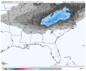
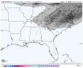
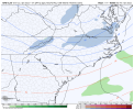
We in the Carolinas truly do suck. Seeing Central Alabama and North Georgia possibly getting a suprise mini snowstorm ,while we watch the cold pattern was supposed to make to the eastern SE starting on the Jan 10-12 timeframe fading away quick is hard to watch. Also the MJO appears to be staying in phase 7 for a longer period of time,which the Models appears to be responding to that doesn't help neither.Another GFS and CMC run that have backed way off on the PNA ridging in the day ten timeframe. The extended cold spell advertised for this period is looking like a head-fake at this time.
Don’t know what you’re looking at but all the models I’m seeing show continued cold air pushing through the SE maybe not crazy arctic air but cold enough for winter mischief and storm chances and definitely nothing more than 1-2 warm days throughout the entire runAnother GFS and CMC run that have backed way off on the PNA ridging in the day ten timeframe. The extended cold spell advertised for this period is looking like a head-fake at this time.
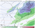
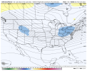
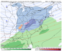
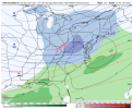
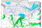
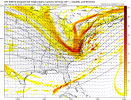
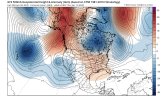
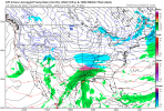
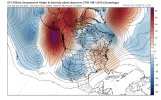
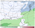
Lousy ridging in Midwest looks to be trying to eliminate what could be a good opportunity. Might be time for it to change.Wish it was the euro showing this but View attachment 101131View attachment 101132View attachment 101133
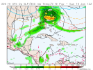
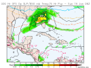
Um, we've gone to this:

From this:

CMC is similar, EURO OP too.

From this:

CMC is similar, EURO OP too.
NW trend means this is in a perfect spot

