-
Hello, please take a minute to check out our awesome content, contributed by the wonderful members of our community. We hope you'll add your own thoughts and opinions by making a free account!
You are using an out of date browser. It may not display this or other websites correctly.
You should upgrade or use an alternative browser.
You should upgrade or use an alternative browser.
Pattern Januworry
- Thread starter SD
- Start date
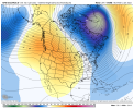
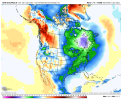
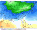
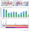
Noticing a few members now want to take it through low amp phase 1 and 2. The good thing I see is that it’s staying on the left side which is obviously what we want. I know a lot of people were playing down the importance of the MJO last week with how bleak the models were looking and there are certainly other pieces of the puzzle, but I’m a firm believer now that it’s the single most important index in a LaNina… what happened with the pattern last February made be a believer of that. Obviously the models are seeing us going into phase 8 and are responding to more troughs in the eastIn combo with the rising PNA, it is hard as a cold lover to not like these:
View attachment 100771View attachment 100772
bigstick10
Member
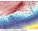
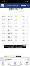
BS on that map..High temperatures with this arctic shot .. models trying to sniff out some CAD junk a little after this high pressure moves a bit away . CAD would have more credence with a cold and dry airmass like this View attachment 100811
This storm is wild
bigstick10
Member
20s for highs in the Outer Banks, sorry not gonna happen.BS on that map..
What’s your reasoning on that? I’m not saying that those highs will definitely verify, but there’s certainly a lot of ensemble support right now that well below average high temperatures is in the cards for that week.BS on that map..
Makes me wonder how much of a punch tomorrows little line will haveThis storm is wild
1046 sitting over the central US at d10 on the euro with below 0 dews on the doorstep of the region. We get the pattern the gfs/euro are advertising we are going to see the coldest temps in years (since 2018) for NC/SC/GAWhat’s your reasoning on that? I’m not saying that those highs will definitely verify, but there’s certainly a lot of ensemble support right now that well below average high temperatures is in the cards for that week.
I'll go with underwhelmingMakes me wonder how much of a punch tomorrows little line will have
NBAcentel
Member
I agree completely, and as I said it’s not just operationals doing goofy things, as there is lot of support in the ensembles for it. One thing I would watch for that time is something trying to develop along the front if it stalls near the Gulf Coast… perhaps a weak wave, but with that type of airmass in place you can see nice widespread 2-4 inch type event1046 sitting over the central US at d10 on the euro with below 0 dews on the doorstep of the region. We get the pattern the gfs/euro are advertising we are going to see the coldest temps in years (since 2018) for NC/SC/GA
NBAcentel
Member
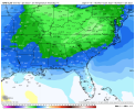
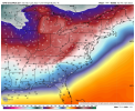
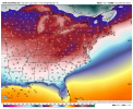
Same with the gefs with highs barely getting above freezing, it also has lows in the upper teens across N NC. No bs hereLol then there’s this at hour 150, high around/below freezing View attachment 100815
That 18z gfs run was probably the most exciting but infuriating thing I've seen. Great hemispheric pattern right through 384 but warms up to rain with almost every system.
NBAcentel
Member
AFD this afternoon said the next cold shot here mid/late week, will be colder than the next day or two here. We touch 30 on Tuesday and then go basically 20 highs and -5 to 10 lows for the next 10-15 days! That can only benefit y’all down the line!1046 sitting over the central US at d10 on the euro with below 0 dews on the doorstep of the region. We get the pattern the gfs/euro are advertising we are going to see the coldest temps in years (since 2018) for NC/SC/GA
I agree completely, and as I said it’s not just operationals doing goofy things, as there is lot of support in the ensembles for it. One thing I would watch for that time is something trying to develop along the front if it stalls near the Gulf Coast… perhaps a weak wave, but with that type of airmass in place you can see nice widespread 2-4 inch type event
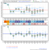
Indeed, look at all of the members with 1045+ mb highs in red: this is believable based on the MJO forecast:
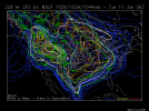
That 18z gfs run was probably the most exciting but infuriating thing I've seen. Great hemispheric pattern right through 384 but warms up to rain with almost every system.
I haven't looked yet. Let me guess, no -NAO and an annoying WAR?
NBAcentel
Member
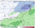
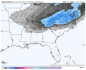
Although this is a bit different evolution than our current one I do worry about more amplification and such going NW with this system if we’re starting here .. but we will see how far that cold air initially can push through I think the more it can push through the further south the snow could end upI didn’t realize the gefs was this good for this system, if the euro could hop on to the cho cho weenie train, then this might need a thread in a day or 2, another interesting look for the same areas we’re watching with Monday mornings system View attachment 100818View attachment 100819
14 - 94F in TX this afternoon, those are surface temps, it’s been cooking and max CONUS departure today was >115F, MN and TX. It’s really just the evolution of a pattern change that gave BC historic flooding, Pac NW and CA snow, CO rapidly moving wildfires with 100+ mph winds, east, and it sets up a active pattern with multiple systems and a very cold air supply to work with in the SE over the coming weeks.
Cold and DRY ?
And that actually works for us…
NBAcentel
Member
All I see on the gefs is low-mid 40s over low 30s/upper 20s, now thats winter
Yeah, I know Matthew East once said on the other board that even if everything else is going right, here in the south you still got to have good timing. Overall I think we’ll all take our chances with the pattern the models have been trending towards the last few daysNo war they don't make them much colder than that 18z run for us. But the lack of a -nao and poor timing means no snow. Going to have to time things right in a +pna/+nao look and run for cover 24 hours before the event
View attachment 100825
View attachment 100826
bigstick10
Member
Anything is better than this 75 degree BULL S H I TAll I see on the gefs is low-mid 40s over low 30s/upper 20s, now thats winter
There will be a few cloudy days where it flizzards all day and highs in the single digits. Happened a lot last year, get lots of inversions here and always hope for a clipper!Cold and DRY ?
Well you will flizzard your way to more snow in a week's time than I've had in 3 years.
I'm really excited about what the models have overall. These big pac ridge cold Hudson/Davis strait vortex looks haven't been terrible in the past. I wouldn't be shocked if we tried to tack on some -nao toward the end of this pattern 1/20ishYeah, I know Matthew East once said on the other board that even if everything else is going right, here in the south you still got to have good timing. Overall I think we’ll all take our chances with the pattern the models have been trending towards the last few days
Last edited:
bigstick10
Member
Hey GaWx love your insight. Wasn't January 21, 1985,, a day I will never forget in Atlanta, a La Nina year? Temps dropped from 56 to 14 in about 4 hours then down to -8 at KATL, I had -11..Models are hinting that there will be 3 different Arctic highs likely to come down between 1/7 and 1/20 to bring cold to the SE before any January thaw. Two of those highs are a near lock now.
Last edited:
At this rate, a lot of us would be happy with 50s lolAll I see on the gefs is low-mid 40s over low 30s/upper 20s, now thats winter
Amen! Drove back to clt today from Asheville and it was 74 on the blue ridge parkway. Just atrocious. Also found many Bermuda yards in my neighborhood greened up again.Anything is better than this 75 degree BULL S H I T
BHS1975
Member
Same with the gefs with highs barely getting above freezing, it also has lows in the upper teens across N NC. No bs here View attachment 100816View attachment 100817
Been a while since we had temps like that.
Sent from my iPhone using Tapatalk
True but glad to see the cold. Will worry about other things later. We know it definitely won't snow at 79 degrees. We may yet see a -NAO pop up.No war they don't make them much colder than that 18z run for us. But the lack of a -nao and poor timing means no snow. Going to have to time things right in a +pna/+nao look and run for cover 24 hours before the event
View attachment 100825
View attachment 100826
SnowNiner
Member
I didn’t realize the gefs was this good for this system, if the euro could hop on to the cho cho weenie train, then this might need a thread in a day or 2, another interesting look for the same areas we’re watching with Monday mornings system View attachment 100818View attachment 100819
To me, the darker blue colors on the ensemble snow mean outlines where the threat really is. For my back yard for me to take notice of a threat, generally I'm looking for the 2 inch mean south to at least rock hill, sc. That one looks like another Virginia storm right now.
NCHighCountryWX
Member
- Joined
- Dec 28, 2016
- Messages
- 699
- Reaction score
- 1,918
NCHighCountryWX
Member
- Joined
- Dec 28, 2016
- Messages
- 699
- Reaction score
- 1,918
cd2play
Member
Agreed. I can handle a quick 2-3 day warm spell where temps spike into the 70s, but this ongoing warm spell for the last 10 days is ridiculous.Anything is better than this 75 degree BULL S H I T

