LickWx
Member
Nice day at the beach . Near 80 in Wilmington mid 60s here at Wrightsville along the shore. I had to go to the beach at least once figured today. Shoulda waited till Wednesday , gon be even warmer along the shore .
I knew I shoulda put the top down and packed the cooler.Nice day at the beach . Near 80 in Wilmington mid 60s here at Wrightsville along the shore
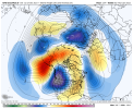
This yields a big difference across the conusView attachment 99406
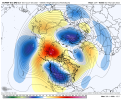
View attachment 99407
Pretty big difference in the Npac between the eps and gefs


The key is the recovering heights off of the west coast there’s the big difference in both .. lower heights on the Gfs keeps it dumping out west and opens up the SER .. on the euro they are nowhere to be seen so cold air progresses East and keeps a lid on the tremendous ridging
The EPS has sucked this winter so far. And the GEFS seems to be similar to what we had so far. Want to lay odds on who turns out to be more correct lol@Rain Cold says go with the GEFS.
The EPS has sucked this winter so far. And the GEFS seems to be similar to what we had so far. Want to lay odds on who turns out to be more correct lol
I'm disappointed by the non-obliteration of that ridge axis through the Aleutians. Hopefully that will change. It seems to be showing on both models but the Euro has the strongest anomaly to the north and set up as a block, which allows some shallow ridging across the extreme SW US....creates a broad trough. I still don't like the main ridge axis where it is, though, through the Aleutians.
Maybe this is the beginning of the rumblings on the euro … I want a happy hour Gfs 18z to jump onboard


Why wouldn't it be? That side of Georgia does very well with cold chasing moisture when it happens to work out.1-2" in the western Atlanta suburbs. Do you really think thats realistic ?

I knew I shoulda put the top down and packed the cooler.
The other big event like this we had in Nov the EPS was right.View attachment 99406
View attachment 99407
Pretty big difference in the Npac between the eps and gefs
Yep we can still score a snow storm or 2 in the upper southeast during a warmer winter. Hell if we couldn’t get snow in a warmer winter we’d never get snow. ?I suspect we see an Apps runner similar to last February at some point this winter, giving middle and west TN ice or snow.
I actually don’t really care about the snow it’s showing as it’s unlikely to be anywhere near what the model is showing. At this point I care much more about the cold coming and knocking this warmth out which is way more likely then the snow. I won’t be shocked however if this area sees some flakes fly on Sunday night into Monday that add up to a dusting. Middle Tennessee has not seen a flake yet so it’s bound to happen sooner then later .But would the ratio actually be 10:1 ?
I actually don’t really care about the snow it’s showing as it’s unlikely to be anywhere near what the model is showing. At this point I care much more about the cold coming and knocking this warmth out which is way more likely then the snow. I won’t be shocked however if this area sees some flakes fly on Sunday night into Monday that add up to a dusting. Middle Tennessee has not seen a flake yet so it’s bound to happen sooner then later .
Being. Dealing with a La Niña we’re going be dealing with a ser. Bet on thatYeah, just get us back to normal temperatures averaged out over a couple of weeks. That’s all I need to be content.
Good news is that new Euro weeklies are a bit colder for 1/13-23 for the SE vs the prior run due to less -PNA/more +PNA though they continue to show no -AO or -NAO. For the last 3 weeks of January, it has the SE averaging near +1.5 vs 1991-2020 climo, which I’d take in a heartbeat especially compared to the current torch. That compares to the +3 of the Thursday run and would mean a pretty normal January overall, but will it verify? The weeklies I believe have a bit of a warm bias but OTOH models have been solidly cold biased this month overall. So, I just hope it is close to reality and that the SER doesn’t try to rear its ugly head too much.
Lets get together, all of us, and move it 2000 miles east.Just a 1054 arctic high coming of Canada. Nice. View attachment 99436
Accuweather says Atlanta's next freeze is January 23. Larry, has Atlanta ever entered the month of January with only 1 freeze ?The extended outlook in the the 4th to 9th of Jan looks like 70 and 55 again, so sick of this s h i t .
Upper -20’s? Mack might need a new pair of pants18gfs Mid-Long range a lot better look with cold locked in. Even kicks out SER..
View attachment 99439
