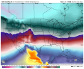
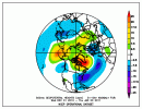
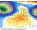
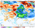
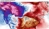
Yep as bad as this is it takes less time to get out of this since we have a very amplified pattern with plenty of cold in NA. If we had to build blocking and get cold over to this side of the world we'd be looking at weeks to do that. This could be flipped pretty quickly if we could just move that feature in the Pacific a little. But that's asking a lot at the moment.I don't think it's written in stone anywhere for us not to have a period in January where it gets cold. And I don't mean to indicate that the models are showing an unending torch pattern. They're not. They could be, and that would be bad. The cold could be out of NA completely. That would be bad. But that's not the case either. But in any event, it seems pretty unlikely that we'll slip into a favorable winter pattern for the SE within the next two weeks. Doesn't mean it for sure won't happen. But it would be unwise to consider that the most likely outcome.
-
Hello, please take a minute to check out our awesome content, contributed by the wonderful members of our community. We hope you'll add your own thoughts and opinions by making a free account!
You are using an out of date browser. It may not display this or other websites correctly.
You should upgrade or use an alternative browser.
You should upgrade or use an alternative browser.
Pattern Januworry
- Thread starter SD
- Start date
NBAcentel
Member
Prestige Worldwide
Member
NBAcentel
Member
Webberweather53
Meteorologist
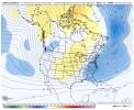
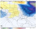
Pretty easy to see why this gefs run is cooler, we took a baby step to this look. Unfortunately we’re probably gonna take steps back and forth, and for that solution to happen above, we need some sizable changes View attachment 98671View attachment 98672
Just goes to show that if we move the ridge in the GOA anywhere it’s still an improvement over what we have now. A nudge towards the Aleutians could encourage the subtropical ridge to move toward the southern Rockies and desert SW
iGRXY
Member
No teleconnection lasts in one position for an entire season. You will get short term periods of fluctuations. That tends to be when we score winter storms. Even a neutral PNA coupled with a -NAO would be greatly beneficial to the entire southeast. You can dump cold air southeast without dropping the hammer of cold and we get suppression.I don’t see how the PNA is going to suddenly flip. -PNA’s tend to last all winter, once started.
StormWatch
Member
I've discussed about this in my article about a new oscillation that I'm implementing. You can find the link to my article in the whamby thread.I think it was @Ollie Williams that posted the Dec 2010-Jan 2011 pattern but I can't find it now. It may have been Webber. Either way it was a west based -NAO and also had an Aleutian ridge and no ridging out west and we still were cold and had snow. I don't get it. I'm going to join @Rain Cold on the dark side and agree this is a very persistent stubborn pattern and it holds on regardless of what the indices say and only breaks when it wants to. We clearly don't understand all the forces at work that drive patterns.
Misc - 2021-22 Fall/Winter Whamby Thread
It's the cold hard truth. You cling to anything and everything that shows even so much as an inkling of a favorable look for snow/ice, even if it's out at hour 10000000000000. No really what did the 10000 hour cfs show??
southernwx.com
Last edited:
olhausen
Member
November would like a word with you.Betting on cold is like beating the house in Vegas these days.
Sent from my iPhone using Tapatalk
tennessee storm
Member
December sure notNovember would like a word with you.
tennessee storm
Member
Thank you mr La Niña for saving me some
Money on my electric bill thus far…
Money on my electric bill thus far…
Mr. Golf
Member
Monday update
How often do they do a lr pattern update? I tried to find it on YouTube, but no luck
I have faith the 0z models gonna save us all. 2 lonely hours to make or break this winter, lol.
NBAcentel
Member
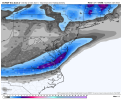
Looks spot on after you do the normal 50% reduction on the southern extent. Could give a light snow to Sparta NC and southern Virginia.The Euro Control actually has a strip of snow across northern NC from an overrunning system.
View attachment 98692
Webberweather53
Meteorologist
Yep the 0z suite totally sucked. No end in sight for this stupid strong/persistent -PNA
L
Logan Is An Idiot 02
Guest
What needs to happen to change the -PNA?Yep the 0z suite totally sucked. No end in sight for this stupid strong/persistent -PNA
The GOA ridge really never moves to a position thats favorable on Models, which forces a strongly -PNA. What shame we are wasting a winter where we have the coldest air on the Northern Hemisphere and -NAO/AO on this. Congratulations to Seattle,WA and Portland,OR I guess.Yep the 0z suite totally sucked. No end in sight for this stupid strong/persistent -PNA
tennessee storm
Member
Basically a prayer. Just being honestWhat needs to happen to change the -PNA?
L
Logan Is An Idiot 02
Guest
Yeah I feel like theirs been a -PNA for 3 years lolBasically a prayer. Just being honest
Yep goes to the point that we in the SE need a +PNA. I know there are exceptions but generally we need a big western ridge to push storm tracks to our south. Otherwise we just keep getting storm tracks up through the great lakes which also keep the coldest air in the west.
L
Logan Is An Idiot 02
Guest
The last couple of days on the GEFS weren’t too bad temp wise. Still not ideal for snow but more seasonable temps. All it takes is one week like Seattle is getting and everyone on this board will be happy
Webberweather53
Meteorologist
What needs to happen to change the -PNA?
With the -NAO place now, we could literally move the GOA ridge just about anywhere else and have a better result here. Once the -NAO dies, if this ridge is anywhere between the Aleutians to Gulf of Alaska we get a nice SER
Webberweather53
Meteorologist
The last couple of days on the GEFS weren’t too bad temp wise. Still not ideal for snow but more seasonable temps. All it takes is one week like Seattle is getting and everyone on this board will be happy
It looks like a mirage to me overall. The GOA ridge doesn’t move at all through the end of the run. We’re stuck in the same ? as we’re in now
Webberweather53
Meteorologist
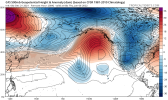
The 6z op GFS shows one of the synoptic pathways I mentioned yesterday wrt how we get out this crap. The Okhotsk vortex comes out into the Bering Sea and Aleutians, speeds up/extends the pacific jet, forcing the GOA to move eastward closer to the west coast. Still would not a good or great pattern by any means but it would be an improvement over what we have now.

iGRXY
Member
As bad as the H5 pattern looks on the west coast, I think the -NAO/-AO is going to cause changes like this the closer we get to the short range. Obviously nowhere near what we want for snow but it keeps you generally average or slightly below average which in this pattern is about all you can ask for. But if that -NAO starts breaking down, everyone west of the apps is going to roast and everyone east can get saved every now and again from CAD but still will get warm as well.
Webberweather53
Meteorologist
Yep goes to the point that we in the SE need a +PNA. I know there are exceptions but generally we need a big western ridge to push storm tracks to our south. Otherwise we just keep getting storm tracks up through the great lakes which also keep the coldest air in the west.
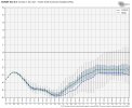
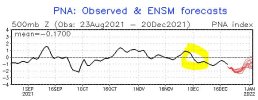
I’d settle for neutral or even -1 at this rate.
EPS forecast is all the way down near -6 ?
L
Logan Is An Idiot 02
Guest
Oh yeah absolutely. I was just happy to see near normal anomalies instead of 10+ above normal hahaIt looks like a mirage to me overall. The GOA ridge doesn’t move at all through the end of the run. We’re stuck in the same ? as we’re in now
B
Brick Tamland
Guest
I don't think anyone knows exactly what we need to get snow here anymore.
It dropped negative right at the start of met winter.I’d settle for neutral or even -1 at this rate.
EPS forecast is all the way down near -6 ?
View attachment 98696
Oh my. The 06z GFS run was pretty ugly (for those who are sick of the warmth) until the very end.
-PNA wins again!
-PNA wins again!
B
Brick Tamland
Guest
The weather here today looks lovely. 40s and rain. Awesome.
I’d settle for neutral or even -1 at this rate.
EPS forecast is all the way down near -6 ?
View attachment 98696
Thanks for posting that. The PNA is like the NAO for WxBell in that their numbers are inflated vs NCEP. They’re forecasting -6, which is way more negative than any NCEP PNA on record. So, they clearly use a different scale. Just to compare, NCEP’s forecast has it dipping to -2 vs the WxBell’s -6. On an NCEP basis, -2 is a very strong -PNA:
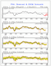
OTOH, WxBell’s AO numbers seem to be consistent with NCEP.
Webberweather53
Meteorologist
Thanks for posting that. The PNA is like the NAO for WxBell in that their numbers are inflated vs NCEP. They’re forecasting -6, which is way more negative than any NCEP PNA on record. So, they clearly use a different scale. Just to compare, NCEP’s forecast has it dipping to -2 vs the WxBell’s -6. On an NCEP basis, -2 is a very strong -PNA:
View attachment 98700
OTOH, WxBell’s AO numbers seem to be consistent with NCEP.
We're currently on pace to potentially set a record for strongest -PNA in December.
ATLwxfan
Member
Oh my. The 06z GFS run was pretty ugly (for those who are sick of the warmth) until the very end.
-PNA wins again!
Pattern persistence…it’s undeniable. Also seems there are trends carrying on from year to year. Seems the south has gotten warmer and maybe less snowy while the Pac NW is a veritable snowtopia.

Sent from my iPhone using Tapatalk
IncorrectI don't think anyone knows exactly what we need to get snow here anymore.
B
Brick Tamland
Guest
Incorrect
My bad. We need precip and temps near or under freezing. We just don't know what will give us the pattern to make that happen anymore.
IncorrectMy bad. We need precip and temps near or under freezing. We just don't know what will give us the pattern to make that happen anymore.

