Dewpoint Dan
Member
Cold air plus moisture = cold rainSure we do. Cold air plus moisture will do the trick! ?
Cold air plus moisture = cold rainSure we do. Cold air plus moisture will do the trick! ?

You say this every year. But we really haven't had many "good" patterns for snow in a long time. Just because you hear people on here talking about a favorable index doesn't mean that it's a good pattern. There are lots of people who do know what a good pattern is for snow. To say that we don't know what a good pattern is is just incorrect.
This is straight up garbage

Ok sounds good. Tell you what...I know how we can know for sure. Let me know when you look at a current pattern and analyze it and feel that it is a good pattern for snow. Then, we'll talk about it and see how it turns out. Sound like a good plan?I disagree. Even when we do have a pattern that produced in the past and is favrobale for producing snow here, it's still harder than it used to be with that same pattern to actually get it to produce. That's my point.
Ok sounds good. Tell you what...I know how we can know for sure. Let me know when you look at a current pattern and analyze it and feel that it is a good pattern for snow. Then, we'll talk about it and see how it turns out. Sound like a good plan?

So is that a yes or is that the typical spin and walk away? Because if you're going to make the same definitive statements year after year, you ought to be willing to test them. Post reactions really aren't a good test.Webber gave me a thumbs up on that post, so...
So is that a yes or is that the typical spin and walk away? Because if you're going to make the same definitive statements year after year, you ought to be willing to test them. Post reactions really aren't a good test.
Just tell me when you see a snow pattern and we'll look at it and see what it produces. That sounds fair, right? And no rush, there's going to be plenty of time before we have to worry about it.
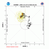
RMM isn’t gonna show all of whats going on in the backgroundEasy to see why things are failing. Tropical forcing is holding on for dear life around the maritime continent thru day 11 View attachment 98728


I just don't see why it's hard for you to look at a pattern and tell me when it is a good one for snow. Lots of people say this or that in weather weenie world. That doesn't make it so. You tell me when you see a good snow pattern and we'll check it out.There have been times in the past where people have said we were in a good pattern, when we had good indexes that are more favorable for snow compared to other factors, and it still didn't produce. I don't know how you can't see in general we have had patterns that mets themselves say are what we need to see for snow, but they still don't produce snow for us as often now as they did in the past.
We may not have the good patterns as often, either, but when we do have patterns that mets say are better for snow here they still don't end up producing as often as they used to.
Easy to see why things are failing. Tropical forcing is holding on for dear life around the maritime continent thru day 11 View attachment 98728
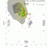
I’m convinced phase 7 is the worst phase for winter storms hereRMM isn’t gonna show all of whats going on in the background View attachment 98730View attachment 98731
RMM isn’t gonna show all of whats going on in the background View attachment 98730View attachment 98731
A -NAO is not a snow pattern. You can copy and paste text describing indexes, but that doesn't tell you about a pattern that is good for snow. A winter storm pattern is more than an index. The data you described above says that there is a positive correlation to a -NAO and particularly within an El Nino. I'm not going to dare ask you why that is the case, but the El Nino case is not applicable this year. Just let me know when you look at a map and see a snowy pattern and we'll talk about it then.This is what I look for when considering if the pattern is good or not for snow here. It's based on research from the NC Climate Office. I believe when we do have the good factors that this research says we need for snow here it still doesn't produce as often now as when we had these factors in the past.
On a seasonal time scale, NC snowfall departures are inversely related to departures in the NAO. In other words, a negative NAO is often observed with increased snowfall in North Carolina.
Excluding March, winter months that averaged a negative NAO experienced at least a 25% increase in the number of snow days compared to the 52 year average, while positive NAO months had at least a 25% decrease in snow days.
On a daily timescale, it appears that trends in the NAO can be used to detect enhanced potential for winter weather in NC. When the NAO has been in a negative phase (allowing cold air to become entrenched across the region), and then begins to increase towards a neutral phase, it appears that significant NC snowfalls become more likely.
Our results found that a negative NAO combined with a positive ENSO phase (El Niño) resulted in the most snow days on average, with an increase of 25% (or more) in snow days for all four winter months.
A positive NAO combined with a negative ENSO (La Niña) resulted in the greatest decrease in average snow days. This is due to a lack of cold air (results of a typical positive NAO), and less active subtropical jet stream (results of a typical La Niña).
NAO had the most significant impact on snow days. Even in winter months that featured La Niña conditions (typically warm and dry), combined with a negative NAO, only February saw a decrease in snow days, which suggests that the NAO has a more direct influence on NC snowfall than ENSO. The reason behind this is that the NAO directly impacts the large scale atmospheric pattern over the eastern U.S. on a daily timescale, whereas the ENSO pattern indirectly effects the eastern U.S. atmospheric pattern by altering global circulations, and does so on monthly to seasonal timescales.
North Carolina State Climate Office – A Public Service Center
legacy.climate.ncsu.edu
A -NAO is not a snow pattern. You can copy and paste text describing indexes, but that doesn't tell you about a pattern that is good for snow. A winter storm pattern is more than an index. The data you described above says that there is a positive correlation to a -NAO and particularly within an El Nino. I'm not going to dare ask you why that is the case, but the El Nino case is not applicable this year. Just let me know when you look at a map and see a snowy pattern and we'll talk about it then.
What I'm trying to say is that a -NAO in and of itself isn't a snowy pattern. We haven't had very many winters with a -NAO anyway. The conclusions you're drawing are not well founded. You can't really say that a good pattern doesn't produce snow anymore until we actually get a good pattern, or lots of them, and they don't produce. What I'm trying to tell you is that we have not had very many actual good winter weather producing patterns. We may get one component in our favor here or there, but it takes more than a -NAO to get a snowy pattern. Just show me when you see one. Until then, there's not much point in arguing about abstracts.Well, that's what I am talking about when I say the overall global pattern in general doesn't produce as often now as it has in the past when we do have the factors that are talked about in this study. Not sure why you have to be a jerk about it anyway. You're coming off as pompous and condescending.
Well, the end of the EPS was showing an icebox a week or so ago. It's trash!
I’m honestly not a firm believer in MJO. If there’s a +PNA I personally don’t think the MJO matters
Well, the real essential question is, what causes that +PNA? I think that tropical forcing is much more significant than many people realize. While the MJO is not the only indicator, there are a lot of factors that you really have to have an eye for to predict. That's why I rely so heavily on people like Webber & HM.I
I’m honestly not a firm believer in MJO. If there’s a +PNA I personally don’t think the MJO matters
I
I’m honestly not a firm believer in MJO. If there’s a +PNA I personally don’t think the MJO matters
Easy to see why things are failing. Tropical forcing is holding on for dear life around the maritime continent thru day 11 View attachment 98728
If it backs into o 6, then we’re just not supposed to have cold and snow this year.I still think the very warm Maritime Continent is a problem as widespread convection continues there making the MJO act like it is still in the MC. This is somewhat correlated to a stubborn SER in the means. See BAMWx recent videos that @NCHighCountryWX has been posting. You can sure hear the intense frustration in the tone of the videos as they note the long delays in the MJO movement.
Fwiw though and as I’ve posted, history back to 1975 strongly suggests that it is a matter of when and not if as regards the move toward phase 8. Now it may take another 3 weeks lol as there have been several cases when it seemingly gets stuck in phase 7 and it may go inside left side of COD then, but history says it won’t stay in 7 and then back up to MC phases. We’ll see!
Oh my. The 06z GFS run was pretty ugly (for those who are sick of the warmth) until the very end.
-PNA wins again!
700 hours. Take it to the bank. Ready for itSo good news is 6z CFS finally pushes all the cold east. Bad news is it takes 700 hours to get there.
View attachment 98744
