I like that kind of weenie talk.It is now weenie talk time. I say weenie because it involves 1984-5:
1. For SAV among other places, Dec 2021 will end up warmer than Nov 2021 by a whopping ~3F per current forecasts. The only time back to the 1870s that Dec ended up more than 3 warmer than Nov was 1984, when it was 3.7 warmer.
2. For RDU and ATL, forecasts have Dec slightly warmer than Nov. In 1984, Dec was also warmer than Nov. (by the biggest amount on record at RDU and the 3rd biggest at ATL).
3. After a BN Nov of 1984, Dec of 1984 was one of the warmest on record at all 3 and even warmer than the forecast for Dec of 2021.
4. The last half of Dec of 1984 had a strong -PNA, strong +NAO, and +AO. The MJO was in phase 5 and then 6. There was a -EPO.
5. Jan had -EPO, a strong +PNA and -NAO, and a very strong -AO.
6. ENSO of late 1984 was very similar to that of now. Also, it, too, was a 2nd year La Niña.
7. January of 1985 was extreme I realize. So, expecting a repeat in January of 2022 would still be quite weenie even with these many strong similarities in 2021 preceding it. But who’s to say that at least part of January of 2022 won’t slightly resemble January of 1985?
End of weenie talk.
PS it is pretty obvious that we go from -PNA to +PNA to best resemble January of 1985’s indices.
-
Hello, please take a minute to check out our awesome content, contributed by the wonderful members of our community. We hope you'll add your own thoughts and opinions by making a free account!
You are using an out of date browser. It may not display this or other websites correctly.
You should upgrade or use an alternative browser.
You should upgrade or use an alternative browser.
Pattern Januworry
- Thread starter SD
- Start date
NBAcentel
Member
D
Deleted member 609
Guest
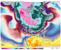
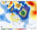
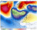
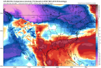
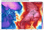
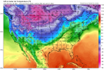
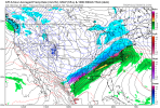
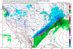
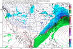
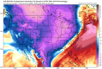
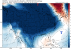
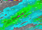
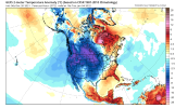
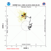
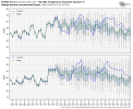
Crazy changesWhere did this look come from, it’s still not great for us but it’s a pretty massive change View attachment 98545View attachment 98546View attachment 98547
D
Deleted member 609
Guest
I’ll refer to my previous comments about how things will evolve better models always can’t handle pattern changes well .. I doubt this is that last change and last look .. again not worried about nothing right nowWhere did this look come from, it’s still not great for us but it’s a pretty massive change View attachment 98545View attachment 98546View attachment 98547
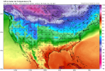
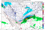
Fantasy late run storm coming? Looks like a major CAD on the horizon
Fantasy level weenie boardwide winter storm with epic amounts of trailing Arctic cold right behind incoming by hour 360.
D
Deleted member 609
Guest
Snow from Houston to NY. Nothing this way so far. Interesting look thoughFantasy level weenie boardwide winter storm with epic amounts of trailing Arctic cold right behind incoming by hour 360.
D
Deleted member 609
Guest
I don’t want to call it an anafront but I think that’s what it is. Temp gradient is razor sharp. That would be some cold cold air dropping down. If only we could get something inside 300. Then 200. Then 150. That’d be nice.Snow from Houston to NY. Nothing this way so far. Interesting look though
I could something like that actually happening this year. We have had quite a few of analfronts this year with the rain behind them.I don’t want to call it an anafront but I think that’s what it is. Temp gradient is razed sharp. That would be some cold cold air dropping down. If only we could get something inside 300. Then 200. Then 150. That’d be nice.
D
Deleted member 609
Guest
Haha yea who knows. Nothing gets anal front status at 300+ hours. Chasing the dragon here.I don’t want to call it an anafront but I think that’s what it is. Temp gradient is razor sharp. That would be some cold cold air dropping down. If only we could get something inside 300. Then 200. Then 150. That’d be nice.
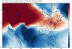
What is that ~30C change in NY. Haha.
That has that analfrontal look that gave AL 35” of snow on a model run 2-3 years ago! I think a few weenies still have it as their avatar
Webberweather53
Meteorologist
And also the west coast. Basically the 6Z GEFS late had a nice look for everyone,except for the eastern SE
Webberweather53
Meteorologist
Beautiful
Clem282340
Member
Can we still get cold air in that phase
BelmontWX79
Member
Tends to better for the se as we go into Jan.Can we still get cold air in that phase
L
Logan Is An Idiot 02
Guest
Is that not supposed to be good for us? I’m so confused lol
Is that not supposed to be good for us? I’m so confused lol
Thought 8 was our optimum. 7 not so much
L
Logan Is An Idiot 02
Guest
When it comes down to it there’s only like 1 or 2 favorable phases for snow around here. Sucks lolThought 8 was our optimum. 7 not so much
7 is the single snowiest phase in NC.Thought 8 was our optimum. 7 not so much
There is no favorable phase anymore, things don't work like they used too and as far as the eye can see it's torch with intermittent cool shots but no pattern that favors winter in the SE. Our small window of opportunity in January is closing, La Nina Febs suck and who wants snow in March anyway. Next
The UK used to have one of these charts but I can't find it anymore. It was pretty good, IIRC. Anyway, not far from reversing into 6 again, just like last year. Need it to progress through 7 and toward 8. Clearly not going to happen very fast.
I keep hearing that, and statistically speaking that may be true...but I can't figure out why, if that's the case, we keep seeing the rest of the country get cold except for the SE, even though we're progged to be in phase 7 for the next 2 weeks. Is snowfall more likely in late Jan phase 7 or in an El Nino phase 7 or a la nada phase 7 or just in the mountains phase 7? Or is it just generally, in the winter, we get more snow in phase 7, irrespective of everything else? Not trying to be a negative Nancy, just trying to understand, because the stats don't pass the eye test right now for me. I don't see anything shown on the models for the next 2 weeks that looks snowy for NC, even though we're going to be in phase 7.7 is the single snowiest phase in NC.
Anyway, how's the CFS?

