-
Hello, please take a minute to check out our awesome content, contributed by the wonderful members of our community. We hope you'll add your own thoughts and opinions by making a free account!
You are using an out of date browser. It may not display this or other websites correctly.
You should upgrade or use an alternative browser.
You should upgrade or use an alternative browser.
Pattern Januworry
- Thread starter SD
- Start date
- Joined
- Jan 23, 2021
- Messages
- 4,603
- Reaction score
- 15,199
- Location
- Lebanon Township, Durham County NC
Storm5
Member
For the record . We are not starting a thread for this potential system until at least 12z Monday .
Sent from my iPhone using Tapatalk
Sent from my iPhone using Tapatalk
NBAcentel
Member
Not really support from the GEFS however of a system digging that far SW
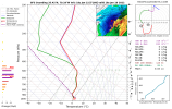
The reason there is not much of a warm nose is because the system is so dynamic that the upward motion keeps the column cold… that’s actually the same thing that happened with the ‘93 Superstorm for CLT metro… the changeover to snow occurred as the low was moving directly overheadVerbatim, there’s not much of a warm nose. However, I don’t buy any solution that predicts 36” unless it’s under 60 hrs.
View attachment 109788
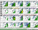
Still thought looks like a good amount of hits and a good amount of just barely missed type of storms.. definitely great at this range .. everyone is still in the game on this oneNot really support from the GEFS however of a system digging that far SW
GeorgiaGirl
Member
Well, that was a crazy run.
I don't think 36"+ happens in NC, but there have been players on the field for something to happen here.
If a bomb happens, it'll probably be further NE.
maybe it can bomb out and give DC some rain in the process instead of snow
I don't think 36"+ happens in NC, but there have been players on the field for something to happen here.
If a bomb happens, it'll probably be further NE.
maybe it can bomb out and give DC some rain in the process instead of snow
LukeBarrette
im north of 90% of people on here so yeah
Meteorology Student
Member
2024 Supporter
2017-2023 Supporter
Info on what DT thinks about upcoming systems in the middle of the article. If anyone cares at all here it is.
ya, its weird *from what I have looked at* there is really no support for this op solutions.
In all seriousness if you are watching these runs and thinking “am I getting punked” the answer is no. i think we’ve seen enough op run nukes + ensembles supporting essence of the idea to call this legit. There is top tier echelon potential here. Goes without saying this is a huge fish to reel in and the SE is a small boat, but will be fun to see where this goes!
packfan98
Moderator
Batman
Member
Toss every model run 7 days out if you are expecting verbatim results. Sun angle??? In January??? Our temps have been generally below average for 3 weeks...In January... Worried about soils temps???SMHnot buying this solution at all. i would expect the sleet line to be 5-10 more miles further inland. also snow maps not taking into effect soil temps and sun angle. toss
Next weekend has been showing the potential for something big somewhere in the SE for awhile. It is now getting within 7 days. It's not a slam dunk. It never is for the SE. But, it is certainly worth our attention.
YVille1128
Member
I think he was being sarcastic. I think he's a believer in the big picture potential.Toss every model run 7 days out if you are expecting verbatim results. Sun angle??? In January??? Our temps have been generally below average for 3 weeks...In January... Worried about soils temps???SMH
Next weekend has been showing the potential for something big somewhere in the SE for awhile. It is now getting within 7 days. It's not a slam dunk. It never is for the SE. But, it is certainly worth our attention.
Having two 1"+ snows from separate systems less than a week apart at Charlotte and some other places hasn't happened since way back in January of 2000, well before most wx bbs existed! That's how special this week has been.
Yeah, the GFS has snowfall rates of 3 inches an hour. Warm ground ain't doing squat lol.Toss every model run 7 days out if you are expecting verbatim results. Sun angle??? In January??? Our temps have been generally below average for 3 weeks...In January... Worried about soils temps???SMH
Next weekend has been showing the potential for something big somewhere in the SE for awhile. It is now getting within 7 days. It's not a slam dunk. It never is for the SE. But, it is certainly worth our attention.
It was sarcasm guys.....Good grief.
The GEFS is nada for here with a few good members for NC. Hope its wrong.
The GEFS is nada for here with a few good members for NC. Hope its wrong.
Stormlover
Member
in a good spotNot really support from the GEFS however of a system digging that far SW

- Joined
- Jan 23, 2021
- Messages
- 4,603
- Reaction score
- 15,199
- Location
- Lebanon Township, Durham County NC
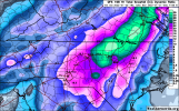
3.67 QPF and ONLY 31.7”?? Come on GFS.not buying this solution at all. i would expect the sleet line to be 5-10 more miles further inland. also snow maps not taking into effect soil temps and sun angle. toss
Y'all really thought iLMRoss was serious about soil temps, etc? Come on, recognize the member that is making the post and then read a little further and you will see clearly. Wow
- Joined
- Jan 23, 2021
- Messages
- 4,603
- Reaction score
- 15,199
- Location
- Lebanon Township, Durham County NC
We’ve dropped seven degrees since the sun went down.
To me this is a perfectly reasonable look from the ensembles. We’re in the ballpark. If it slides further east in subsequent runs then yeahhhhhh time to lower your expectationsin a good spot
NBAcentel
Member
GEFS took a step towards the euro/EPS, which means more ots, nothing to freak out over now but this setup could be prone to that
HurricaneSolomon
Member
- Joined
- Dec 6, 2021
- Messages
- 154
- Reaction score
- 276

Once again WRAL has jumped onboard with the “potential” for something to arise this coming weekend...
Sent from my iPad using Tapatalk
- Joined
- Jan 23, 2021
- Messages
- 4,603
- Reaction score
- 15,199
- Location
- Lebanon Township, Durham County NC
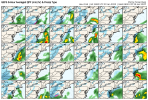
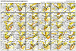
@Myfrotho704_ and others, Tomer Burg has GEFS 500mb Vorticity + Geopotential Height ensembles on his site.
NBAcentel
Member
Gonna be funny when we go from that to a off the EC late bloomer tonight at 00z, GFS digs the S/W wayyyy SW of the ensemble mean
NBAcentel
Member
Fun fact about the parent trough/shortwave- it already exists. We are not utilizing combining table scraps/wave propagation in the yukon to form our shortwave.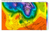
Watch the 972 low south of the Aleutians stream poleward, round the ridge then start diving. that's our guy. I bet we see a little more run to run continuity with this. I've always thought that the big dogs bark very far in advance and this is no exception.

Watch the 972 low south of the Aleutians stream poleward, round the ridge then start diving. that's our guy. I bet we see a little more run to run continuity with this. I've always thought that the big dogs bark very far in advance and this is no exception.
NBAcentel
Member
wow
Member
zero CAD.. all dynamically driven by ULL.. temps marginal
NBAcentel
Member
Yep.. we often don’t do to well with these but when we do we do really well, should be a fun week whether it happens or notzero CAD.. all dynamically driven by ULL.. temps marginal
And you know this. Specifics will change but you have to think we make a run at something significant again next weekend@SD gon love this one, this is amazing ! View attachment 109797
NBAcentel
Member
Yep. all members have the pieces, even the wide right membersAnd you know this. Specifics will change but you have to think we make a run at something significant again next weekend
NBAcentel
Member
Temps looked just like that on ensembles for this past storm we just went through .. they can see significant storm signals far out.. so I can see how this event was seen in terms of major temp changes and such (those usually come with some sort of big event on the beginning or end of them) so the fact that we continue to see this signal in our medium range right now is another great sign that something else is coming for someone in the SE
Flotown
Member
Anybody with more knowledge can tell me what he is alluding to???wide right ,cutter??

