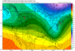
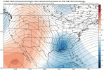
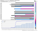
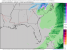
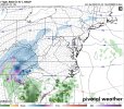
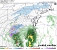
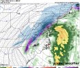
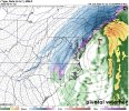
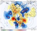
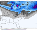
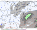
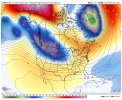
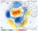
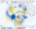
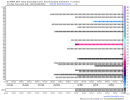
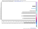
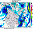
Agree, this is a good look overall. Doesn’t mean it will work out. Those to the west of us will want to see it dig sharper and to the west a bitI will take too progressive and out east at this range all day long. As we’ve seen multiple times this winter, things seem to amp up towards go time.
-
Hello, please take a minute to check out our awesome content, contributed by the wonderful members of our community. We hope you'll add your own thoughts and opinions by making a free account!
You are using an out of date browser. It may not display this or other websites correctly.
You should upgrade or use an alternative browser.
You should upgrade or use an alternative browser.
Pattern Januworry
- Thread starter SD
- Start date
Hopefully GFS is leading the way. ? says it’s the best global model..Need things to hang back a bit if we want a shot here.
Absurd - the GOAK trough and BC ridge doing its dirty workLol Euro trying to go for another storm end of its run, this one won’t whiff
Almost looks like our last storm the way it developsAbsurd - the GOAK trough and BC ridge doing its dirty work
NBAcentel
Member
lexxnchloe
Member
GFS has been very consistent. I like the euro being too far east for now. Better than over Norfolk and hoping for an east trend.The teeth-gnashing you hear is from the NE crew...?
View attachment 109677
NBAcentel
Member
DadOfJax
Member
Not liking the global looks for any of these systems for AL
NBAcentel
Member
SnowsWonderful
Member
Nope.. Trough axis keeps showing to far east. This is definitely the Carolina's year unfortunately for us.Not liking the global looks for any of these systems for AL
LukeBarrette
im north of 90% of people on here so yeah
Meteorology Student
Member
2024 Supporter
2017-2023 Supporter
It hasn’t been Carolinas year in awhile. They deserve itNope.. Trough axis keeps showing to far east. This is definitely the Carolina's year unfortunately for us.
NBAcentel
Member
Yeah pretty crazy took Charlotte 3 years to see there 2 biggest snows this past weekIt hasn’t been Carolinas year in awhile. They deserve it
pcbjr
Member
Fro,+EAMT at day 10 on the euro View attachment 109742
What does 500 and surface look like at this same time on the WB maps?
Thanks in advance!
Phil
SnowsWonderful
Member
You're right, but January is fading fast & the pattern going in to February looks to be unfavorable for southeast winter storms so now or never just might be the case here in AL for this winter season.It hasn’t been Carolinas year in awhile. They deserve it
Storm5
Member
Nope.. Trough axis keeps showing to far east. This is definitely the Carolina's year unfortunately for us.
We've already had a few systems drop snow this year . Not sure how anyone can really complain
Sent from my iPhone using Tapatalk
But yet I keep missing storms to North,the Northeast,the East, Northwest, etc. Last night, totals busted on the low side for the Aiken/Augusta area. Ever since I moved to this area,I haven't any snow above 1 inch yet. Atlanta, Macon and New Bern have also struggled to get snow this winter. so not every area east of the mountains(only speaking on areas who are capable of snowing in the first place) has had it great this winter regarding snow.It hasn’t been Carolinas year in awhile. They deserve it
Z
Zander98al
Guest
Us Birmingham people have really whiffed though. The new year system only received barely a dusting. And then the next one just a cold long rain lol.We've already had a few systems drop snow this year . Not sure how anyone can really complain
Sent from my iPhone using Tapatalk
You're right, but January is fading fast & the pattern going in to February looks to be unfavorable for southeast winter storms so now or never just might be the case here in AL for this winter season.
Huntsville also has gotten smoked this season.
Storm5
Member
Feeling pretty optimistic, about Alabama snow chances, seems like the GFS is coming back around to it's original idea of a good cold shot and a deep low.
Us Birmingham people have really whiffed though. The new year system only received barely a dusting. And then the next one just a cold long rain lol.
We also live in Alabama. Shouldn't expect snow every year . A dusting is a dusting you didn't have before
Sent from my iPhone using Tapatalk
As much as these models have flipped in 24 hours, I am not exactly sure why there is so much despair today. The players are still on the field to produce so at the very least, not all hope is gone. 18z will probably yield another solution.
As to anyone "deserving" weather phenomena of any kind, the notion is utterly ridiculous. The only thing you deserve living in the south when it comes to winter weather is lack of it. Comes with the territory. Literally.
As to anyone "deserving" weather phenomena of any kind, the notion is utterly ridiculous. The only thing you deserve living in the south when it comes to winter weather is lack of it. Comes with the territory. Literally.
Tarheelwx
Member
For what it’s worth and not complaining, here on Greensboro we have 6” for the season with an 8” average. So yes, we’re doing well, but not exactly hitting it out of the park. If we got nothing else, it would be a bit disappointing. The best part is that the 2 last storms were very cold with temps generally in low/mid 20s.
TW
TW
SnowsWonderful
Member
Not really complaining but the big 8" snow Huntsville received early this month was sharply cut off north of me. I'm extreme southern Madison county (New Hope). I had only 1 1/2 in. The event this past Sunday was 1/2 in. that was gone by night fall. So, I havn't had a 6+ incher since end of Feb. 2015. I'm due as well. lolWe've already had a few systems drop snow this year . Not sure how anyone can really complain
Sent from my iPhone using Tapatalk
I do however hope the Carolinas can get a phased bomb this coming weekend since it's looking more likely for them. As long as someone in the SE is getting crushed with huge totals I couldn't be happier.
Last edited:
NBAcentel
Member
pcbjr
Member
... and here we are today ...Feels like we are seeing this all over again, models wanting to speed up the pacific jet and bring it closer, undercut the ridge and it become a cutoff ridge north of AK in the LRView attachment 109750View attachment 109748View attachment 109749
NBAcentel
Member
I unfortunately can’t get that mslp/H5 map where it’s together overlapping on wxbell for the euro I’m shocked they have it for the EPS but not the euro itself, I think they have it on TT for the euro tho... and here we are today ...
NBAcentel
Member
Tropical forcing looks weak over the next couple of weeks, looks like there’s weak convective pulses in The MC/IO but not a real MJO wave, perhaps some weak 120E convection/IO forcing over the next few weeks, but this would probably translate to COD on the RMM, either way we’re entering a time where odds start becoming stacked against us 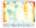

- Joined
- Jan 2, 2017
- Messages
- 1,566
- Reaction score
- 4,279
If anyone is down about the upcoming week don't jump so fast. Just because there's no clown maps to hang your hat on is senseless. Models are so far apart right now and likely not a single of them is right. Just look at the differences on these 3 that Fro posted earlier. They have no idea
pcbjr
Member
COD is generally a plus, but have you looked at the PNA and the NAO ... PNA in particular? It gonna take a miracle after 2/5 unless and until afterwards ...Tropical forcing looks weak over the next couple of weeks, looks like there’s weak convective pulses in The MC/IO but not a real MJO wave, perhaps some weak 120E convection/IO forcing over the next few weeks, but this would probably translate to COD on the RMM, either way we’re entering a time where odds start becoming stacked against us View attachment 109751
MichaelJ
Member
IMO, March will suck but April will be nice and cold  with monster storms going into the NE and MA
That's the nirvana look we are looking for in the eastern half/third of the SE in this setup. Check out how far south the 540 line is


850s look quite good. Would be hard for areas Aiken/Augusta, Montgomery, Macon and even the far eastern areas like New Bern/the Outer Banks to miss out on the snow with this sort of look. Too it's the JMA and that model is simply horribe.That's the nirvana look we are looking for in the eastern half/third of the SE in this setup. Check out how far south the 540 line is


pcbjr
Member
nir·va·na| nərˈvänə, nirˈvänə | noun (in Buddhism) a transcendent state in which there is neither suffering, desire, nor sense of self, and the subject is released fromthe effects of karma and the cycle of death and rebirth.850s look quite good. Would be hard for areas Aiken/Augusta, Montgomery, Macon and even the far eastern areas New Bern/the Outer Banks to miss out on the snow with this sort of look. Too it's the JMA and that model is simply horribe.
@griteater was pretty spot on with his choice of the adjective ...
Ha, didn't realize I was getting that deep in meaning, but we'll take it!nir·va·na| nərˈvänə, nirˈvänə | noun (in Buddhism) a transcendent state in which there is neither suffering, desire, nor sense of self, and the subject is released fromthe effects of karma and the cycle of death and rebirth.
@griteater was pretty spot on with his choice of the adjective ...
Nice trend here on the GEFS on the runs over the last few days. Short wavelengths over the North Pac, but stronger Aleutian ridge, stronger trough in the GOAK, stronger BC ridge.....and Eastern trough backing to the west a bit as the wave packet drops down thru the Rockies


