iGRXY
Member
If this were to verify, this would be the largest January snowfall I’ve seen here in Union County since 2011. Had 6 inches with that storm and haven’t had more than 1 inch any January since.Charlotte gets smacked on the 3km NAM. Poor folks in Columbia snowing just one county north.
View attachment 63899
heartbreaking.Charlotte gets smacked on the 3km NAM. Poor folks in Columbia snowing just one county north.
View attachment 63899
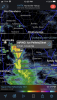
Wait could there actually be front end snow ?! View attachment 63911View attachment 63912View attachment 63913
How far are you from Hendersonville? That's where I'm at. Calling 4-8 here.Really liking those higher amounts in far SW Virginia
I'm in 3-6 range. Great mapUpdated call map for this event. Feeling pretty confident that most of us east of the mountains in NC will see some snow/sleet at some point in this event.
I think the north-central Blue ridge jackpots w/ >6" on eastern facing slopes, 2-5" ish for @BIG FROSTY & Birdman.
1-2" is probably a good call in the triad, could see areas just NW of Greensboro sneaking 3-4". North-central Charlotte metro, central piedmont, and areas just NW of Raleigh probably will see at least a light dusting of snow/sleet accumulation on the backend and start out as a wintry mix of wet snow, sleet, and rain before eventually changing to sleet and probably snow on the backend. For Raleigh & pts SE in the coastal plain this is mostly a rain event, might briefly start out as a mix before going to rain. Expecting lots of trace-dusting amounts from the backend thump down here, could see a few spots seeing more than that, afraid to go much higher than a 0.5" given uncertainties in the banding, crappier low-level thermals, and ground temps that would melt some of the initial snow/sleet, especially if it's not falling hard enough.
View attachment 63935
One's the 10:1 ratio and the other is the KucheraWhat’s up with the same picture twice?
Welp, looks like it’s a RAP for my area.


Honestly, even for areas that see a few inches of snow they can probably get by with WWAs. Impacts should be fairly minimal given wet ground, and marginal surface temps. I’m not sure even 3” will really stick to roadways.
Radarscope. It's an app. Costs a few bucks though, and some features require a paid subscription (not too expensive), but it's well worth it, one of the best radar apps out there.Is that an app or website you are using? TIA
It’s mPING reports on radar scope you can download the MPING app to get ground truth reportsIs that an app or website you are using? TIA


Hrrr is really pumping that initial band over your way. If you can get just cold enough it'll be a nice start to the event.hrrr is probably way to generous but I could see there being some humongous clumped wet snow flakes Mixed with Sleet/rain in this falling For 30 minutes - 1 hour View attachment 63942View attachment 63943View attachment 63944
That’s probably the hrrr selling sleet as snowView attachment 63948
Lol is that 10” in one hour!?


That’s probably the hrrr selling sleet as snow
But this is interesting, is we do crash the column temporarily, there might be a big quick burst on the front side with huge chicken feathersView attachment 63950View attachment 63952
This chance increases as you head towards I-40, very unlikely around CLTDumb question based on most modeling but is it even remotely possible that if we crash the column enough with heavy precip rates- that we could stay frozen throughout the majority of the event?
Looks like much of western NC is going to miss the big plume of moisture to the East.

Agreed maybe the far NW piedmont and some of the foothills can hang on long enough to stay mostly snow but S to SE winds between 750 and 800 are going to try to push the warm nose into there as well. Some of the soundings around Charlotte and points north are interesting, you have a well defined warm nose but then many are near or just below freezing below the warm nose to the surface, not sure if that would be enough for IP or rain.This chance increases as you head towards I-40, very unlikely around CLT
Precip literally curves around Wake lol. Dry slot has been advertised all week and unfortunately RDU looks to be in it