accu35
Member
At least it looks to me that 0Z was a bottom for now. I'm liking the angles on a majority of the GFS members being low. Helps bring more snow over GA.
How does it stop before it gets to S.C.? Serious question.
topography.... the mountains delay the cold air from penetrating farther south and down-sloping has a tendency to dry out the atmosphere.How does it stop before it gets to S.C.? Serious question.
So is it set in stone that this will happen or a chance that this could change somehow?topography.... the mountains delay the cold air from penetrating farther south and down-sloping has a tendency to dry out the atmosphere.
KBMX going with the nam/euro . Matt talks about the gfs being too flat with the trough
Sent from my iPhone using Tapatalk


Does anyone post blogs for Birmingham weather other than James Spann?
Sent from my iPhone using Tapatalk
Doesn't this same process also potentially cause areas to the west, such as N AL, to see less precipitation as the energy transfer to the coast?You can see exactly what I'm talking about on the 48 hour z500 trend on the GFS. The bigger Carolina wave is strengthening the downstream ridge over Atlantic Canada and allows the trough many are concerned about for this arctic front to slow and become neutrally tilted sooner.
View attachment 13455


All inFFC going with NBM (National Blend of Models) and WPC QPF forecast.
000
FXUS62 KFFC 261128
AFDFFC
Area Forecast Discussion...Updated for Aviation
National Weather Service Peachtree City GA
625 AM EST Sat Jan 26 2019
.LONG TERM /Sunday Night through Friday/...
Primary concern in the extended forecast period continues to be the
wintry precipitation Tuesday. Still significant differences in the
medium-range models concerning mainly the amounts of precipitation
and the timing/duration of the mixing/change-over from liquid to
frozen precipitation. GFS and Canadian models continue to be faster
and noticeably lower in QPF than the ECMWF. This appears to be due
to the stronger, slower and more southerly track of the short wave in
the European solution. I have stuck with a model blend for now
(namely the NBM for most parameters and WPC QPF) with precipitation
type driven by a non-diurnal temperature trend during the day
Tuesday. This yields a potential for advisory-level or higher
snowfall amounts across the higher elevations of the far north.
Otherwise, only trace amounts are generated across north Georgia,
including into the northern and western metro Atlanta area. No
accumulations expected across central Georgia. Confidence that we
will see some kind of rain/snow mix across much of north Georgia is
fairly high, confidence on accumulations remains low at this time.
Cold and dry air moves across the forecast area from west to east by
late in the day with only lingering light rain in eastern portions of
the forecast area into the early evening. Wouldn`t be surprised to
see a few areas with a light rain/snow mix into central Georgia late
in the afternoon/early in the evening, but no accumulations across
that area.
https://forecast.weather.gov/produc...FC&product=AFD&format=CI&version=1&glossary=1

I would take this in a hot second but zero margin for error and that's never good in Atlanta.
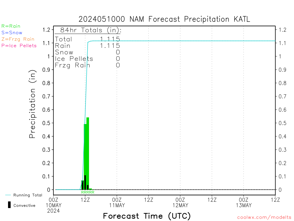
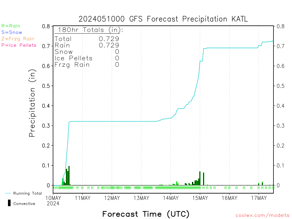
Oh lord... here we go. Some folks are going to get Jean Claude Van NAMned based off this run. Make it stop
Dr Tim Coleman
Sent from my iPhone using Tapatalk
Dr Tim Coleman
Sent from my iPhone using Tapatalk


