• Hello, please take a minute to check out our awesome content, contributed by the wonderful members of our community. We hope you'll add your own thoughts and opinions by making a free account!

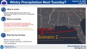
Wintry January 21-23 2025

Honestly if we can dig the TPV related trough more SW we could change the characteristics of this setup to more of a miller A
Also, I'm sort of digging how the 12z Euro had the long stretch of overrunning... that's not as dependent on the shortwave coming out and generating precip. We get that long fetch with WSW flow just a tick better and we've got a major storm inside of day 6 just from that, (The euro already is a major storm with it I'd say).

The Euro AI has been close with that too.. just need it to tick north a little.
 
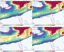
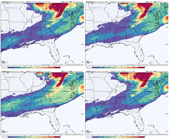
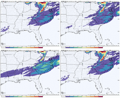
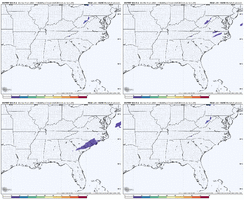
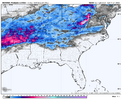
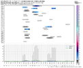
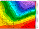
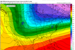
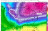
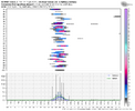
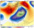
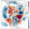
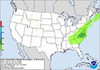
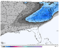
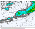
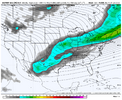
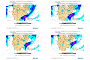
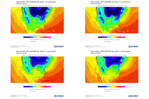
I mean you can’t complain right now with what we got. EPS is increasing probabilities quick. And yes while it’s had its bad moments, it’s not alone, lots of OP models have something. The GEPS looks good. The GEFS is okay, just a little squashy IMG_3972.gifIMG_3973.gifIMG_3974.gifIMG_3975.gif
 
Can anyone remember the few storms that were continuously modeled to be suppressed and stayed that way? Seems like there was a storm in mid December one year maybe 2018 that started out modeled for a S AL event and never really changed.
December 8-10th, 2018, was the first storm I followed on the weather forums (American). That one got its act together around day 7 and stayed consistent until about verification.
 
I foresee now that this is going to be somewhat of a battle between those of us that want a suppressed solution and the ones at more northern latitudes that would not benefit as much from said solution, let's hope that somehow this system gets everyone involved.
True, I would definitely prefer a suppressed solution vs the storm too amped and the low tracking so north that my location just gets ice. I guess we can't all be winners with these scenarios.
 
Right now, other than no storm which again I feel less worrisome about right now, I think worse case scenario is you start seeing the energy detaching from the TPV leading to more amped solutions. Even then at least for my neck of the woods you’d be looking at a lot more ZR and true ice storm issues. Obviously best case scenario is the euro or UK solutions from last night and a few days ago.
 
Not trying to be a downer....but there are 18 members basically with little to nothing though. Is this a scenario where its a monster (Phasing) or not much more than a Nuisance?. I just know TV guys are gonna say "ohhh welp lookie here 18 that have almost nothing so you can toss bc Mean is skewed ..."
There are like 50 members so 18 or so with nothing is no big deal . Hug your odds
 
True, I would definitely prefer a suppressed solution vs the storm too amped and the low tracking so north that my location just gets ice. I guess we can't all be winners with these scenarios.
I mean this in no disrespect, but IMO those along the coast are on borrowed time with this. I think there’s much better chance you see this thing trend north since we are dealing with overrunning and WAA. You’re seeing on the EPS the energy out west digging more which supports this. I’d be terrified if I lived on the gulf or below I20 that this is going to be a heavy ice situation. Again I could be wrong but that’s just how these setups tend to go.
 
Not trying to be a downer....but there are 18 members basically with little to nothing though. Is this a scenario where its a monster (Phasing) or not much more than a Nuisance?. I just know TV guys are gonna say "ohhh welp lookie here 18 that have almost nothing so you can toss bc Mean is skewed ..."
I'm pretty sure those members that are little to nothing are the ones that are leaving more of the southwest energy behind (similar to the op). But the fact we have more than half not doing that combined with the trends in the op and mean plus all of the other guidance out there makes me lean away from that scenario being the most likely as of now.
 
I mean you can’t complain right now with what we got. EPS is increasing probabilities quick. And yes while it’s had its bad moments, it’s not alone, lots of OP models have something. The GEPS looks good. The GEFS is okay, just a little squashy View attachment 163831View attachment 163832View attachment 163833View attachment 163834
Yes and I've been saying this for a few days now, but I really believe this is the type of setup where the ensembles will latch on early. This is a classic progression of seeing more and more members latch on and the op is trending towards the ensemble mean.
 
Not overly worried about the GEFS but this fairly thin...better chance of snow on Sunday then next Wednesday. Only 4 members have something for next Wed.

View attachment 163838
I look at it like this... we are more worried we might lose the s/w too far west towards the Pacific.

The GFS doesn't have a storm b/c it doesn't detach it at all. So we can't be worried about both, (s/w too detached and hung back, and also worried about a s/w that doesn't break away at all).

As such, I'm tossing the GFS and it's Ensembles until it starts showing a more realistic outcome that is at least in the same ballpark with all other guidance.
 
This storm also brings back memories of the January 2022 coastal. I do want us to refresh ourselves on what happened with that storm.

Models about 7 days out were locked with a big dog. There was one 18z run where the Euro, GFS, and CMC had significant storms (Euro and CMC from 12z). The setup was similar because we had to time the southern phasing correctly with the exiting northern stream. There was a good cold press that was exiting SE Canada. We also had a strong western ridge and a ULL high nosing into Greenland.
ecmwf-ensemble-avg-namer-z500_anom-7396000.png79185B43-D7E2-4567-BDB4-E43A00124C91.png.01cb2e31dba99f9a339f2d654b4c0869.png

The WPC for that storm was also all in around day 6. And we had a 5-inch Euro mean in Central NC

E6D0451E-A336-4669-A0E7-A140B5FDCA18.jpegCF85F574-9305-4285-9D12-B41B0D8E3540.png

We relied on the southern energy to phase correctly with the northern stream. Around day 6, the GEFS ensemble said the energy would get held back into Baja, while the EPS and GEPS were stuck with the snow chances for a few more cycles. The very next 12z cycle, the Euro lost the storm, and we got bits and bobs of what could have been.
25750D6E-B1A2-4FC4-8FCA-042F69C37DF8.png75066020-6467-4E4D-BD1B-F565579295FC.png
There are some apparent differences between this potential and the one in January 2022. For one, the PV lobe and cold air source are much stronger and broader, while in 2022, getting it timed right was a thread the needle setup. In 2022, we also had to phase Southern energy, while with this setup, we're only worrying about digging a piece of the northern lobe.

However, the moral of the story is, no matter how comfortable and in good agreement the models are, 6-7 days out is still a good enough time that the very next run of the CMC/Euro/UKMET could cave to the GFS/GEFS and kill the storm like in 2022. I don't expect this to happen, but this is in the back of my mind for now.

 
This storm also brings back memories of the January 2022 coastal. I do want us to refresh ourselves on what happened with that storm.

Models about 7 days out were locked with a big dog. There was one 18z run where the Euro, GFS, and CMC had significant storms (Euro and CMC from 12z). The setup was similar because we had to time the southern phasing correctly with the exiting northern stream. There was a good cold press that was exiting SE Canada. We also had a strong western ridge and a ULL high nosing into Greenland.
View attachment 163836View attachment 163837

The WPC for that storm was also all in around day 6. And we had a 5-inch Euro mean in Central NC

View attachment 163839View attachment 163840

We relied on the southern energy to phase correctly with the northern stream. Around day 6, the GEFS ensemble said the energy would get held back into Baja, while the EPS and GEPS were stuck with the snow chances for a few more cycles. The very next 12z cycle, the Euro lost the storm, and we got bits and bobs of what could have been.
View attachment 163843View attachment 163844
There are some apparent differences between this potential and the one in January 2022. For one, the PV lobe and cold air source are much stronger and broader, while in 2022, getting it timed right was a thread the needle setup. In 2022, we also had to phase Southern energy, while with this setup, we're only worrying about digging a piece of the northern lobe.

However, the moral of the story is, no matter how comfortable and in good agreement the models are, 6-7 days out is still a good enough time that the very next run of the CMC/Euro/UKMET could cave to the GFS/GEFS and kill the storm like in 2022. I don't expect this to happen, but this is in the back of my mind for now.

While a fair point, the opposite could also be true. We could trend towards the higher end of the ceiling with this event, whereas in that case that likely already had occurred. Changes are going to happen, no doubt, but this one could actually keep trending better IMO.
 
Mama cita....
Lets Go Sport GIF by ALL ELITE WRESTLING


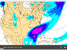
Screen Shot 2025-01-15 at 2.07.04 PM.png
 
Are you worried at all we are trending towards leaving the energy behind? That seems the way this is going a bit
View attachment 163816

I worry about this too. It looks like it's digging so far west, it'll close it off soon and leave it behind, more toward the GFS. EPS surprisingly looks good, but the op seems like it's going the wrong way.

I'm not really worried about suppression per say, I'm worried the energy just get's left behind and we don't really have a storm. Or that it's so delayed that we depend on the northern stream only and it's a late coastal scraper.
 
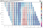
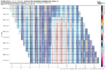
On the EPS for RDU it doesn't get above freezing from 0z Monday until Thursday afternoon...I don't think I've ever seen that here.

View attachment 163850

ATL max from 0z Monday until Thursday afternoon is 33F...if this happens we are going to have pipes freezing in the garage, spigots, etc...

ecmwf-ensemble-KATL-tmax_multirun-6942400.png
 
can anyone comment on if this model is beginning to get consistent on this? it is seared into my mind how this model locked in on the last storm around this range and generally held that look in a chokehold until verification
I believe its been ticking a bit better/more ukie/euro?
 
Back
Top