iGRXY
Member
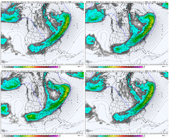
HP Texas-Kentucky-offshore Va. Banana high?FYI, I edited this to enlarge the map.
I mean, absolutely spectacular high pressure with absolutely spectacular QPF signal. These are the ones we used to draw when we were little.
Definitely, usually I can benefit from a storm that’s a little northerly but I need it to hang down in south central GA before trending north. Generally it seems that more Tuesday night solutions are better for the board a whole vs Wednesday morningI foresee now that this is going to be somewhat of a battle between those of us that want a suppressed solution and the ones at more northern latitudes that would not benefit as much from said solution, let's hope that somehow this system gets everyone involved.
It’s certainly a risk, more connection from the main TPV trough like 06z is idealAre you worried at all we are trending towards leaving the energy behind? That seems the way this is going a bit
View attachment 163816
If this was say 8-9, that would be more concern. Right now I think it can only go so much furtherAre you worried at all we are trending towards leaving the energy behind? That seems the way this is going a bit
View attachment 163816
Does that include sleet?3-4” means on the EPS at day 7 is just asking for a monster
Really nice trends for all of us really
This is day 7.5 dude. Holy smokes. How’s H5 looking compared to previous?
Not trying to be a downer....but there are 18 members basically with little to nothing though. Is this a scenario where its a monster (Phasing) or not much more than a Nuisance?. I just know TV guys are gonna say "ohhh welp lookie here 18 that have almost nothing so you can toss bc Mean is skewed ..."
Definitely worth a mention though that this system isn’t as complicated, that one had 3 different injections of energy. But still, every southern snow setup is complicated in general. But that setup was tweaks that had massive sfc implications for all or nothing in many locationsWord of caution -- EPS showed a MEAN of 12" of snow for Dallas at day 4-5 ahead of the last system.. they ended up with around 1-2" and mostly rain.
This is day 7.5 dude. Holy smokes. How’s H5 looking compared to previous?
The biggest fail point I can see is if we don't bring out the southwestern wave fast enough as @griteater has been saying. But with the western ridge holding firm and the TPV trough remaining connected, hopefully that does not happen.Word of caution -- EPS showed a MEAN of 12" of snow for Dallas at day 4-5 ahead of the last system.. they ended up with around 1-2" and mostly rain.

Yeah, get me these maps on Monday and we batten down alllll the hatchesWord of caution -- EPS showed a MEAN of 12" of snow for Dallas at day 4-5 ahead of the last system.. they ended up with around 1-2" and mostly rain.
That's why you want to be on the north end of the EPS jackpot zone, not the south end. A tale as old as time.Word of caution -- EPS showed a MEAN of 12" of snow for Dallas at day 4-5 ahead of the last system.. they ended up with around 1-2" and mostly rain.
Yes the heaviest axis shifted NE. They are a little more phase dependent out there. The birth zone of a southern winter storm seems to be a little more difficult to iron outWord of caution -- EPS showed a MEAN of 12" of snow for Dallas at day 4-5 ahead of the last system.. they ended up with around 1-2" and mostly rain.
Honestly if we can dig the TPV related trough more SW we could change the characteristics of this setup to more of a miller AThe biggest fail point I can see is if we don't bring out the southwestern wave fast enough as @griteater has been saying. But with the western ridge holding firm and the TPV trough remaining connected, hopefully that does not happen.
View attachment 163828
Yep and that's what we've been seeing to some extent already - EPS is trending that way and the means keep increasing.Honestly if we can dig the TPV related trough more SW we could change the characteristics of this setup to more of a miller A
New Orleans station honking the horn
Word of caution -- EPS showed a MEAN of 12" of snow for Dallas at day 4-5 ahead of the last system.. they ended up with around 1-2" and mostly rain.
