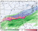
You prefer 33 degree rain vs cold and dry??Eh, I’ll take my chances with a decently amped storm anytime vs sitting here dry and cold and admiring a frost that I’ve seen probably 40 times this winter.
-
Hello, please take a minute to check out our awesome content, contributed by the wonderful members of our community. We hope you'll add your own thoughts and opinions by making a free account!
You are using an out of date browser. It may not display this or other websites correctly.
You should upgrade or use an alternative browser.
You should upgrade or use an alternative browser.
Wintry January 21-23 2025
- Thread starter SD
- Start date
Blue_Ridge_Escarpment
Member
Absolutely. I always prefer anything on radarYou prefer 33 degree rain vs cold and dry??
iGRXY
Member
Oh how little people forget not even a week ago we went to a super amped in the mid levels look just so quickly. The problem is people have a satisfaction need to see these things 10 days out on every single run. I guarantee you that suppressed looks at day 7 is what you want and quite frankly need.
A lot of central Alabamas biggest hits look like this at this range. Solid look here for a lot of folks. Don’t sweat the run to run op changes people.
Stormsfury
Member
Yeah, January 1988 lol. It was stated on several storm post mortems from NWS offices.Has the Canadian ever out performed the GFS or euro for a potential winter storm?
People want to be in the bullseye each run from day 10 to day 0.Oh how little people forget not even a week ago we went to a super amped in the mid levels look just so quickly. The problem is people have a satisfaction need to see these things 10 days out on every single run. I guarantee you that suppressed looks at day 7 is what you want and quite frankly need.
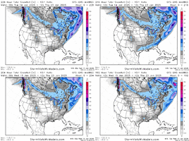
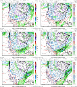
mind if somebody posts a trend of the last 4 runs for this image?
edit- nvm
ie suppression, i'm not concerned about a low ending up in key west but i am concerned about our wave getting chewed up in the south west to a point where we're not taking advantage of this setup's full potential. these things typically have a way of working out but the underwhelming ops do strike a little bit of fear in my heart
mind if somebody posts a trend of the last 4 runs for this image?
edit- nvm
ie suppression, i'm not concerned about a low ending up in key west but i am concerned about our wave getting chewed up in the south west to a point where we're not taking advantage of this setup's full potential. these things typically have a way of working out
WolfpackHomer91
Member
This is the struggle lol....bc lets be honest, good OR bad, if youre in the Bullzeye now.....you wont be by gametime. (No im not Nostradamus or trying to be a know it all, its simply historically dang near impossible to do)People want to be in the bullseye each run from day 10 to day 0.
If you're in the bullseye around day 7-10, you best hope for a southerly trend in the short term so the day 3-5 NW trend puts you in prime positioning..This is the struggle lol....bc lets be honest, good OR bad, if youre in the Bullzeye now.....you wont be by gametime. (No im not Nostradamus or trying to be a know it all, its simply historically dang near impossible to do)
i see nothing to be alarmed about or be encouraged about with this lol, gfs ens seems like it's still getting its sea legs
EPS been pretty consistent at H5 iirc? Either way I don't see much to be worried about yet
D
Deleted member 609
Guest
If it’s suppressed so be it. I’d rather lose the storm to Charleston SC than Charleston WV.
GeorgiaGirl
Member
May be wrong, but to me at least, the GEFS is beginning to look more excited about what may happen later in the week.
I'm on my phone tho so it wouldn't be easy for me to compare.
I'm on my phone tho so it wouldn't be easy for me to compare.
packfan98
Moderator
That's because it's handling the energy differently than other models. If the energy comes out quickly, those looks will disappear.May be wrong, but to me at least, the GEFS is beginning to look more excited about what may happen later in the week.
I'm on my phone tho so it wouldn't be easy for me to compare.
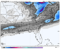
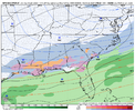
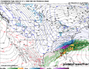
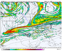
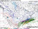
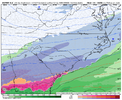
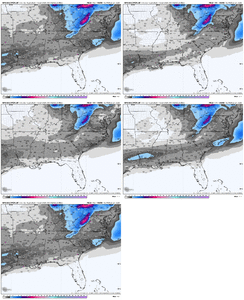
Last 2 images on the UKMet runUKMet - SW wave kicks out...looks fairly suppressed with track
View attachment 163776
View attachment 163775
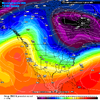
ForsythSnow
Moderator
Suppression is okay for today but if we see it still Friday, it's concerning.
Just so I am clear and since there are few pros and pro hobbyist here; what do we want, ideally, to happen with that damn Baja low? Do we want it left behind..... kicked out early? TIA!
- Joined
- Jan 23, 2021
- Messages
- 4,602
- Reaction score
- 15,197
- Location
- Lebanon Township, Durham County NC
UK was way more suppressed than 0z
iGRXY
Member
Not really. This thing needs to stay right where it is until at least Saturday.Suppression is okay for today but if we see it still Friday, it's concerning.
ForsythSnow
Moderator
Energy layout will be locked in by then. It'll not have time to trend far enough north. It's a fine line. Worse yet it can keep going south and we don't see anything north of I 10.Not really. This thing needs to stay right where it is until at least Saturday.
WolfpackHomer91
Member
exactly give the southern tier their Eye candy for another 24hrs....then pull it up 100 miles where Climo says it should be. I mean hey, as long as Nashville gets blanked We can all celebrate jmoEnergy layout will be locked in by then. It'll not have time to trend far enough north. It's a fine line. Worse yet it can keep going south and we don't see anything north of I 10.
With all due respect, I could not disagree more.Energy layout will be locked in by then. It'll not have time to trend far enough north. It's a fine line. Worse yet it can keep going south and we don't see anything north of I 10.
iGRXY
Member
Energy has routinely changed in the day 3-5 range. The models flipped every 24 hours until about 36 hours out with the last storm between flat and amped. If y’all want to be in a storms bullseye at day 4 or 5 be my guest but I’ve seen this long enough to know you won’t like the end result.Energy layout will be locked in by then. It'll not have time to trend far enough north. It's a fine line. Worse yet it can keep going south and we don't see anything north of I 10.
MA forum wants to see this thing suppressed til it gets inside 100hr. I’d advise we go the same route
packfan98
Moderator
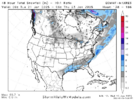
Euro has something


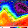
I’m really happy with the broader long-wave pattern. All we need to work on, is minute changes in digging and cold-press and we’ll be fine
NBAcentel
Member
iGRXY
Member
RollTide18
Member
New Orleans station honking the horn

