iGRXY
Member
I feel bad for scrolling through here and thinking "I hope this moves to crush the charlotte area" because that means the whole rain/snow line moves and the storm busts for people in GA and SC.Not everybody wants a N trend though.
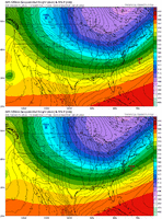
Northern stream digs more but the Baja Low feature continues to hang back. It could work but I don't know.Seems like the GFS at 06z loss the amplitude of the western ridge, hence why it doesn’t really dig. This run is better, but don’t think it’s enough either but could be wrong. It is a outlier with that though

Ahhhh, the GFS Rex Blocks the E Pac Ridge... Sheesh12z GFS still an outlier at 03z Monday compared to 00z UKMET / 06z ECMWF / 12z ICON.
View attachment 163731View attachment 163728View attachment 163734
View attachment 163733
wasn't the gfs giving us some weird cutter for the past storm at points too.?If this were reversed......GFS in our corner against the Euro, UKMET, and ICON, you know how the board would feel. Despair. I'd rather be in the camp with Euro, UKMET, and Icon over GFS, any day.
And continues to be much different at H5 than all other models.gfs is probably going to be a horrible run
The GFS looks like it Rex Blocked the E Pac High and actually has some retrogression on the low features between Hawaii and California. Not sure if I'm buying thatAnd continues to be much different at H5 than all other models.
View attachment 163743
View attachment 163744
More amplified but still a nice cold coast to coast look. This could be a monster

SE ridge flexing more?View attachment 163743
View attachment 163744
More amplified but still a nice cold coast to coast look. This could be a monster
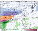
Its solid QPF as it travels across panhandle and looks like its then blowing up from thereCanadian is going to be a QPF monster View attachment 163750
