NBAcentel
Member
06z euro looks like a better version of that 12z run yesterday
Aka not suppressed like 0z then06z euro looks like a better version of that 12z run yesterday
What’s your current thinking?The 06z EPS and 00z UKMET were very close. In fact, I think the 00z UKMET is more in line with the EPS than the op Euro as far as the southwestern US energy and how it brings it out.
View attachment 163681
View attachment 163683
View attachment 163684
Big picture wise, I think we're still trending towards a significant to possibly major winter storm. Seeing the EPS slowly increase the signal and not jumping around a ton at H5 and with support from the GEPS and various other op runs all looks promising. Good long ways to go, but liking where we are at the moment.What’s your current thinking?
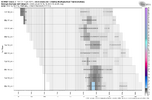
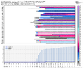
Yeah big difference vs the last one at this lead time was we wasn’t getting consistently good or better runsBig picture wise, I think we're still trending towards a significant to possibly major winter storm. Seeing the EPS slowly increase the signal and not jumping around a ton at H5 and with support from the GEPS and various other op runs all looks promising. Good long ways to go, but liking where we are at the moment.
View attachment 163687
View attachment 163685
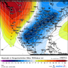
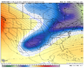
This setup is somewhat unconventional for us to get our big snows. Looking back at January 1940, arguably our most board-wide storm, you'll notice that the wave deepened in the Southeast as it tilted positive off of Cape Hatteras. Meanwhile, even with our best-case scenario models (CMC, UKMET), the wave can't deepen over the Southeast, or it's heading northeast by the time it does.
With a Miller-A, a deeper low can bring in more cold air, while with this overrunning setup, we have to worry more about timing and mixing issues. The magnitude of the air mass is so extreme that it's hard to find anything to compare to this one. The only storm that comes to mind is December 2017. But, the air mass was much more marginal. Compare it with the UKMET:
View attachment 163691View attachment 163693
If anyone has any other similar storms in mind, let me know.
2017 was coming to mind when I saw some of the early maps on models and how suppressed it came up back then as. I'm hoping it's more overrunning so more cam get snow but wouldn't be mad if it repeated 2017 here. Overrunning could also lead to a longer storm.
You are so right. I was fortunate enough to experience the January 2003 storm with the incredible 40:1 ratios. I was literally able to sweep it off my front steps with a broom0z Canadian focused at 12z 1/22:
10Fº +SN N10/G20 16:1 ratios
That is something you'd see in Detroit or Cleveland. I dont know how many of yall have ever experienced such a cold snow but its like an actual snow globe.
I saw that in March 1980... heavy snow and 10 degrees. Incredible.0z Canadian focused at 12z 1/22:
10Fº +SN N10/G20 16:1 ratios
That is something you'd see in Detroit or Cleveland. I dont know how many of yall have ever experienced such a cold snow but its like an actual snow globe.
Hopefully those Ops come around in the next day or so.would be funny if this storm was just too suppressed and just went poof, nicky would be on a generational hater run (and if i were in his shoes i would be too)
i like the ensembles but would it kill the gfs and euro to throw us some candy?
For me, the UKMET on our side is just about as good as the Euro OP but thats just me.would be funny if this storm was just too suppressed and just went poof, nicky would be on a generational hater run (and if i were in his shoes i would be too)
i like the ensembles but would it kill the gfs and euro to throw us some candy?
Haha just trying to keep expectations down. I’ve seen plenty of times where a storm looked great just to have it disappear in the final moments. It’s the most deflating feeling. There’s big dog solutions but there’s also fail solutions as well in the ensembles. Both can happen and it includes a suppressed solution and an energy gets left behind and links up with another piece too late which cuts (my personal favoritewould be funny if this storm was just too suppressed and just went poof, nicky would be on a generational hater run (and if i were in his shoes i would be too)
i like the ensembles but would it kill the gfs and euro to throw us some candy?
Do we even want the day 7 OP GFS showing a hit...we know the Op GFS is great at telling us what's not going to happen.would be funny if this storm was just too suppressed and just went poof, nicky would be on a generational hater run (and if i were in his shoes i would be too)
i like the ensembles but would it kill the gfs and euro to throw us some candy?
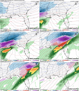
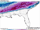
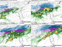
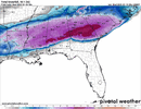
Heck of a sleet storm down into middle/ south GA. A lot of potential with this oneSeems to be a lot of people hanging on for dear life after the 06z gfs op run that is clearly an outlier. Let me share last nights 00z CMC and 00z UKMET for those that may have missed it. We have had runs like this since Sundays euro in some form or fashion on the models and the eps really cranked things up last night. Not sure what else some of you need to see, but this is the best big dog potential I’ve seen for a lot of us. Seeing the UKMET, EPS, even the GEFS with suppressed solutions, along with the AI starting to bend towards these. Hold on tight.
View attachment 163698View attachment 163699View attachment 163700View attachment 163701
