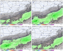
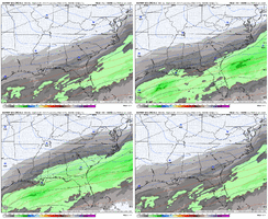
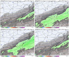
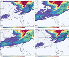
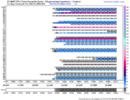
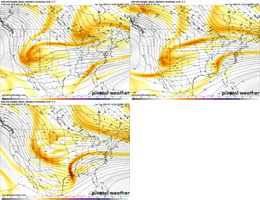
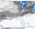
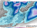
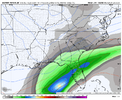
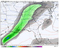
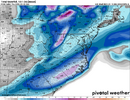
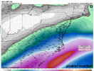
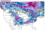
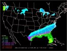
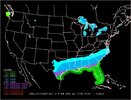
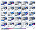
That may be the most ridiculous model image yet. A 5-7” mean across the Deep South at seven days out is absolutely nuts.
-
Hello, please take a minute to check out our awesome content, contributed by the wonderful members of our community. We hope you'll add your own thoughts and opinions by making a free account!
You are using an out of date browser. It may not display this or other websites correctly.
You should upgrade or use an alternative browser.
You should upgrade or use an alternative browser.
Wintry January 21-23 2025
- Thread starter SD
- Start date
CNCsnwfan1210
Member
Really good QPF trends at different timestamps at 6-7 days
Sent from my iPhone using Tapatalk
Forevertothee
Member
Columbia NWS
An anomalously deep 500 mb trough (near the NAEFS climatological
minimum for this time of year) will dip into the north central US
late this weekend and early next week. A strong surface high will
filter arctic air into the central and eastern US. There is very
high confidence in temperatures well below normal. 90 percent of the
NBM members have high temperatures in the 40s or lower for Monday
through Wednesday. Mean temperatures have also been trending colder
for early next week. There are a growing number of ensemble members
showing precipitation over the Southeast from early to mid next
week. 50 to 70 percent of ECMWF members and 30 to 50 percent of GEFS
members record measurable precipitation. The synoptic setup of
abnormally cold air over the region and potential for moisture to
spread into the forecast area is a situation that will continue to
need monitoring. That said there is still a large spread in the
timing of any potential precip and amounts, or lack thereof. This
ultimately is keeping PoPs limited to slight chance for the end
of the long term since the confidence of precip at any given
period is low. Model guidance varies greatly in the track of a
low pressure system which may bring the Southeast some form of
wintry precip near the end of the long term.
Forevertothee
Member
GSP NWS
A secondary northern stream wave crosses the area Sunday which
pushes a weak low pressure center and secondary cold front across
the southeast. The guidance agrees on a precip changeover to snow
for the NC mountains but doesn`t agree on precip chances elsewhere.
Some are dry while others show enough moisture and forcing for a
brief period of precip. For now, have kept a small PoP over the NC
mountains with diminishing PoP elsewhere.
The guidance agrees on an arctic air mass moving into the area
Monday and Tuesday with temps dropping to around 20 degrees below
normal. The guidance shows some precip may move in during the day
Tuesday, but differs greatly on coverage and location. Have capped
any PoP at slight chance for now, as there is quite a bit of
uncertainty.
Forevertothee
Member
Peachtree City NWS (ATL)
oward the end of the week, the next system approaches. Rain is
expected to begin on Saturday morning and push off by Sunday
morning. Rainfall totals have come up some, with amounts ranging
from 1-2".
Sunday afternoon and into Monday will give us a chance to dry out,
but temps drops pretty substantially behind that system. Confidence
in a gulf low is growing as models are coming into agreement with
timing and formation. The system tries to push into southern GA on
Tuesday afternoon and given the cold air in place, at least some
kind of rain snow mix appears likely in the southern portions of our
CWA.
albertwilsonjr
Member
Thoughts on latest gfs
Sent from my iPhone using Tapatalk
Sent from my iPhone using Tapatalk
That’s a fail mode.Thoughts on latest gfs
Sent from my iPhone using Tapatalk
albertwilsonjr
Member
That’s a fail mode.
Not a good run at all. We move forward to the gefs
Sent from my iPhone using Tapatalk
ForsythSnow
Moderator
We're still in the ENS model range currently so not too worried about each OP run changing look how many times the last storm vanished or went somewhere. I still think we are fine when we have the UK, EPS, and some GEFS.
Yea you definitely don't want a delay to late next week with baja ejection. You get one, its crippiling ice storm for mby and inland cutter. 6z GFS is also only model showing snow showers for Sunday. So its an outlier
Fail for us but our friends just west of us love it. It was slower, cold press relaxed, it absorbed the remnant baja crap, went negative tilt early and boom, an amped up inland bomb. I'm more worried about this outcome over suppression all day long. But it's just one op run.That’s a fail mode.
Anyone got any 6z euro info?
Six Mile Wx
Member
NBAcentel
Member
Last time it took us until day 5 and less to get a clearer picture of the upcoming storm. Right now, we don't even know if there will be a storm and what day if it materializes. We just need a few more days of model runs. Until then we'll get big variability in outputs. As Fro said above, I'm rooting for the ensembles right now.
The GFS/GEFS has the weakest western ridge of all the models. I counted only about 3/30 members that have the initial overrunning big dog. The GFS shears out the energy, holds it back, and phases with a new piece of energy that enters later... the GEFS does something similar.
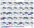
As @Webberweather53 indicated yesterday, the GEFS/GFS suite tends to do a poor job of handling the digging wave over the Western US and will likely correct it as we get closer. Even though the 00z Euro failed, I counted a whopping 40 members with an initial overrunning! I'm not going to lie; not having all the ops on our side makes me anxious, but based on our current data, we can toss the GFS suite.
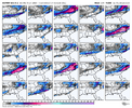

As @Webberweather53 indicated yesterday, the GEFS/GFS suite tends to do a poor job of handling the digging wave over the Western US and will likely correct it as we get closer. Even though the 00z Euro failed, I counted a whopping 40 members with an initial overrunning! I'm not going to lie; not having all the ops on our side makes me anxious, but based on our current data, we can toss the GFS suite.


packfan98
Moderator
Yeah, the GFS can’t figure out how to handle the western energy among its own members. I tend to favor a faster progression. Until this gets settled, you can’t put a lot of faith in the GFS suite.The GFS/GEFS has the weakest western ridge of all the models. I counted only about 3/30 members that have the initial overrunning big dog. The GFS shears out the energy, holds it back, and phases with a new piece of energy that enters later... the GEFS does something similar.
View attachment 163662
As @Webberweather53 indicated yesterday, the GEFS/GFS suite tends to do a poor job of handling the digging wave over the Western US and will likely correct it as we get closer. Even though the 00z Euro failed, I counted a whopping 40 members with an initial overrunning! I'm not going to lie; not having all the ops on our side makes me anxious, but based on our current data, we can toss the GFS suite.
View attachment 163664
View attachment 163663
Six Mile Wx
Member
GEFS says: maybe the 21st, maybe the 22nd, maybe the 23rd, maybe, the 24th, we’ll let you know later.
Psalm 148:8
Member
- Joined
- Dec 25, 2016
- Messages
- 344
- Reaction score
- 789
James Spann just posted a video.. GFS showing a storm around Thursday, CMC and ECMWF showing Tuesday.. he notes.. the signal is there.. just gotta iron out the details.. so I’m encouraged that we at least have a storm at some point next week.. and plenty of cold air he noted!
packfan98
Moderator
Yep. Obviously they can’t all be right. I guess we could try to focus on the members that matches the other models, or we could just toss the entire suite until the energy gets resolved.GEFS says: maybe the 21st, maybe the 22nd, maybe the 23rd, maybe, the 24th, we’ll let you know later.
John1122
Member
While I got like 16 inches that GFS run, it's a bigger version of how it failed last storm. Too amped it kept giving me 7-8 inches, I got 4. I fear that's what it's doing now 50 percent. Of course the other half of me will always fear a cutter when we see big nw jogs in this window.
packfan98
Moderator
We have so many weather models these days and most have their ensemble suite, I'm not even sure the total number. The amount of data computation is insane and yet almost every one of them show some form of a winter storm next week. Can't be mad about that
Honestly good to see it shift south at this lead time0z euro AI was a little more suppressive and colder than 18z, but it still looks like a bad ice storm.
View attachment 163667
- Joined
- Jan 23, 2021
- Messages
- 4,602
- Reaction score
- 15,197
- Location
- Lebanon Township, Durham County NC
- Joined
- Jan 23, 2021
- Messages
- 4,602
- Reaction score
- 15,197
- Location
- Lebanon Township, Durham County NC
- Joined
- Jan 23, 2021
- Messages
- 4,602
- Reaction score
- 15,197
- Location
- Lebanon Township, Durham County NC
GEPS has a mean high of 20 degrees next tuesday.
NBAcentel
Member
06z euro/EPS must of been greatness because they are stuck
- Joined
- Jan 23, 2021
- Messages
- 4,602
- Reaction score
- 15,197
- Location
- Lebanon Township, Durham County NC
yeah they sent out a message that its broken06z euro/EPS must of been greatness because they are stuck
packfan98
Moderator
Nice! Not much freezing rain either.
wow
Member
Not a model it's a forecast .. wpcWhat models are those?
Sent from my iPhone using Tapatalk
Literally says it right on the bottom of the graphNot a model it's a forecast .. wpc

