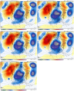
Yes, we need the wave to come on out of the SW and kick east - no delays or squashing it in the SWI would be concerned if this gets pushed in to late next week as guidance is showing temps moderating considerably beginning next Thursday. The brunt of the arctic air is entrenched Tues/Weds, with models taking a couple steps back from the record cold ledge over the past few days. There is a window for sure, it's just not as large as it was say 2-3 days ago.
-
Hello, please take a minute to check out our awesome content, contributed by the wonderful members of our community. We hope you'll add your own thoughts and opinions by making a free account!
You are using an out of date browser. It may not display this or other websites correctly.
You should upgrade or use an alternative browser.
You should upgrade or use an alternative browser.
Wintry January 21-23 2025
- Thread starter SD
- Start date
iGRXY
Member
NBAcentel
Member
Mahomeless
Member
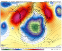
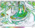
Best ICON look we’ve had at H5
For sure- that is my biggest concern as well. We gotta kick that wave out sooner rather than later. WPC has 10% probs down to the coast. That’s really rare. If we can time this up right we’re looking at potentially a really special eventI would be concerned if this gets pushed in to late next week as guidance is showing temps moderating considerably beginning next Thursday. The brunt of the arctic air is entrenched Tues/Weds, with models taking a couple steps back from the record cold ledge over the past few days. There is a window for sure, it's just not as large as it was say 2-3 days ago.
iGRXY
Member
ICON is definitely colder and better with the Vortex over the Great Lakes thru 117
NBAcentel
Member
Icon is a gulf coast hit
Stormsfury
Member
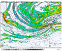
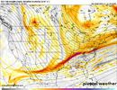
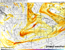
Based on the 500mb look, this run should continue to get it done.
Edit: Based on Jrips, it's happening lol
Edit: Based on Jrips, it's happening lol
Blue_Ridge_Escarpment
Member
Too much PV push this run squashing our energy. We’ve got to trend away from that if we want a big dog.
NBAcentel
Member
While it's much rarer that a suppressed run actually stays suppressed as a event approaches it's has happened before. History says this will trend NW over time and suppressed is okay look right now. I will get nervous by Saturday if models look like that by thenToo much PV push this run squashing our energy. We’ve got to trend away from that if we want a big dog.
Round Oak Weather
Member
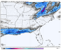
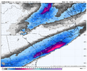
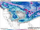
All snow that far south is impressive. Definitely think this cold press can get a lot of good things done for a lot of us in the Deep SouthThat’s just beautiful for this range man View attachment 163712
iGRXY
Member
Again, you keep this thing suppressed for as long as humanly possible. That NW trend will be real in the final 48 hours. It always is with overrunning and like others have pointed out, this H5 setup favors amplification
Stormsfury
Member
Just by gathering this look the ICON has, the SFC low tracks across Central Florida ...That’s just beautiful for this range man View attachment 163712
WolfpackHomer91
Member
Yea, the only issue is, I believe it was 2022 we (NC Piedmont) Had issues with EVERYTHING being too positive or Neutral and sliding right underneath us or hitting Caostal Plain areas. NW Trends do occur 90% of the time and Im fine without at this range...but, IF this thing is still showing this southern coastal slider in 48hrs I think we need to listen
SnowNiner
Member
Yes, we need the wave to come on out of the SW and kick east - no delays or squashing it in the SW
GFS is the only one that so far closes off the energy in the SW right? However the Euro keeps digging and digging it further SW I think. My fear is it also eventually trends into separation from the trough and we get little to no storm at all until too late. Lot's of whiffs in the EPS right now, which makes me uneasy. Glad to see the AIFS has a winter storm though.
The last storm stuck the energy in the SW pretty early too, and killed the chance for a bigger storm, eventually giving us a light event. I'd hate for that to happen again here.
Cary_Snow95
Member
I don’t know who remembers January 2017, but it was modeled to be insanely cold. Cold wasn’t even a top 3 concern while tracking. 5 days out everyone was freaking out because precip was confined to the coast and wasn’t amping enough. Fast forward to the event and everyone SE of Durham rained. Leave the icon right there lol
The thing that keeps me optimistic is this is not strictly a “coastal” look. It’s overrunning with a chance to go boom boom east.
Stormsfury
Member
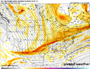
There wasn't much change at hour 114 with the 500mb/SFC looksThe thing that keeps me optimistic is this is not strictly a “coastal” look. It’s overrunning with a chance to go boom boom east.
Stormsfury
Member
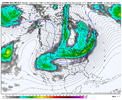
Yeah, SC Coastal Events (Snows) generally favor a Central FL crossover ...Yeah think you’re right. This is the first frame where I can see a closed contour. It really may even track across southern florida hahaView attachment 163716
NBAcentel
Member
Yup. Exactly why we need this look to last. The process behind overrunning precipitation ahead of the S/W trough for lift is warm air advection and FGEN. Typically those overperform NWP hence why areas north get more snow/warm nose farther north/more precipitation then modeled.I am trying to remember last storm but I want to say ICON was suppressed for awhile leading up to event there too???
RobertRath
Member
Facts.. seen it a few times in the last 10 years.While it's much rarer that a suppressed run actually stays suppressed as an event approaches it's has happened before. History says this will trend NW over time and suppressed is okay look right now. I will get nervous by Saturday if models look like that by then
The other this precip always spreads further north and west than what models indicate with an overrunning set up at this rangeAgain, you keep this thing suppressed for as long as humanly possible. That NW trend will be real in the final 48 hours. It always is with overrunning and like others have pointed out, this H5 setup favors amplification
TBH, I don't think you could draw up a better run for much of the SE 7 days out. Let the N trend and amplification commence inside 120hrs, for right now bury it in the GOM and FL.
packfan98
Moderator
Yes. It scooted off the coast instead of turning the corner. Wasn't enough energy diving in from the north to phase.Is the final 180hr surface map out yet?
SnowNiner
Member
Cad Wedge NC
Member
Biggest reason I see that causes the NW trend .... the cold push is always over done. As we approach verification time the models will back off on the pressure, leading to the NW trend. I can certainly see it happening here as well. Watch the pressures over the Midwest in the coming runs. That will tell us all we need to know.I don’t know who remembers January 2017, but it was modeled to be insanely cold. Cold wasn’t even a top 3 concern while tracking. 5 days out everyone was freaking out because precip was confined to the coast and wasn’t amping enough. Fast forward to the event and everyone SE of Durham rained. Leave the icon right there lol
The 2nd storm in January 2022 was a coastal slider all the way up to 48 hrs prior to the storm and it trended NW to give the entire Piedmont a decent all snow event. Also February 2010 was going to be an I-10 and southeast coast only storm only 24-36 hours out. Even 48 hours from now there will still be a long way to goYea, the only issue is, I believe it was 2022 we (NC Piedmont) Had issues with EVERYTHING being too positive or Neutral and sliding right underneath us or hitting Caostal Plain areas. NW Trends do occur 90% of the time and Im fine without at this range...but, IF this thing is still showing this southern coastal slider in 48hrs I think we need to listen
NBAcentel
Member
Drizzle Snizzle
Member
Not everybody wants a N trend though.TBH, I don't think you could draw up a better run for much of the SE 7 days out. Let the N trend and amplification commence inside 120hrs, for right now bury it in the GOM and FL.

