• Hello, please take a minute to check out our awesome content, contributed by the wonderful members of our community. We hope you'll add your own thoughts and opinions by making a free account!

Pattern January 2021 - Joyless January

I'd be ok with a brief change over for an hour. I can count on 3 fingers the number of snowfalls I've seen since April 2018

Raleigh agrees...

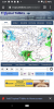
"Thus for now keep precipitation of the liquid
variety, but a changeover to frozen at the end of the event on
Friday night and Saturday morning is possible across the northern
Piedmont as cooler air advects in behind the system."
 
prateptype_cat.us_ma.png
 
Man we should be excited with a low in that spot in the middle of January. Smh

It may still be. The GFS is an absolute mess at 850mb with the surface low redeveloping. The 850mb low is so weak and messy, there isn’t CAA even north of it. Definitely a period to watch with how the models are trending colder with the evolution of the systems.
 
Without a nice strong 50/50 low in this "-nao" pattern to funnel in a wedge, confluence, and cold air, no storm is going to have a chance for a winter storm east of the mountains IMO. I won't say a nice block pattern sucks, but it's missing a key ingredient I think.

If that's not there in this pattern, we punt till after the 15th and hope Eric is right about the polar tap of the -epo.

My opinion so far this year is reenforced, we need the -epo with a +PNA. Need Pacific tap of cold for a general cold pattern in the southeast. Then let's take our chances with timing.
 
In the heart of January with that low track it should be a freaking winter storm! But like @DarkKnight said it's a good look for 8-9 days out

Mind boggling. Low placement is great. Well on the bright the northwest trend won’t sting quite as bad.


Sent from my iPhone using Tapatalk
 
Seems like the end of every gfs run recently has been retrograde to a SER
Even though I said it’s unlikely above, honestly it wouldn’t shock me if we got a -EPO driven cold outbreak after the marginal -NAO stuff then a Southeast ridge, I was thinking at one point we’d keep the Blocking but per HM, if we switch to maritime forcing, and get that NPAC jet extension/dump out west, down goes February, I think this time is has more legs because the GEFS sorta hints at -EPO which is all or nothing
And oh yeah ninas in feb normally suck
 
Someone, I think it was @Ollie Williams had a composite of winterstorms and MJO phases. All phases looked similar to me for producing winterstorms, especially in Feb. except phase 1. Which I had always thought was a good phase. I do believe the MJO can affect the overall pattern whether it's a torch or not. But undividual winterstorms not so much. The more I learn each year the more I'm convinced it really doesn't matter the indexes or pattern. It just takes luck around here. The advertised pattern coming surely helps odds but still need luck.
It was @Webberweather53, but you're right, phase 1 is our worst for snow.
EOFVFvgXkAAMwzt.jpg
 
Even though I said it’s unlikely above, honestly it wouldn’t shock me if we got a -EPO driven cold outbreak after the marginal -NAO stuff then a Southeast ridge, I was thinking at one point we’d keep the Blocking but per HM, if we switch to maritime forcing, and get that NPAC jet extension/dump out west, down goes February, I think this time is has more legs because the GEFS sorta hints at -EPO which is all or nothing
And oh yeah ninas in feb normally suck
Ninas in Feb usually suck but this Nina isn't exactly behaving like a typical Nina is it ?
 
Even though I said it’s unlikely above, honestly it wouldn’t shock me if we got a -EPO driven cold outbreak after the marginal -NAO stuff then a Southeast ridge, I was thinking at one point we’d keep the Blocking but per HM, if we switch to maritime forcing, and get that NPAC jet extension/dump out west, down goes February, I think this time is has more legs because the GEFS sorta hints at -EPO which is all or nothing
And oh yeah ninas in feb normally suck
We probably get there eventually but the gfs/gefs are probably too fast. What I find interesting about that gfs run is the fact it starts getting that big vortex near the lakes then it starts digging the western trough. Obviously that's more upstream driven than downstream but you can't help but wonder if the gfs is erroring there. Maybe the model feels the block out front and instead of shearing the energy under the block its consolidating and digging? Idk maybe just a coincidence in the timing
 
Back
Top