whatalife
Moderator
Brief warm-up after D10 on the eps, that wasn't there yesterday (I don't think) but looks like pattern reload after that.... delayed but not denied.
Where have I heard that before?
Sent from my iPhone using Tapatalk
Brief warm-up after D10 on the eps, that wasn't there yesterday (I don't think) but looks like pattern reload after that.... delayed but not denied.
Not gonna lie, I just want to see that nice +PNA inside hour 336
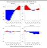
I noticed that too, but at the same time looks like flatter Pac ridge... can't we get the +PNA, -AO, -NAO trifectaOne nice thing is the EPS is slight trend with higher heights over the pole and push the PV to Siberia.
View attachment 30166


I noticed that too, but at the same time looks like flatter Pac ridge... can't we get the +PNA, -AO, -NAO trifecta


KrloG, how about Mississippi, Alabama, Georgia, and Tennessee??Geez...quickly looking at the members there's probably 10 that have snow south of NC.

That looks cold to me, especially for an ensemble mean. It's been pretty steady around the 20th.
View attachment 30172
Yes, it looks real good, but per what @metwannabe was referring to, the period 1/19-21 was warmer on this EPS vs the prior one due to more of a warmup in between the two Arctic highs. But afterward (1/23-4), it was colder than the 0Z with the 2nd Arctic high due to higher pressure getting down into the SE.


Agreed, I especially don’t trust the gfs when it shows cold like this since it’s new upgrade. I’m one of the more optimistic posters when it comes to winter weather and think posts of winter cancel in early January are just silly. That said I feel the same when the models are showing bone crushing cold in what has been a very warm start to winter. I am very happy to see changes towards cold but I’m not getting overly excited yet because after all we live in the south and most in here from the Deep South. It is a Lot more likely to have 2-3 cruddy winters then it is to have 2-3 good ones in a row. Hopefully we are on our way to a great 2nd half comeback!!!This is not meant to be negative in any way ... parts of the SE are forecasted to be cold, but that is not a present tense or any sort of guaranteed thing ... it is indeed nice to see a model show what the 18z suggests, and some consistent later runs by it and other models would lend credence, but until it happens, please Folks, enjoy the movie, but remember that it's only a movie (for now) ...
Up here on the highland rim we got two 3 plus inch snows in less then a week. The elevation up here helps so much as I always talk about. It’s the reason I’m much more optimistic then most other middle Tennessee posters who live near the city of Nashville.Same event I'm talking about I'm sure. Here in Tennessee it turned cold on Christmas day December 2017 and stayed cold to very cold into January. It was cold and dry for the first 8 days of the month highs in the upper 10s and lower 20s. We had lows of 1, 0 and 3 nights below 0 in that time frame. We had a trace of snow in the 15 day period from December 25th to Jan 8th. 14 of the 15 days
saw 0.00 precip.
If finally got to 33 on January 9th and to add insult to injury, it rained.
Most likely the further north you live the more accurate this is.Not sure if you're serious, but according to -------------, that old wive's tale has been accurate (I'm going off memory) like 1 out of 8 times in the past decade. So, very little correlation, if any.


The Euro Control is the Main ECMWF data set. The OP runs off of the Control, so essentially the OP is about the same thing, but higher res and only runs out to 240hrs, while the control runs up to 360hrs. The EPS also runs off of the Control. Think of it as a family tree. The Control is the Parent and the OP and EPS are its kids.Can someone explain what is the difference between the euro control and the operational euro??
The control also uses the same initialized conditions as the operational ECMWF whereas the rest of the ensemble members used perturbed conditions. Every ensemble (GEFS, GGEM, etc,) has a control run. Generally speaking, I don’t think there’s any value to looking at the control run aside from seeing snow porn and entertainment (which is what we’re all here for, so you know damn well I look at them, LOL).
This upcoming period looks exciting. Will we score? For a lot of us, probably in some capacity, but who knows in what degree, and we very well could strike out. A good pattern is no guarantee of anything. We live in the South.
Personally, I am a good law abiding citizen, but I do know of some folks that might just be willing to sell the GFS, the GEFS, and the EURO something brewed up on the side for a 3 week round-the-clock happy hour ...And you and all of us know there's still no guarantee we'll even get the "good" (as in BN) pattern down in the SE but at least it is almost definite we'll get something better than the current torch.


The Euro Control is the Main ECMWF data set. The OP runs off of the Control, so essentially the OP is about the same thing, but higher res and only runs out to 240hrs, while the control runs up to 360hrs. The EPS also runs off of the Control. Think of it as a family tree. The Control is the Parent and the OP and EPS are its kids.
I believe this is correct.I could be wrong but I always understood it as the operational run being the first “run”.
The operational is then ran at a lower resolution on purpose as to try and “smooth” it out a bit, which is the control.
Then, 50 ensemble runs are created from the low resolution operational aka Control, which is then averaged with the control to make the EPS mean.
Sent from my iPhone using Tapatalk
 Zr threat has returned on the gfs