dsaur
Member
I'm so envious. That's my kind of storm for sure. I hope there is some moisture left when the tail end drags thru here. Enjoy your bounty of sleet ")
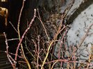
You can learn something new every day. Still mid 40's here. Hoping for ice needles, ice worms, ice pellets...I can do without zr. I've seem my fill in the past. Looking like a lot of snow behind the sleet to the west. That's encouraging.Oooo oooo, I know this one! They’re called ice needles and have to have some very specific conditions to form. Check this out: https://www.wunderground.com/articl...iners/news/2019-12-04-snow-needles-logan-utah
WHERE ARE YOU LOCATED @accu35Lot more precip to come and ice is forming fast

Yeah same here, lot more sw of me. It’s heavy ZR here for a while now. Morning commute gonna be roughSTILL GOT MORE HEADED MY WAY AND WAHT WAS SUPPOSED TO BE ALL FZR IS NOW POSS SOME SNOW. LOOK LIKE SOME MORE MOISTURE OFF TO THE SW OF ME THAT MAY TICK THINGS UP A BIT
View attachment 142630
I HOPE MY RELIEF CAN GET TO WORK. I GOT A 33 MILE TRIP FROM MY CURRENT LOCATION ON THE RADAR PIC BACK TO THE SW EDGE OF SHELBY COUNTY IF IT WOULD EVEN BE POSSIBLE...Yeah same here, lot more sw of me. It’s heavy ZR here for a while now. Morning commute gonna be rough
Yeah same here, lot more sw of me. It’s heavy ZR here for a while now. Morning commute gonna be rough
HE LIVES IN CLARK COUNTY SW ALABAMAWhere you live?
Sent from my iPhone using Tapatalk

I dunno but it must be that good kind…lmao. Weather Channel app got me with some rain and snow this morning. What they smokin?


A few places are reporting 32 this morning except Henderson which is reporting 30. Not sure that is correct, it if is, they are going to have some minor issues there but that seems lowI think we've got a decent shot at ending as some snow or sleet this afternoon.
Roxboro had about three hours of freezing fog at 30. I would imagine that could cause some issues.A few places are reporting 32 this morning except Henderson which is reporting 30. Not sure that is correct, it if is, they are going to have some minor issues there but that seems low


.png")