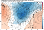
energy is staying back, slower than 0z euro last night coming out of SW
edit ; on the move at hour 108.
edit ; on the move at hour 108.
Man those are some sufficient dews down into the VA/NC borderThis little difference to our NE gets some wedging going in NC View attachment 141152View attachment 141153

Looks like its suppressed at hour 132. Hopefully that will all fill in with time.Euro not going to get it done this time in midsouth anyways

Too close!
Looks like it’s suppressed at hour 132. Hopefully that will all fill in with time.ab
Absolutely it could. It was close and we’re still five days outLooks like its suppressed at hour 132. Hopefully that will all fill in with time.
Hopefully there will be some nice hits with the EPS.Absolutely it could. It was close and we’re still five days out
A really nice snow for DC metro.
All we want to see on modeling is a slower system/more northern stream confluence, this allows penetration of the Arctic boundary further east along with a slower storm. Just sucks though because the euro is the most favorable than most models, and this could just be it waffling to something more favorable for 1 runGenerally what you want to see here. As others said, this is close to a good one even for some east of the mountains.View attachment 141167
Looked like the euro warmed the surface air too quickly (for the CAD areas) as the precip came in. If this look was to verify, I would expect the CAD (look) to strengthen as we get closer.This is clearly the trend we need east of the apps. We need to trend to a deeper, digging trough in the NE which turns into confluence as it lifts up. Really close call for CAD areas View attachment 141161View attachment 141156View attachment 141159View attachment 141162View attachment 141158
Exactly. The underestimate wedge of models!Looked like the euro warmed the surface air too quickly (for the CAD areas) as the precip came in. If this look was to verify, I would expect the CAD (look) to strengthen as we get closer.
Agreed. That ridging to our east off the Atlantic gives me pause. That usually takes a favorable track off the table regardless of all the other things we may have going for us.All we want to see on modeling is a slower system/more northern stream confluence, this allows penetration of the Arctic boundary further east along with a slower storm. Just sucks though because the euro is the most favorable than most models, and this could just be it waffling to something more favorable for 1 run

It’s actually been happening quite a bit lately. We’ve had a number of systems since late fall that have trended south from a few days out and has brought heavier rain to the Carolinas after it initially was modeled over Tennesseesouth trends? Don't see that too often
Let’s get a late developing low to give that high pressure time to build out front. Then we can let her rip.
be careful what you wish forAgreed. That ridging to our east off the Atlantic gives me pause. That usually takes a favorable track off the table regardless of all the other things we may have going for us.View attachment 141168
I’m thinking of driving up from Birmingham with the kids Sunday afternoon since they’re out of school Monday and I’m off work. Do you think staying somewhere around Nashville would be good, @olhausen? Thanks!!For the Nashville folks.
looks like the snow would start falling late Sunday night with temps in the lower 20s and dropping quickly. snow continues to fall into late Monday afternoon making this a long duration snow event.
Gfs without kuchera
Gfs with kuchera
View attachment 141146
TldrI don't want to get caught up in the "well this model does this too fast or that model doesn't handle that thing well and so on" because that stuff gets thrown out like candy. But like I mentioned yesterday, it is true that when you have a big block, there is often a propensity for it to hang around a bit longer than models think it should. That can have downstream effects (out in time) in that it can make things appear to shift south as you close in on the event. We don't see this very much, as most of our events trend north over time. But we don't usually have big blocks up there either.
Now, I don't want to suggest that there's going to be some magical massive shift that magically makes a snowstorm occur, but if things are marginal and you only need a few slight tweaks to make it a solid wintry event, then that is probably within the realm of possibility when you have a block like this.
Tldr
Tldr
Misc - Winter Weather Support Group
Just one more of that and something that can’t be unseen will be seen I hope it's not like the time I saw my grandma naked.southernwx.com
thx
