PARSONBROWN
Member
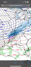
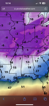
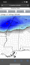
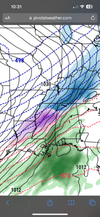
This could be a decent sledding type event for north Al. Not a ton of snow, but enough sleet freeze rain to get some good sledding in. All I know is. School will canceled for the cold next week at some point. Wish I went to school these days ?

")